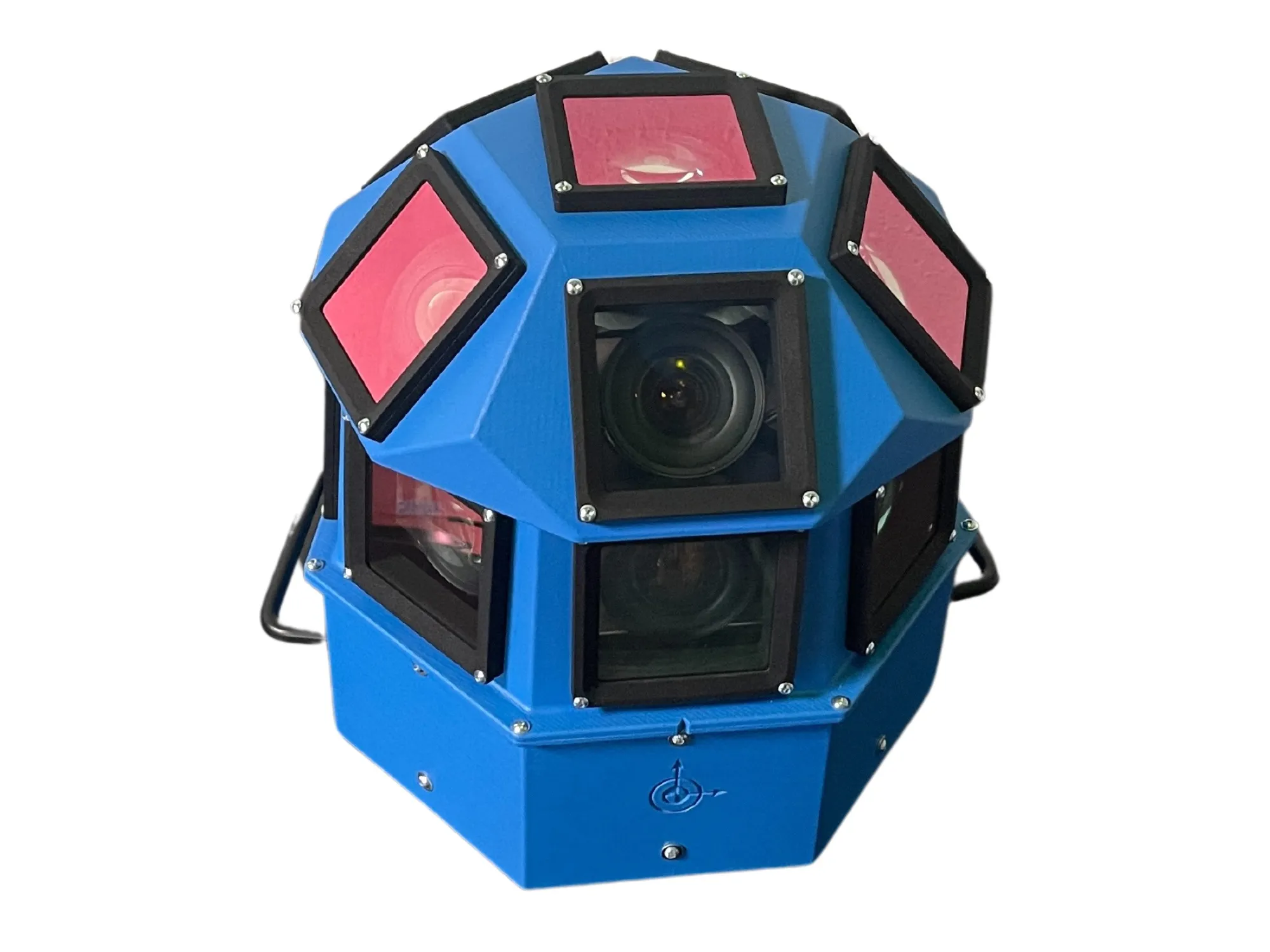
AI-InfraSolutions and Stemmer go the full 360°

Panoramic camera head designed for automated data collection in traffic applications
By David Arminas November 13, 2024 Read time: 2 mins
The head delivers 180 MPixel resolution with 360° horizontal and 120° vertical coverage

AI-InfraSolutions, a geospatial mapping technology business, has partnered with Stemmer Imaging to develop a 360°-degree panoramic camera head.

It is designed for automated data collection in applications such as traffic sign identification, road condition assessments and environmental monitoring. The technology enables municipalities and companies to efficiently manage assets and adopt predictive maintenance strategies.

AI-InfraSolutions said the new head will “redefine the future of geospatial mapping”. Engineered through machine vision specialist Stemmer’s More Engineering Services, the head delivers 180 MPixel resolution with 360° horizontal and 120° vertical coverage. It captures synchronised images every 5m at driving speeds of up to 100km/h, making it an ideal solution for large-scale geospatial mapping projects.

Development of the head posed several technical challenges, including selecting optimal sensors, synchronising image capture with GNSS systems and minimising parallax for smooth panoramic stitching. Stemmer's engineering expertise and precise intrinsic calibration were instrumental in addressing these challenges. This resulted in a robust solution capable of continuous high-speed recording for up to 247km, expandable to 496km.

Once the images are captured, AI-InfraSolutions’ powerful AI-driven data processing algorithms automatically prepare the data for further analysis. This system is particularly effective in areas such as infrastructure asset management and road condition monitoring. Offline post-processing features, including tone mapping and panoramic stitching, ensure that the collected data is refined for optimal accuracy

“By combining our innovative approach with Stemmer Imaging’s leading vision, we are elevating our solutions to an unmatched level,” said Jeroen Zanen, founder and chief executive of AI-InfraSolutions.

For more information on companies in this article

Related Content

  • Agencies in pursuit of high-speed WIM accuracy
    April 20, 2017
    Alan Dron looks at where WIM is heading in the near future. As Weigh-In-Motion (WIM) systems grow in sophistication and accuracy, they are increasingly being used in more active roles to help ensure road safety through enforcement action against overweight vehicles.
  • Pioneering IntelliDrive technologies in Michigan
    February 2, 2012
    Pete Goldin reports on upgrades to the USDOT's Michigan Test Bed, where IntelliDrive technologies are being pioneered
  • Trimble’s RTX automotive positioning is in the driver’s seat
    June 7, 2018
    The most accurate positioning available is what automated vehicles need and Trimble’s RTX fits the bill. It combines Trimble’s precise positioning IP with automotive-qualified GNSS components. Trimble is now working supplying RTX positioning technology - based upon years of accurate positioning in the agriculture sector - with tier one suppliers and original equipment manufacturers in the automotive sector. Trimble said that its RTX is the best performing satellite-delivered correction service when measuri
  • SCATS study shows significant savings
    December 16, 2013
    Australian study quantifies the benefits of SCATS to the motorists, the environment and the economy. Opportunity weekday cost savings potential of some AUD16 million (US$15.2 million) has emerged from rigorous analysis of a one-day study of Australia’s Sydney Coordinated Adaptive Traffic System (SCATS) in operation. This represents 27% of the total cost of a real alternative semi-adaptive traffic control. The estimated indicative annual weekday-based value is AUD3,900 million (US$3,705 million) or 0.9% of t