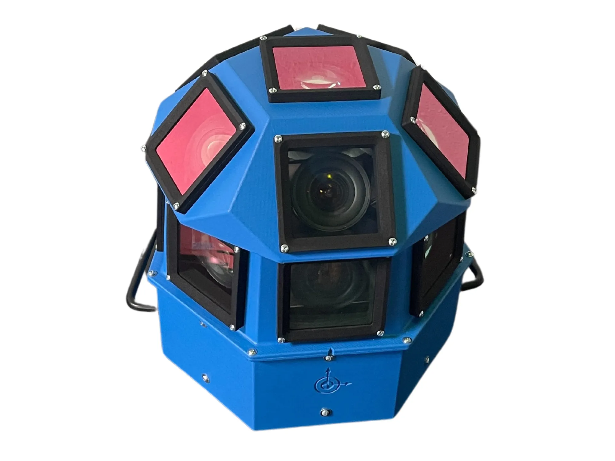
AI-InfraSolutions and Stemmer go the full 360°

Panoramic camera head designed for automated data collection in traffic applications
By David Arminas November 13, 2024 Read time: 2 mins
The head delivers 180 MPixel resolution with 360° horizontal and 120° vertical coverage

AI-InfraSolutions, a geospatial mapping technology business, has partnered with Stemmer Imaging to develop a 360°-degree panoramic camera head.

It is designed for automated data collection in applications such as traffic sign identification, road condition assessments and environmental monitoring. The technology enables municipalities and companies to efficiently manage assets and adopt predictive maintenance strategies.

AI-InfraSolutions said the new head will “redefine the future of geospatial mapping”. Engineered through machine vision specialist Stemmer’s More Engineering Services, the head delivers 180 MPixel resolution with 360° horizontal and 120° vertical coverage. It captures synchronised images every 5m at driving speeds of up to 100km/h, making it an ideal solution for large-scale geospatial mapping projects.

Development of the head posed several technical challenges, including selecting optimal sensors, synchronising image capture with GNSS systems and minimising parallax for smooth panoramic stitching. Stemmer's engineering expertise and precise intrinsic calibration were instrumental in addressing these challenges. This resulted in a robust solution capable of continuous high-speed recording for up to 247km, expandable to 496km.

Once the images are captured, AI-InfraSolutions’ powerful AI-driven data processing algorithms automatically prepare the data for further analysis. This system is particularly effective in areas such as infrastructure asset management and road condition monitoring. Offline post-processing features, including tone mapping and panoramic stitching, ensure that the collected data is refined for optimal accuracy

“By combining our innovative approach with Stemmer Imaging’s leading vision, we are elevating our solutions to an unmatched level,” said Jeroen Zanen, founder and chief executive of AI-InfraSolutions.

For more information on companies in this article

Related Content

  • Xerox automates HOV/HOT enforcement
    May 27, 2014
    Counting the number of people in a vehicle has always been a manual task, but now Xerox has developed a real-time system to automate the process. Xerox has introduced an automated system that determines the number of passengers in a vehicle, enabling authorities to detect non-qualifying drivers using the High Occupancy Vehicle (HOV) and High Occupancy Toll (HOT) lanes. Traditionally HOV/HOT enforcement has entailed local police visually confirming each vehicle has the required number of occupants and chasin
  • Inrix informs FHWA’s data improvements
    December 19, 2017
    Refinements in the data available from the US Federal Highway Administration will improve road management across America. David Crawford reports. In August 2017, the US Federal Highway Administration (FHWA) issued the first results from an upgraded version of its National Performance Management Research Data Set (NPMRDS). Developed to identify the locations and times of high congestion affecting traffic flows along America’s 259,000km (161,000 mile) national highway system, this is a key resource for sta
  • BlackBerry invests in CerebrumX Lab AI deep learning for vehicle data
    April 12, 2023
    Firm says it will develop embedded in-car synthetic sensors to collect information
  • Crisma Security and Videotec partner on integrated surveillance system
    March 21, 2017
    Security systems specialist Crisma Security has integrated the Navtech radar with the Ulisse thermal radical range of PTZ thermal cameras manufactured by Videotec, to provide a flexible solution for optimal management of large-scale critical infrastructures. The Navtech radar uses millimetre wave technology, creating an automated and reliable system to help protect against intrusion, with the ability to automatically detect a person in a radius of up to 1000m, both day and night and in all environmental