AI-InfraSolutions and Stemmer go the full 360°

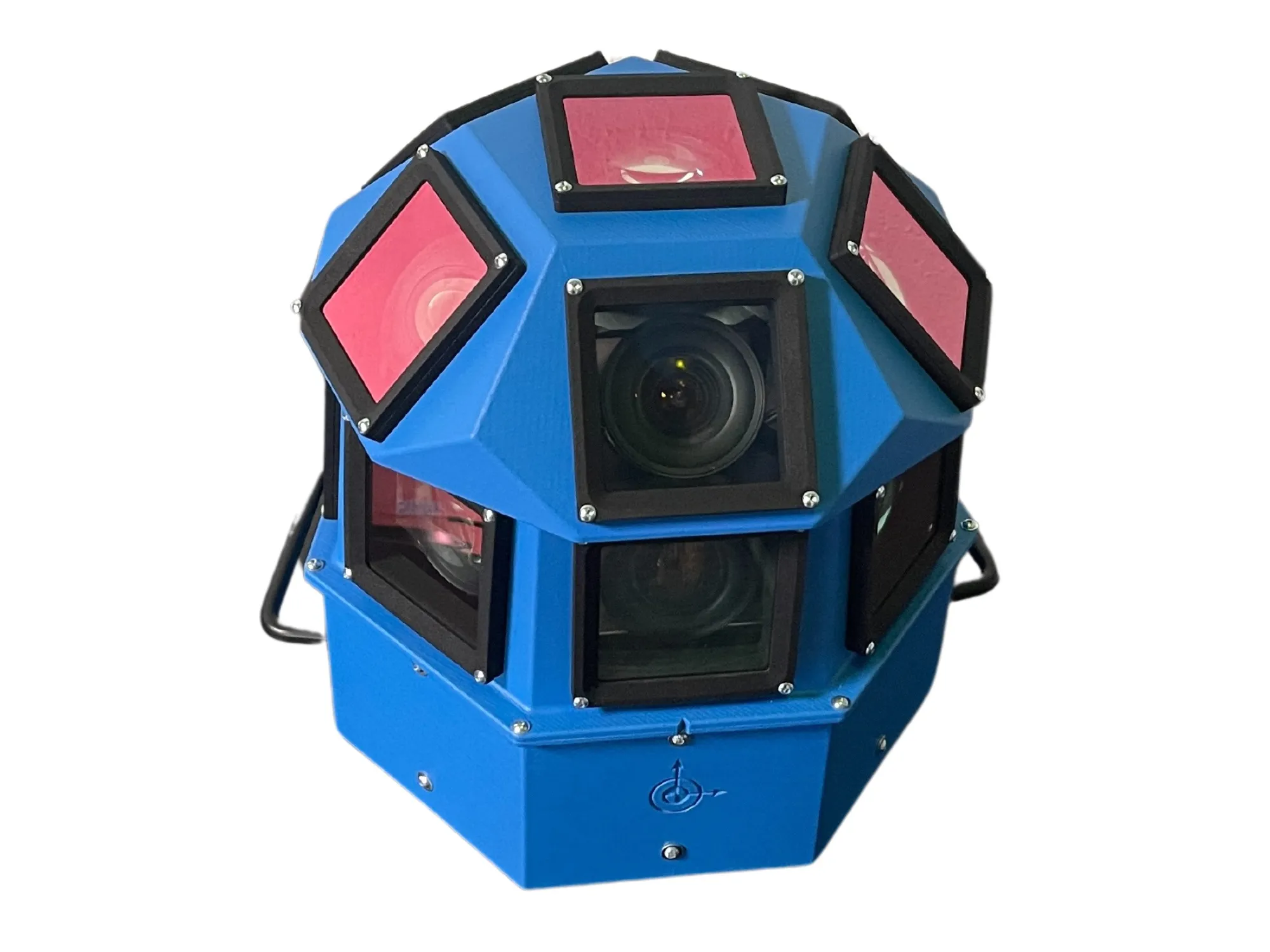
Panoramic camera head designed for automated data collection in traffic applications
By David Arminas November 13, 2024 Read time: 2 mins
The head delivers 180 MPixel resolution with 360° horizontal and 120° vertical coverage

AI-InfraSolutions, a geospatial mapping technology business, has partnered with Stemmer Imaging to develop a 360°-degree panoramic camera head.

It is designed for automated data collection in applications such as traffic sign identification, road condition assessments and environmental monitoring. The technology enables municipalities and companies to efficiently manage assets and adopt predictive maintenance strategies.

AI-InfraSolutions said the new head will “redefine the future of geospatial mapping”. Engineered through machine vision specialist Stemmer’s More Engineering Services, the head delivers 180 MPixel resolution with 360° horizontal and 120° vertical coverage. It captures synchronised images every 5m at driving speeds of up to 100km/h, making it an ideal solution for large-scale geospatial mapping projects.

Development of the head posed several technical challenges, including selecting optimal sensors, synchronising image capture with GNSS systems and minimising parallax for smooth panoramic stitching. Stemmer's engineering expertise and precise intrinsic calibration were instrumental in addressing these challenges. This resulted in a robust solution capable of continuous high-speed recording for up to 247km, expandable to 496km.

Once the images are captured, AI-InfraSolutions’ powerful AI-driven data processing algorithms automatically prepare the data for further analysis. This system is particularly effective in areas such as infrastructure asset management and road condition monitoring. Offline post-processing features, including tone mapping and panoramic stitching, ensure that the collected data is refined for optimal accuracy

“By combining our innovative approach with Stemmer Imaging’s leading vision, we are elevating our solutions to an unmatched level,” said Jeroen Zanen, founder and chief executive of AI-InfraSolutions.

For more information on companies in this article

Related Content

  • Road safety systems on show at ITS World Congress
    January 30, 2012
    A vast array of new products and systems for aiding road safety were displayed at the ITS World Congress in October. David Crawford assesses a selection of safety initiatives exhibited in Orlando. Vital roles for ITS applications in road traffic safety emerge clearly from a new report from the US Transportation Safety Advancement Group. The report has been carried out for the Next Generation 911 What's Next Forum, which is preparing the way for future development of the US national 911 emergency single call
  • Bridge & tunnel management: seeing the bigger picture
    September 10, 2024
    A variety of technologies are available to monitor the health of critical infrastructure – and to keep the drivers who use it safe by flagging incidents while reducing false alarms
  • Close shave for Brazilian project
    June 12, 2015
    Signing the order to equip a new control room just 45 days before the city hosts a major sporting event is challenging - but some deadlines just cannot be moved. There is nothing like a deadline to concentrate minds and effort as Mitsubishi and the Brazilian city of Belo Horizonte discovered in the run-up to the 2014 World Cup. Although municipal authorities had been considering a new command centre for years, it was the hosting of the World Cup last summer that provided the final impetus.
  • Dutch approval for Redflex mobile speed enforcement
    September 5, 2014
    RedflexRadarcam, Redflex’s flexible mobile speed enforcement system, has undergone testing by the Dutch metrology institute, NMi Certin (NMi), and verified to meet Dutch approval requirements. Said to be the first speed enforcement system to utilise dual radar detection for accurate speed detection in all weather conditions, RedflexRadarcam also provides lane identification, vehicle position and positive vehicle identification across up to six lanes of traffic simultaneously.