AI-InfraSolutions and Stemmer go the full 360°

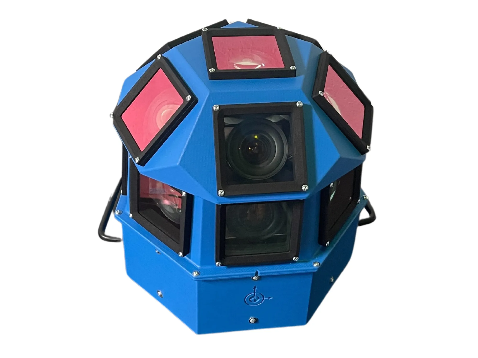
Panoramic camera head designed for automated data collection in traffic applications
By David Arminas November 13, 2024 Read time: 2 mins
The head delivers 180 MPixel resolution with 360° horizontal and 120° vertical coverage

AI-InfraSolutions, a geospatial mapping technology business, has partnered with Stemmer Imaging to develop a 360°-degree panoramic camera head.

It is designed for automated data collection in applications such as traffic sign identification, road condition assessments and environmental monitoring. The technology enables municipalities and companies to efficiently manage assets and adopt predictive maintenance strategies.

AI-InfraSolutions said the new head will “redefine the future of geospatial mapping”. Engineered through machine vision specialist Stemmer’s More Engineering Services, the head delivers 180 MPixel resolution with 360° horizontal and 120° vertical coverage. It captures synchronised images every 5m at driving speeds of up to 100km/h, making it an ideal solution for large-scale geospatial mapping projects.

Development of the head posed several technical challenges, including selecting optimal sensors, synchronising image capture with GNSS systems and minimising parallax for smooth panoramic stitching. Stemmer's engineering expertise and precise intrinsic calibration were instrumental in addressing these challenges. This resulted in a robust solution capable of continuous high-speed recording for up to 247km, expandable to 496km.

Once the images are captured, AI-InfraSolutions’ powerful AI-driven data processing algorithms automatically prepare the data for further analysis. This system is particularly effective in areas such as infrastructure asset management and road condition monitoring. Offline post-processing features, including tone mapping and panoramic stitching, ensure that the collected data is refined for optimal accuracy

“By combining our innovative approach with Stemmer Imaging’s leading vision, we are elevating our solutions to an unmatched level,” said Jeroen Zanen, founder and chief executive of AI-InfraSolutions.

Related Content

  • December 6, 2017
    Vision technology lifts blinkers from tunnel vision
    Sony’s Jerome Avenel looks at how advances in imaging technology are helping improve safety. On the 24th March 1999, a Belgian truck transporting flour and margarine through the 11.6km Mont Blanc tunnel caught alight when a cigarette stub entered the engine induction snorkel, lighting the paper air filter. The fire left over 30 dead and many more injured. At the time, the Mont Blanc tunnel disaster was the world’s worst tunnel fire.
  • March 28, 2022
    Lidar: recipes for success
    Lidar is being deployed all over the world - and you can even read a cookbook on the subject...
  • February 3, 2012
    Detection analysis technology successfully predicts traffic flows
    David Crawford investigates new detection analysis technology from IBM. Locations on both the East and West Coasts of the US are scheduled for early deployments of IBM's new Traffic Prediction Tool (TPT) statistical analysis model for the fine-time resolution and near-term prediction of road flow conditions. Developed by IBM's Watson Research Laboratories, TPT is designed to analyse data from the the key detection indicators - average vehicle volumes and speeds passing a location in a given time interval -
  • June 11, 2015
    Machine vision’s image of road management’s future
    Q-Free’s Marco Sinnema looks at how the commoditisation of high-quality vision-based solutions is widening their application. Machine vision technology’s entry into the ITS/traffic management sector has followed a classic top-down path. This is unsurprising given the extremely demanding performance criteria which are the standard in its market of origin, manufacturing processing. Very high image qualities combined with frame rates often in the hundreds per second range resulted in vision systems with capabi