AI-InfraSolutions and Stemmer go the full 360°

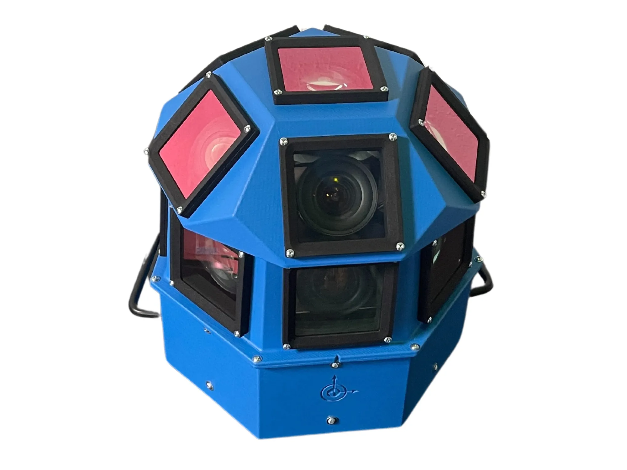
Panoramic camera head designed for automated data collection in traffic applications
By David Arminas November 13, 2024 Read time: 2 mins
The head delivers 180 MPixel resolution with 360° horizontal and 120° vertical coverage

AI-InfraSolutions, a geospatial mapping technology business, has partnered with Stemmer Imaging to develop a 360°-degree panoramic camera head.

It is designed for automated data collection in applications such as traffic sign identification, road condition assessments and environmental monitoring. The technology enables municipalities and companies to efficiently manage assets and adopt predictive maintenance strategies.

AI-InfraSolutions said the new head will “redefine the future of geospatial mapping”. Engineered through machine vision specialist Stemmer’s More Engineering Services, the head delivers 180 MPixel resolution with 360° horizontal and 120° vertical coverage. It captures synchronised images every 5m at driving speeds of up to 100km/h, making it an ideal solution for large-scale geospatial mapping projects.

Development of the head posed several technical challenges, including selecting optimal sensors, synchronising image capture with GNSS systems and minimising parallax for smooth panoramic stitching. Stemmer's engineering expertise and precise intrinsic calibration were instrumental in addressing these challenges. This resulted in a robust solution capable of continuous high-speed recording for up to 247km, expandable to 496km.

Once the images are captured, AI-InfraSolutions’ powerful AI-driven data processing algorithms automatically prepare the data for further analysis. This system is particularly effective in areas such as infrastructure asset management and road condition monitoring. Offline post-processing features, including tone mapping and panoramic stitching, ensure that the collected data is refined for optimal accuracy

“By combining our innovative approach with Stemmer Imaging’s leading vision, we are elevating our solutions to an unmatched level,” said Jeroen Zanen, founder and chief executive of AI-InfraSolutions.

For more information on companies in this article

Related Content

  • User-based insurance joins the battle for big data
    November 10, 2015
    User-based insurance is blazing a trail others would like to follow and is also discovering the challenges. The ITS sector needs to keep a very careful eye on the automotive industry: “There’s a war going on in the connected car space creating richer datasets than we ever imagined possible” says Paul Stacy, research and development director of Wunelli, part of the LexisNexis group. The car makers have gone way beyond infotainment, unlocking huge amounts of data in the process … facts and figures which the i
  • Baidu autonomous car reaches milestone in Beijing
    December 11, 2015
    An autonomous car developed by Chinese language Internet search provider Baidu has successfully completed rigorous, fully autonomous tests on one route with mixed roads under a variety of environmental conditions, says the company. The Baidu autonomous car is the first in China to have demonstrated full autonomy under mixed road conditions, marking a milestone in China's autonomous driving effort. The road tests were carried out under complex road conditions, and the Baidu vehicle, a modified BMW 3 Serie
  • OpenSpace visualises how social distancing will work
    May 26, 2020
    OpenSpace CEO Nicolas Le Glatin tells Adam Hill how Xovis camera tech might help unlock more convenient ways for moving through mobility hubs during Covid-19
  • Multi-platform mapping with Robin
    May 24, 2016
    3D Laser Mapping’s new multi-platform mapping system, Robin, provides three alternative mapping options in one solution, allowing users to benefit from the ability to map areas via walking, driving or flying. Robin integrates a 12 MP camera (for drive) and 18MP (for walk and fly), two GNSS antennas, GIS grade IMU navigation system, touch screen control unit, three mounting systems, capture software, a post-processing software package and has a field of view of 330 degrees. Long-range and precision versi