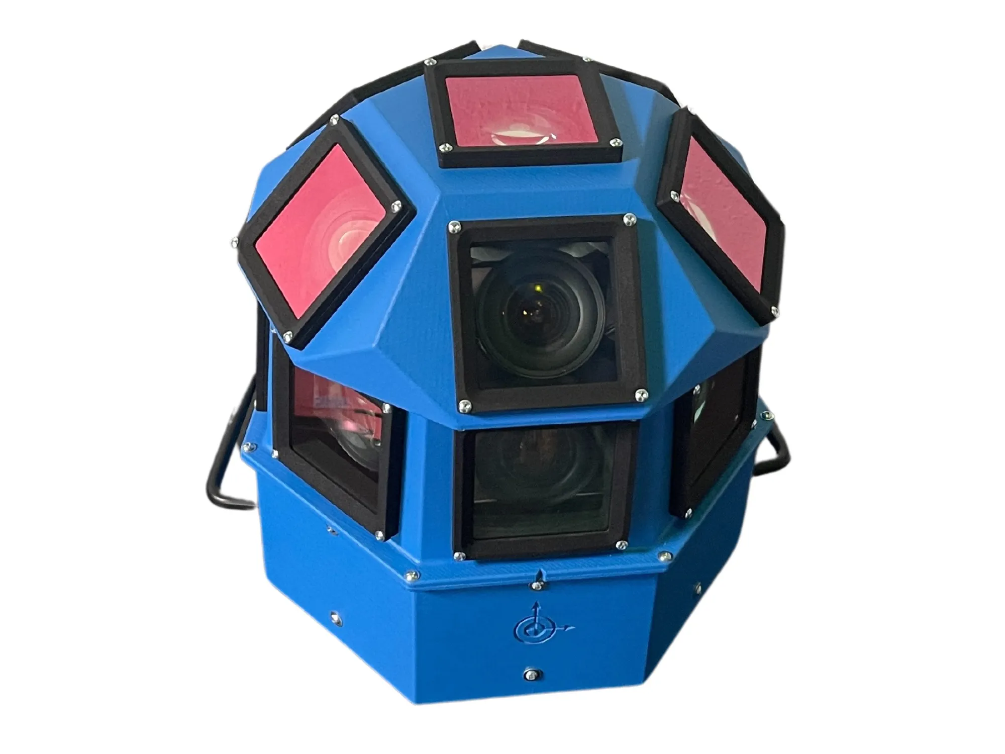
AI-InfraSolutions and Stemmer go the full 360°

Panoramic camera head designed for automated data collection in traffic applications
By David Arminas November 13, 2024 Read time: 2 mins
The head delivers 180 MPixel resolution with 360° horizontal and 120° vertical coverage

AI-InfraSolutions, a geospatial mapping technology business, has partnered with Stemmer Imaging to develop a 360°-degree panoramic camera head.

It is designed for automated data collection in applications such as traffic sign identification, road condition assessments and environmental monitoring. The technology enables municipalities and companies to efficiently manage assets and adopt predictive maintenance strategies.

AI-InfraSolutions said the new head will “redefine the future of geospatial mapping”. Engineered through machine vision specialist Stemmer’s More Engineering Services, the head delivers 180 MPixel resolution with 360° horizontal and 120° vertical coverage. It captures synchronised images every 5m at driving speeds of up to 100km/h, making it an ideal solution for large-scale geospatial mapping projects.

Development of the head posed several technical challenges, including selecting optimal sensors, synchronising image capture with GNSS systems and minimising parallax for smooth panoramic stitching. Stemmer's engineering expertise and precise intrinsic calibration were instrumental in addressing these challenges. This resulted in a robust solution capable of continuous high-speed recording for up to 247km, expandable to 496km.

Once the images are captured, AI-InfraSolutions’ powerful AI-driven data processing algorithms automatically prepare the data for further analysis. This system is particularly effective in areas such as infrastructure asset management and road condition monitoring. Offline post-processing features, including tone mapping and panoramic stitching, ensure that the collected data is refined for optimal accuracy

“By combining our innovative approach with Stemmer Imaging’s leading vision, we are elevating our solutions to an unmatched level,” said Jeroen Zanen, founder and chief executive of AI-InfraSolutions.

Related Content

  • February 1, 2012
    Idris paves the way for loop based speed enforcement
    With the Idris system now validated as a speed verification tool, the way is open for loops to be used in more complex enforcement applications. Diamond Consulting Services (DCS), developer of the Idris inductive loop-based vehicle detection and classification system, has recently successfully conducted validation trials which, the company says, open the way for Idris to be used for speed verification and loop-based sensors to be used for more complex applications such as speed-on-green and differential spe
  • March 25, 2020
    ProPart AV trial crosses the line
    The perceived safety benefits of autonomous vehicles can only be realised with precise positioning. Ben Spencer reports from Sweden on work by a European consortium which aims to use the technology to allow a truck to carry out an automated lane change
  • October 29, 2014
    Tattile targets machine vision
    Tattile’s wide range of camera systems for machine vision use includes the Tag-7 linear camera series and the S200 smart camera range. TAG-7 is a linear CCD CameraLink compact digital camera with a linear 2 megapixel CCD sensor, and is designed to meet the main requirements of machine vision.
  • March 16, 2016
    Radar reinforces detection efficiency
    Radar can have distinct advantages in some transport-related situations as Colin Sowman found out during a visit to Navtech Radar. Despite tremendous advances in machine vision techniques, the accuracy and reliability of camera-based detection systems suffer during periods of poor visibility where other technologies may offer an alternative. Radar is one such technology. It too has seen significant development in recent years and according to Navtech Radar, the technology can often fulfil detection and moni