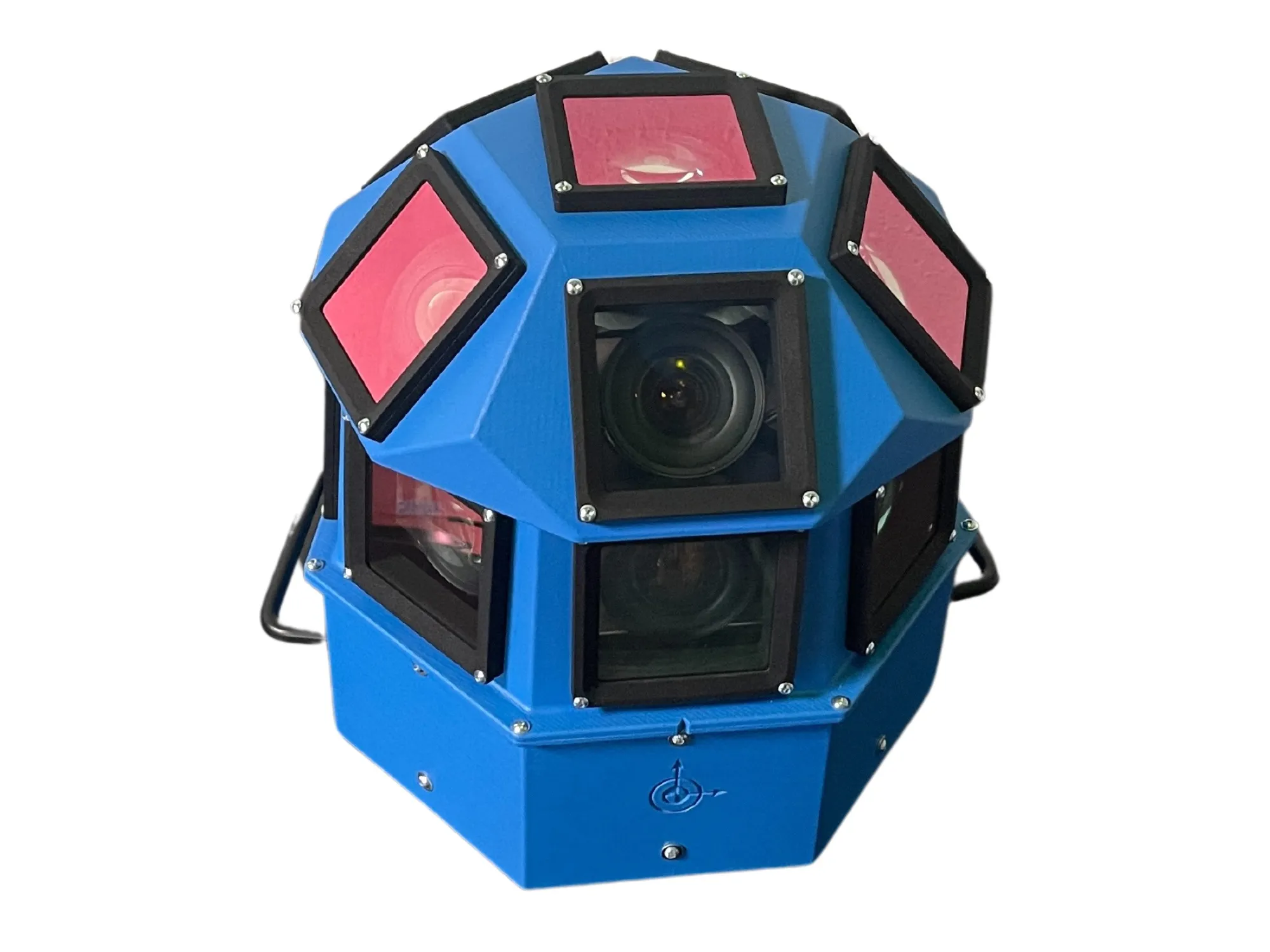
AI-InfraSolutions and Stemmer go the full 360°

Panoramic camera head designed for automated data collection in traffic applications
By David Arminas November 13, 2024 Read time: 2 mins
The head delivers 180 MPixel resolution with 360° horizontal and 120° vertical coverage

AI-InfraSolutions, a geospatial mapping technology business, has partnered with Stemmer Imaging to develop a 360°-degree panoramic camera head.

It is designed for automated data collection in applications such as traffic sign identification, road condition assessments and environmental monitoring. The technology enables municipalities and companies to efficiently manage assets and adopt predictive maintenance strategies.

AI-InfraSolutions said the new head will “redefine the future of geospatial mapping”. Engineered through machine vision specialist Stemmer’s More Engineering Services, the head delivers 180 MPixel resolution with 360° horizontal and 120° vertical coverage. It captures synchronised images every 5m at driving speeds of up to 100km/h, making it an ideal solution for large-scale geospatial mapping projects.

Development of the head posed several technical challenges, including selecting optimal sensors, synchronising image capture with GNSS systems and minimising parallax for smooth panoramic stitching. Stemmer's engineering expertise and precise intrinsic calibration were instrumental in addressing these challenges. This resulted in a robust solution capable of continuous high-speed recording for up to 247km, expandable to 496km.

Once the images are captured, AI-InfraSolutions’ powerful AI-driven data processing algorithms automatically prepare the data for further analysis. This system is particularly effective in areas such as infrastructure asset management and road condition monitoring. Offline post-processing features, including tone mapping and panoramic stitching, ensure that the collected data is refined for optimal accuracy

“By combining our innovative approach with Stemmer Imaging’s leading vision, we are elevating our solutions to an unmatched level,” said Jeroen Zanen, founder and chief executive of AI-InfraSolutions.

For more information on companies in this article

Related Content

  • Aldis now Gridsmart Technologies
    March 16, 2015
    After a successful year in both product development and sales, transportation systems specialist Aldis has changed its name to Gridsmart Technologies, which it says more accurately reflects the company’s goals, product line and identity. Gridsmart Technologies developed the Gridsmart System, a tracking-based vision solution for actuation and data collection at intersections and highways. The system uses a single camera with an ultra-wide angle lens to track all movement in its field of view, which allows f
  • USDoT looks at the costs and potential benefits of connected vehicles
    October 26, 2017
    David Crawford looks at latest lessons learned from the trials of connected vehicles in the US. The progress of connected vehicle (CV) technologies takes centre stage among the hot topics highlighted in the September 2017 edition – the first since 2014 – of the ‘ITS Benefits, Costs and Lessons Learned’ survey from the US ITS Joint Program Office (JPO). The organisation is an arm of the US Department of Transportation (USDoT).
  • How ITS helped Coachella get its groove back
    November 15, 2024
    California’s Coachella Valley attracts visitors to myriad music and sports events. But now an ambitious traffic management initiative aims to cut travel times and reduce emissions. Adam Hill talks to the engineers involved in the massive CV Sync project
  • Euromed countries warm to Galileo’s services
    June 6, 2014
    The EU is helping countries in North Africa and the Middle East utilise Galileo’s services. With its Galileo constellation rapidly taking shape, the European Union has opened lines of communication with countries in North Africa and the Middle East with a view to assisting their governments and businesses to utilise the satellite services that extend across the Mediterranean. The services available to countries are provided through the European Global Navigational Satellite System (E-GNSS), which includes a