3D lane geometry for TomTom Orbis Maps

New development uses AI, including fundamental vision models
By Adam Hill January 7, 2025 Read time: 1 min
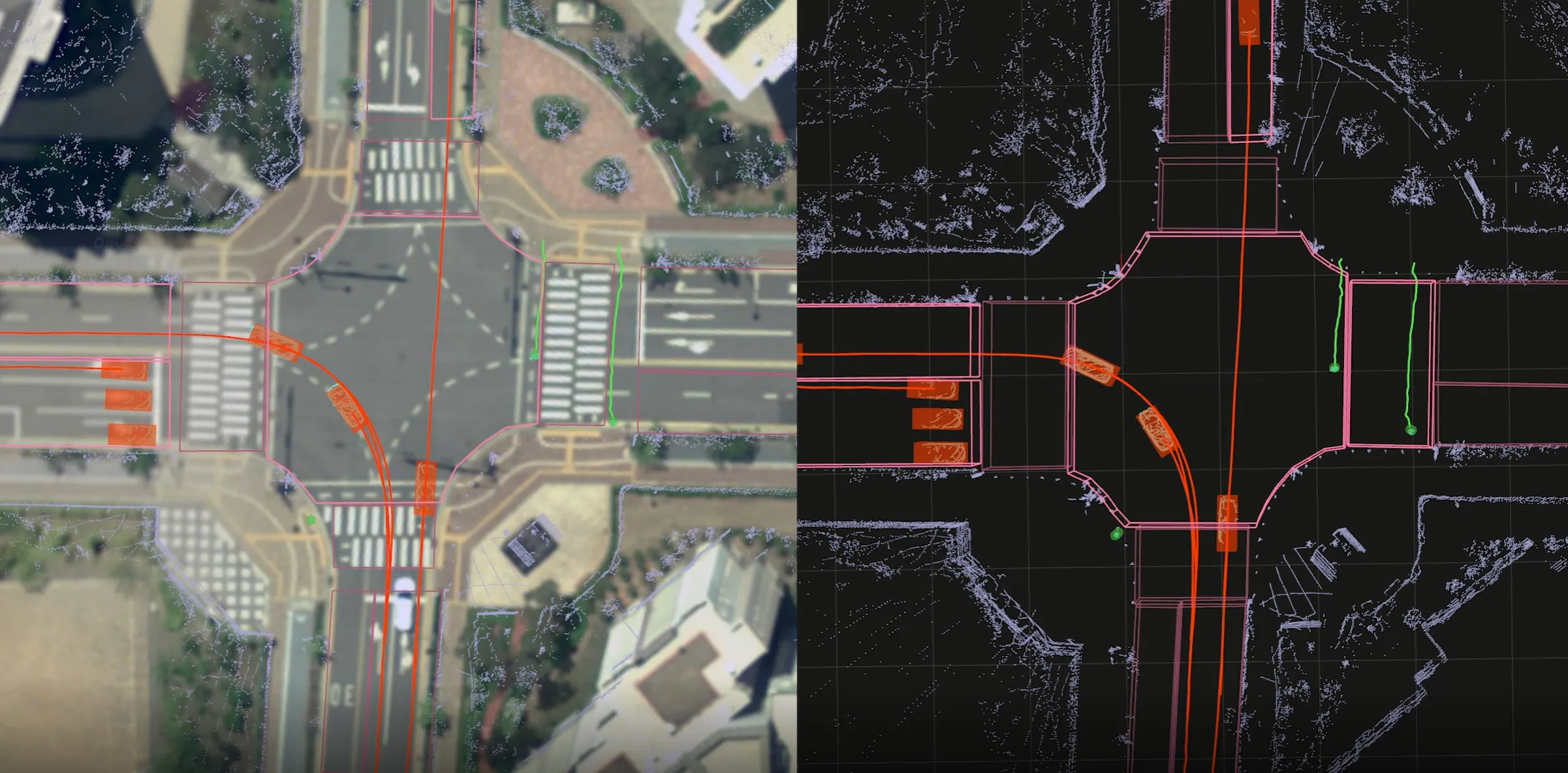
ADAS requires lane-level maps for reliability and safety (image: TomTom)

Location information provider TomTom has expanded lane geometry data on its Orbis Maps.

The maps now offer "lane-level precision that is measured in centimetres, available on a global scale and continuously refreshed", it says.

Mike Schoofs, the company's chief revenue officer, says the move marks a "transformative step in mapping technology".

Using AI, including fundamental vision models, TomTom Orbis Maps can now produce 3D lane geometry for any road type, by merging crowdsourced observations from production vehicles and dashcams, aerial and satellite imagery and Lidar survey data.

Advanced driver assistance systems (ADAS) rely on lane-level maps for reliability and safety, TomTom says, and the new maps can offer accurate delineation of road surfaces and painted lines, and combine 3D traffic signs with insights into driver movements and behaviour.

This "enables navigation in complex urban environments through better anticipation of tricky situations, such as busy intersections, high-speed junctions, and interactions with vulnerable road users", the company suggests.

It can also help last-mile logistics by enabling transport companies to optimise pick-up and drop-off processes.

"Urban planners also benefit from greater granularity in map data, which helps them make informed decisions on lane-level traffic management, bike lane and public transport planning, and parking space optimisation," TomTom says.

For more information on companies in this article

Related Content

  • Seoul Robotics opens doors of perception
    March 25, 2022
    SENSR-I software can capture actionable data on movement of people and vehicles
  • Phoenix rises to the Smart City challenge
    December 10, 2015
    Andrew Bardin Williams looks at the City of Phoenix where voters backed a $30bn plan to revamp its transportation network to cultivate a more connected community. According to a Land Use Institute study, half of all Americans and even more millennials (63%) would like to live in a place where they do not need to use a car very often. The City of Phoenix is putting in place plans to revamp its urban development and transportation policies to meet these changing quality of life perceptions.
  • With C-ITS we can get ourselves connected
    June 27, 2025
    Workzones need to be safer for drivers and workers – and the technology exists to harmonise safety with mobility needs, says Swarco’s Daniel Lenczowski
  • Syracuse models post-industrial revival for US cities
    August 13, 2015
    A connective corridor in Syracuse, New York State, could be a model for other post-industrial cities, as David Crawford discovers. The aim of the city of Syracuse’ 5.6km-long Connective Corridor in Onandaga County in upstate New York is to create a model ‘complete street’ for use in wider regeneration schemes. Key transport-sector components are traffic calming, high-quality transit with accessible passenger information, plus walkability and bike-friendliness.