Capital Metropolitan Transportation Authority (Capital Metro) in Austin, Texas, has partnered with HaCon and Bytemark to develop trip planning tools for both web and mobile platforms. The CapMetro App, which has already been downloaded more than 250,000 times, now features updated traveller tools that provide door-to-door trip planning and real-time data visualisation on a predictive live map.
Capital Metropolitan Transportation Authority (Capital Metro) in Austin, Texas, has partnered with 5550 HaCon and 7877 Bytemark to develop trip planning tools for both web and mobile platforms.
The CapMetro App, which has already been downloaded more than 250,000 times, now features updated traveller tools that provide door-to-door trip planning and real-time data visualisation on a predictive live map. The redesigned CapMetro Trip Planner will help thousands of visitors to navigate the city's growing public transportation network.
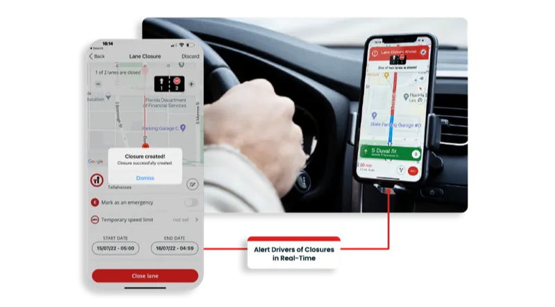
In addition to facilitating real-time trip planning by shortest walking distance, shortest trip time, minimal transfers or preferred service mode, key functionalities and features include integrated mobile ticketing ; detailed maps ; notifications and alarms with information on delays, connection status or service alerts, amongst others.
The CapMetro App, which has already been downloaded more than 250,000 times, now features updated traveller tools that provide door-to-door trip planning and real-time data visualisation on a predictive live map. The redesigned CapMetro Trip Planner will help thousands of visitors to navigate the city's growing public transportation network.
In addition to facilitating real-time trip planning by shortest walking distance, shortest trip time, minimal transfers or preferred service mode, key functionalities and features include integrated mobile ticketing ; detailed maps ; notifications and alarms with information on delays, connection status or service alerts, amongst others.