Bronx bus passengers will soon be able to avoid waits at bus stops and get bus-arrival information on their home computer, smartphone or mobile phone. With MTA Bus Time, passengers can access a map showing where buses are along a particular route. They can also request a text telling them where the nearest bus is on the route. Developed by New York’s Metropolitan transit Authority (MTA), Bus Time uses accurate location data provided by an enhanced GPS device mounted inside each bus. That information is int
October 30, 2012
Read time: 2 mins
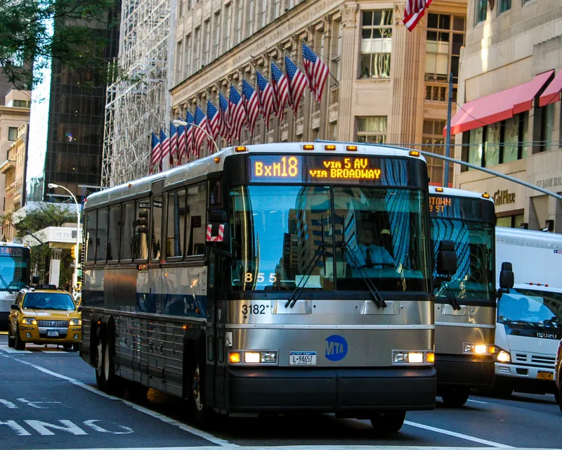
Bronx bus passengers will soon be able to avoid waits at bus stops and get bus-arrival information on their home computer, smartphone or mobile phone.
With MTA Bus Time, passengers can access a map showing where buses are along a particular route. They can also request a text telling them where the nearest bus is on the route.
Developed by New York’s Metropolitan transit Authority (MTA), Bus Time uses accurate location data provided by an enhanced GPS device mounted inside each bus. That information is integrated with the bus operator login information, including the route, run and destination sign code, and transmitted wirelessly to a Bus Time server using onboard cellular equipment and integrated with schedules and map files to output real time next bus information to passengers who can obtain the information through their cell phones, smart phones, PCs and digital displays.
Bus Time was first launched on one bus route in Brooklyn in 2011 as a pilot program and was quickly expanded to another route in the borough, one bus route in Manhattan and the whole of Staten Island. Since then, more than 38,000 passengers in Staten Island have received bus arrival information by text.
“That’s more than 30% of Staten Island’s bus riding population - an extraordinary usage rate,” said Amanda Moskowitz, general manager of5676 Mobile Commons, which runs the texting component of MTA Bus Time.
By the end of next year, passengers anywhere in the city will be able to use MTA Bus Time, according to Craig Stewart, senior corporate management officer at the NYC Transit division.
Each bus stop has a posted identification number. To get bus location information, passengers simply text a bus stop number to Bus Time, which then tells them how far away the next three buses are, Moskowitz said.
“It’s a simple concept but it has a huge impact,” she said. “It’s allowed people to avoid waiting unnecessarily at the bus stop. They can now use that time to grab a cup of coffee or spend a few extra minutes at home with their children.”
With MTA Bus Time, passengers can access a map showing where buses are along a particular route. They can also request a text telling them where the nearest bus is on the route.
Developed by New York’s Metropolitan transit Authority (MTA), Bus Time uses accurate location data provided by an enhanced GPS device mounted inside each bus. That information is integrated with the bus operator login information, including the route, run and destination sign code, and transmitted wirelessly to a Bus Time server using onboard cellular equipment and integrated with schedules and map files to output real time next bus information to passengers who can obtain the information through their cell phones, smart phones, PCs and digital displays.
Bus Time was first launched on one bus route in Brooklyn in 2011 as a pilot program and was quickly expanded to another route in the borough, one bus route in Manhattan and the whole of Staten Island. Since then, more than 38,000 passengers in Staten Island have received bus arrival information by text.
“That’s more than 30% of Staten Island’s bus riding population - an extraordinary usage rate,” said Amanda Moskowitz, general manager of
By the end of next year, passengers anywhere in the city will be able to use MTA Bus Time, according to Craig Stewart, senior corporate management officer at the NYC Transit division.
Each bus stop has a posted identification number. To get bus location information, passengers simply text a bus stop number to Bus Time, which then tells them how far away the next three buses are, Moskowitz said.
“It’s a simple concept but it has a huge impact,” she said. “It’s allowed people to avoid waiting unnecessarily at the bus stop. They can now use that time to grab a cup of coffee or spend a few extra minutes at home with their children.”


