Moovit helps guide visually-impaired transit riders

Moovit has partnered with remote assistance app Aira and Microsoft Azure Maps to help make public transit more accessible for blind and low-vision riders.
January 14, 2020 Read time: 1 min
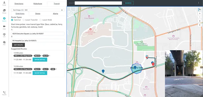
Moovit says Aira’s mobile app or smart glasses allow Aira agents to see a user’s environment through their smartphone camera. This partnership is expected to assist agents in helping users navigate public transit more effectively, with better real-time data.

Azure Maps will provide agents with access to navigational tools while Moovit’s transit application programming interfaces will offer information on multimodal trip planning and transit routes, the company adds.

Yovav Meydad, Moovit’s chief growth and marketing officer, says the solution will “open opportunities for riders to travel more freely and independently, significantly impacting their life”.

Related Content

  • US county launches real-time bus information
    September 5, 2016
    Loudoun County, Virginia has launched a new real-time bus information system that provides commuter bus riders with accurate arrival times of their buses. Bus Time is a web-based tool that can be viewed using a web browser on a mobile device, laptop or PC. This program helps passengers plan their commute by allowing them to see the next several buses scheduled to arrive at their selected stop.
  • Cooperative infrastructure systems waiting for the go ahead
    February 3, 2012
    Despite much research and technological promise, progress towards cooperative infrastructure system deployment is still slow. Here, Robert Cone and John Miles take a considered look at how and when it might come about. From a systems engineering viewpoint it looks logical and inevitable that vehicles should be communicating between themselves and with the road infrastructure. But seen from a business viewpoint the case is not proven.
  • Init introduces web-based passenger services
    May 30, 2013
    German supplier of integrated ITS and ticketing systems for public transport is introducing a range of real time passenger information systems (RTPI), aimed at making public transport an attractive option for travellers, including: Onlineinfo provides reliable RTPI information via the internet, including Google maps, RSS-feeds for disturbance information, PC, mobile web-pages, mobile tagging, web apps and smart phone apps.
  • Transport for London launches competition to create accessibility apps
    March 14, 2013
    Transport for London (TfL) is launching a competition to create new 'Accessibility Apps', marking the first of a series of initiatives to improve the variety of accessibility apps on offer. As part of the competition developers are being invited to apply with ideas for a new travel app which will make Transport for London (TfL) real time data more accessible to a far wider audience than mainstream Apple/Android apps. The winning entries will receive development support from TfL. Making the transport network