Hawaii DoT begins issuing driver speed warnings

10 intersections already have red-light running detection in downtown Honolulu
By Adam Hill March 13, 2025 Read time: 2 mins
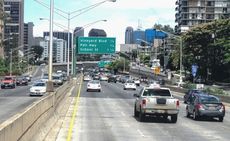
Honolulu morning traffic heads towards Vineyard Boulevard (© Mollynz | Dreamstime.com)

Hawaii Department of Transportation (HDoT) has begun issuing warnings from speed cameras at 10 intersections in downtown Honolulu.

Cameras at these intersections have been issuing citations for red-light running since November 2022 - and this has seen a 69% reduction in major crashes, HDoT says. Adding speed enforcement is designed to improve safety there.

“Speed is a crucial factor in whether or not someone will survive a car crash,” said HDoT director Ed Sniffen. “Although statistics show nearly half of the traffic deaths in Hawaii over the past five years are directly attributable to speed, we know through physics that the higher the collision speed the more serious the injury. If motorists drive at appropriate speeds, we can reduce crashes and keep vulnerable users like pedestrians and bicyclists safe.”

The warnings will continue until 29 April, for the purposes of driver education, after which fines will start to be issued.

Incidents are captured by the system as still images and a 12-second video, and that data is transferred to a processing centre for preliminary screening.

A local reviewer checks the images, data and speed to determine a violation, which are mailed within 10 days of the initial incident.

The vehicle's registered owner can review the data on the online portal after receiving the posted citation in the mail.

Fines will be deposited into a fund which can only be used for "the establishment, implementation, operation, oversight, repair and maintenance of the safety camera systems". 

The intersections are:

Vineyard Boulevard and Pālama Street
Vineyard Boulevard and Liliha Street
Vineyard Boulevard and Nu‘uanu Avenue
Pali Highway and Vineyard Boulevard
Pali Highway and North School Street
Likelike Highway and North School Street
Ward Avenue and South King Street
Kapi‘olani Boulevard and Kamake‘e Street
South Beretania Street and Pi‘ikoi Street
McCully Street and Algaroba Street

For more information on companies in this article

Related Content

  • China’s Smart Cities initiative chooses Econolite ITS solutions
    May 3, 2013
    Econolite’s intelligent transportation systems (ITS) are to be implemented in China’s Smart Cities urbanisation project to enhance roadway efficiencies and safety. The Smart Cities urbanisation project is part of the country’s recently announced infrastructure-based stimulus package estimated at US$6.4 trillion, ten times larger than China’s 2008 stimulus package. The company’s ITS solutions will first address the growing traffic congestion in the Panyu District of Guangzhou, where Econolite and regional pa
  • IRD demonstrates integrated systems including WIM@Toll
    October 23, 2012
    Canada-headquartered International Road Dynamics (IRD) is here in Vienna to present integrated ITS solutions that make highways more efficient. The company is showcasing products, software, and fully integrated systems for automated truck weigh stations using high-speed and low speed weigh-in-motion (WIM), automated toll collection and audit systems, highway traffic management systems (HTMS), advanced traffic data collection, security and access control, and fleet management using GPS. As IRD points out, it
  • Swarco installs 34 VAS cameras to calm speeding in Brent
    February 12, 2018
    Swarco Traffic has installed 34 Vehicle Activated Speed signs (VAS) at key locations in the UK borough of Brent to support its council in reducing collisions, road danger and accidents that involve powered two wheelers (P2Ws) such as motorcycles and mopeds. Motorcycles account for 19% of all road user deaths despite representing 1% of total road traffic, according to the National Think Road Safety Campaign.
  • Travel times halve for tolling converts
    August 5, 2013
    The Port Mann Bridge in Vancouver is a prime example of how the latest ITS systems enable new infrastructures to be built and paid for while still providing additional user benefits. Vancouver has 2.2 million inhabitants and, like so many major cities, is divided into two by a river, the Frazer river. This combination makes Vancouver the second most congested city in North America and the most congested in Canada. Through the middle of the city runs the Trans-Canadian Highway 1 which crosses the Frazer Riv