Hawaii DoT begins issuing driver speed warnings

10 intersections already have red-light running detection in downtown Honolulu
By Adam Hill March 13, 2025 Read time: 2 mins
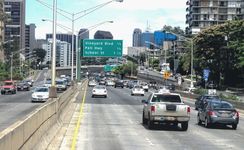
Honolulu morning traffic heads towards Vineyard Boulevard (© Mollynz | Dreamstime.com)

Hawaii Department of Transportation (HDoT) has begun issuing warnings from speed cameras at 10 intersections in downtown Honolulu.

Cameras at these intersections have been issuing citations for red-light running since November 2022 - and this has seen a 69% reduction in major crashes, HDoT says. Adding speed enforcement is designed to improve safety there.

“Speed is a crucial factor in whether or not someone will survive a car crash,” said HDoT director Ed Sniffen. “Although statistics show nearly half of the traffic deaths in Hawaii over the past five years are directly attributable to speed, we know through physics that the higher the collision speed the more serious the injury. If motorists drive at appropriate speeds, we can reduce crashes and keep vulnerable users like pedestrians and bicyclists safe.”

The warnings will continue until 29 April, for the purposes of driver education, after which fines will start to be issued.

Incidents are captured by the system as still images and a 12-second video, and that data is transferred to a processing centre for preliminary screening.

A local reviewer checks the images, data and speed to determine a violation, which are mailed within 10 days of the initial incident.

The vehicle's registered owner can review the data on the online portal after receiving the posted citation in the mail.

Fines will be deposited into a fund which can only be used for "the establishment, implementation, operation, oversight, repair and maintenance of the safety camera systems". 

The intersections are:

Vineyard Boulevard and Pālama Street
Vineyard Boulevard and Liliha Street
Vineyard Boulevard and Nu‘uanu Avenue
Pali Highway and Vineyard Boulevard
Pali Highway and North School Street
Likelike Highway and North School Street
Ward Avenue and South King Street
Kapi‘olani Boulevard and Kamake‘e Street
South Beretania Street and Pi‘ikoi Street
McCully Street and Algaroba Street

For more information on companies in this article

Related Content

  • Florida red-light camera intersections show reduction in crashes, says report
    January 6, 2017
    According to the Florida Department of Highway Safety and Motor Vehicles' (DHSMV) fifth annual report on red-light safety cameras, intersections equipped with the technology are challenging a state-wide trend. While overall crashes state-wide have increased by 33 per cent from 2012-2015, crashes specifically related to red-light running at red-light safety camera intersections have decreased by more than three per cent. There is also a reduction in crashes at red-light safety camera intersections involvi
  • West Midlands schoolchildren help to educate speeding motorists
    May 25, 2017
    Pupils from Salisbury Primary School in Darlaston, West Midlands, UK, recently took part in a Community Speedwatch initiative with West Midlands Police, using a Speedwatch system supplied by UK company Traffic Technology. Under police supervision, the children were given the opportunity to read the data obtained by the Speedwatch device and relay it to the rest of the group, which transferred the information on vehicle type, colour, registration and speed to a specially-produced form. The children then used
  • LiDAR sets its sights on future problems
    February 23, 2017
    AAdvances in LiDAR are helping transport authorities improve services and identify potential problem areas, as geospatial technology expert Dr Neil Slatcher explains. The effects of climate change on the transport infrastructure have long been a cause of concern within the transportation sector - and not only on the structures themselves but also on the surrounding areas. This year, those concerns have become reality with landslides, structural collapses and surfacing issues impacting services across the wo
  • Fresh support from CrashMap
    August 17, 2012
    Less than a year after it launched, CrashMap.co.uk has been updated with the all the latest UK government data on road traffic crashes and new features to help community groups and campaigners. The website uses data collected by the police about road traffic crashes occurring on British roads where someone is injured. This data is approved by the National Statistics Authority and reported on by the Department for Transport each year. The site uses data obtained directly from official sources but compiled in