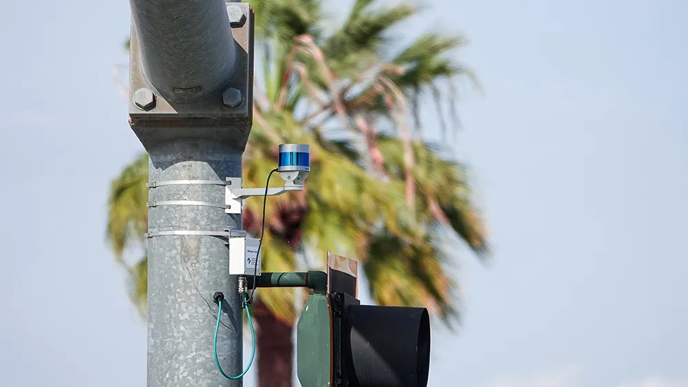
Flir launches TrafiOne Smart City Sensor

Flir Systems is launching the Flir TrafiOne Smart City Sensor, an all-round detection sensor for traffic monitoring and dynamic traffic signal control. Offered in a compact and easy-to-install package, the system uses thermal imaging and Wi-Fi technology to provide traffic engineers with high-resolution data on vehicles, bicycles and pedestrians at intersections and in urban environments. The Flir TrafiOne sensor uses thermal imaging to detect the presence of pedestrians and cyclists who are approaching or
June 13, 2016 Read time: 2 mins
Farid Semmahi of Control Technologies

6778 Flir Systems is launching the Flir TrafiOne Smart City Sensor, an all-round detection sensor for traffic monitoring and dynamic traffic signal control. Offered in a compact and easy-to-install package, the system uses thermal imaging and Wi-Fi technology to provide traffic engineers with high-resolution data on vehicles, bicycles and pedestrians at intersections and in urban environments.

The Flir TrafiOne sensor uses thermal imaging to detect the presence of pedestrians and cyclists who are approaching or waiting at the curbside or who are actually walking on a street crossing. Thermal imaging sensors can see in total darkness, through shadows and sun glare, which helps provide reliable traffic detection 24/7. The TrafiOne can even be combined with rapid flashing beacons to help warn approaching drivers that a pedestrian is present in a mid-block intersection.

Optional Wi-Fi technology can be used to capture traffic flow data and by monitoring Wi-Fi Mac addresses of devices such as smartphones, TrafiOne can determine travel and route times along road segments.

Via Wi-Fi signal strength information the device can also measure queue delay times at intersections. “Flir TrafiOne will help traffic engineers to improve traffic flows in the city in unseen ways,” says Stefaan Pinck, vice-President worldwide ITS Sales at Flir. “Through data collected by the TrafiOne sensor, they will be able to adapt traffic signal schemes, reduce vehicle idling time, monitor congestion, enhance safety for vulnerable road users and measure travel and delay times for different transport modes.”

The information collected by TrafiOne can be accessed for further analysis by Flir’s cloudbased analysis platform. Smart analytics transform the data into useful traffic insights, which are critical to understanding road network performance and to taking extra measures where and when they are needed.

For more information on companies in this article

Related Content

  • Derq predicts violations and saves lives
    June 7, 2018
    Derq has teamed up with FLIR and the Michigan Department of Transportation (MDoT) to pilot new V2X applications at a busy intersection in Detroit, using artificial intelligence (AI) to predict and prevent vehicle-and pedestrian related-accidents. Located at Jefferson Avenue and Randolph Street near downtown, the pilot uses technology that can predict red light violations and vulnerable pedestrians and bicyclists that are approaching the intersection. Derq AI algorithms analyse video feeds from two FLIR came
  • Iteris focuses on video based cycle safety and dilemma zone detection at Intertraffic
    February 26, 2016
    Two important safety innovations will be among a range of products and systems on the Iteris stand at Intertraffic Amsterdam. The company developed the first video-based bicycle detection system, SmartCycle, that it claims provides the unique capability of distinguishing bicycles from other vehicles on the road. Through the use of an Iteris enhanced algorithm, SmartCycle has the capability of making streets safer by extending green times for cyclists when the system knows they are present.
  • McCain’s ATC cabinets used in Los Angeles corridor project
    September 28, 2018
    McCain has supplied 10 Advanced Transportation Controller (ATC) cabinets for a newly opened corridor in Los Angeles which is expected to be safe for all users. The My Figueroa Corridor Streetscape Project (MyFig) was unveiled by the Los Angeles Department of Transportation (LADoT). It covers four miles of streets stretching from the downtown area to the south part of the city. McCain says its 351 ATC cabinets has doubled the corridor’s output channels to 32, which will allow the city to add more sign
  • IN FOCUS: What Lidar does next
    March 16, 2023
    Automotive, tolling, robotics – outside of traffic, road safety and autonomous vehicles, what applications will move the dial in terms of Lidar during 2023? Quite a few, finds Adam Hill