Esri software powers Lithuania project

The government of Lithuania has used Esri’s software to create a website – which went live this week - covering all of its transport network rather than simply one urban area. “It’s a multimodal journey planner for the whole country,” explains Terry C. Bills, Global Transportation Industry Manager at Esri. “So it’s a question of stitching together city systems with inter-city ones and pulling them together in a seamless way.”
October 8, 2015 Read time: 2 mins
Ian Koeppel of Esri shows off the software

The government of Lithuania has used 50 Esri’s software to create a website – which went live this week - covering all of its transport network rather than simply one urban area.

“It’s a multimodal journey planner for the whole country,” explains Terry C. Bills, Global Transportation Industry Manager at Esri. “So it’s a question of stitching together city systems with inter-city ones and pulling them together in a seamless way.”

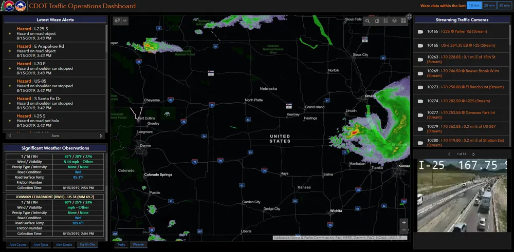
Geographic information system (GIS) platform provider Esri brings location and other data from various sources into a single user-facing site, incorporating such elements as weather (including potential hazards such as ice or snow), the availability of parking spaces or the location of long-term construction works alongside more obvious features such as real-time traffic speeds or camera feeds.

The California-based firm says its solutions are helping governments and local authorities to extol the virtues of public transport. As individual private car ownership creates issues such as congestion and pollution, public transit systems are keen to make – and publicise - other options available.

“Countries want to promote public transport usage,” says Ian Koeppel, Business Development Manager Transportation for Europe. “This information is critical to improving public transport utilisation.” The company’s platform has also recently been used in a similar website covering Helsinki’s transit system, combining information on road, rail and maritime modes.

For more information on companies in this article

Related Content

  • MaaS: 130,000 chances for a bad user experience
    May 4, 2020
    Johan Herrlin, CEO of transit data specialist Ito World, puts himself in the hotseat with ITS International to talk about, among other things, why a beautifully designed MaaS app with a perfect subscription model is still a failure if you get your customers lost along the way
  • Esri highlights benefits of a state-wide data-rich environment
    September 7, 2020
    Walk into virtually any traffic operations centre and you will be confronted by people flipping between different screens and CCTV monitors, and individually viewing a large number of stand-alone applications to try to understand a comprehensive picture of their live traffic, weather, incident, and snow conditions from these disparate sources.
  • Include ITS in policy decisions from the start, not as an afterthought
    February 1, 2012
    DG TREN's Fotis Karamitsos, on why the European Commission's new ITS Action Plan is looking to the past for future direction. The European Commission's (EC's) new Action Plan for the Deployment of Intelligent Transport Systems in Europe, which was announced as 2008 drew to a close, intends that transport and travel become 'cleaner; more efficient, including energy efficient; and safer and more secure'. At first sight, that wording might be interpreted as marking a significant policy shift within Europe, wit
  • How can US transportation be ‘re-envisioned’?
    October 17, 2019
    In her address to this year’s ITS America Annual Meeting, congresswoman Eleanor Holmes Norton, chair of the House Subcommittee on Highways and Transit, called for a ‘re-envisioning’ of transportation. Her speech is below – and ITS International asks a number of US experts what they would like to see ‘re-envisioned’…

    I would like to welcome  ITS America to the nation’s capital.