Vaisala forecasts the Xweather

Data ranges from road conditions and air quality to heat wave detection and lightning strikes
By Adam Hill October 3, 2022 Read time: 2 mins
Vaisala's XWeather suite provides weather and environmental data

Vaisala has launched Xweather, a forecast and observation suite of services providing real-time and hyperlocal weather and environmental data via sensors and machine learning.

Information ranges from road conditions and air quality to heat wave detection and lightning strikes, using what Vaisala calls "a combination of intelligent hardware and software, utilising the latest artificial intelligence and machine learning technologies".

The firm says Xweather brings a new level of accuracy to forecasting by combining massive amounts of weather and environmental data from several sources.

“Until now, the lack of real-time, local data has been a major source for error in weather and environment forecasting," says Samuli Hänninen, head of Xweather.

"With Xweather, businesses and developers can utilise data about the environment in real time from a hyperlocal location that is relevant for them."

Solutions include predicting the availability of renewable energy - such as wind and solar - to increased driving safety and air quality monitoring.

Xweather can also be used to predict lightning strikes at roadsides, which means infrastructure and rescue services can be mobilised quickly to manage a potential fire and thus protect homes and lives.

“Understanding is not enough: we need to take action," continues Hänninen. "We want to help organisations not only think and plan, but to act. The data and insight are available now, let’s together put that data to work."

Xweather data products can be delivered as API or enterprise package and include:

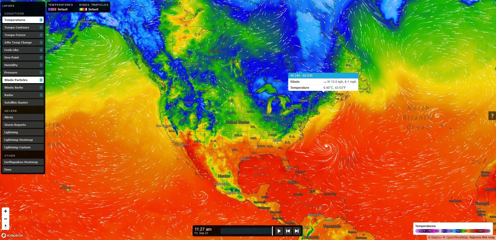
MapsGL – high-quality, vector-based weather data, imagery, and visualisations.

Automotive – Weather, road weather, and air quality information for infotainment, navigation, advanced driver assistance, and autonomous driving.

Lightning – Real-time lightning data, including classification of strikes and their damage potential.

Renewable energy – Historic data sets and forecasted wind and solar data.

Air quality – Air Quality Index and a hyperlocal Air Quality Forecast service connected to local sensors for street level AQ information and forecasts. 

Solutions for businesses with Xweather include Wx Beacon, Thunderstorm Manager, Wx Horizon and RoadAI.
 

For more information on companies in this article

Related Content

  • Iteris to expand its iPerform data and analytics software solutions
    March 12, 2013
    Intelligent traffic management information solutions provider Iteris is expanding its iPerform traffic and weather-related data and analytics software offering. iPerform was established in 2011 and provides a new generation of intelligent traffic and weather-related information solutions. These solutions bring the power of big data to the prediction of traffic conditions and the delivery of actionable information to both the public and commercial marketplace. The segment’s initial product, IterisPeMS, is a
  • Iteris aids CDOT’s road weather forecasting
    February 19, 2015
    Iteris has again been selected by the Colorado Department of Transportation (CDOT) to provide state-wide road weather forecasting and maintenance decision support services using the Iteris ClearPath Weather service. The service agreement is renewable annually for up to three years, bringing the full potential revenue of a three-year contract to approximately US$1.4 million. ClearPath Weather is based on Iteris’ proprietary highway condition analysis and prediction system (HiCAPS) pavement condition model an
  • Global toll revenues $8.5bn while technology ‘battles’ continue
    April 9, 2014
    ABI Research’s Dominique Bonte talks to Jason Barnes about trends in tolling and how a wider appreciation of technology options is sorely needed. Global Electronic Toll Collection (ETC) solution revenues will grow to $8.5bn by 2018, with ETC becoming a main source of funding for both Intelligent Transport Systems (ITS) and Vehicle-to-X (V2X) cooperative infrastructures, according to a new report from ABI Research (Chart 1). But, says the report’s author, ABI Research vice president and practice director Dom
  • Inertial sensors dramatically improve GNSS for ITS applications
    January 18, 2012
    Phil Harris, Thales UK, on how fused sensor data can significantly enhance GNSS-based positioning systems' performance in urban areas. Global Navigation Satellite System (GNSS)-based positioning is unique among available positioning technology due to its universal coverage and low equipment cost. By measuring the distances between an unknown position (such as a vehicle), and at least three known positions (GPS satellites), the unknown position can be calculated in three dimensions (latitude, longitude, and