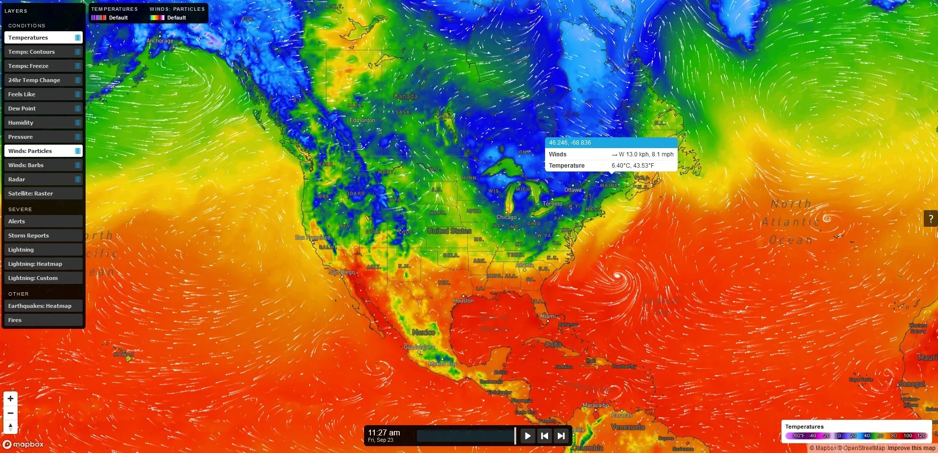
Vaisala forecasts the Xweather

Data ranges from road conditions and air quality to heat wave detection and lightning strikes
By Adam Hill October 3, 2022 Read time: 2 mins
Vaisala's XWeather suite provides weather and environmental data

Vaisala has launched Xweather, a forecast and observation suite of services providing real-time and hyperlocal weather and environmental data via sensors and machine learning.

Information ranges from road conditions and air quality to heat wave detection and lightning strikes, using what Vaisala calls "a combination of intelligent hardware and software, utilising the latest artificial intelligence and machine learning technologies".

The firm says Xweather brings a new level of accuracy to forecasting by combining massive amounts of weather and environmental data from several sources.

“Until now, the lack of real-time, local data has been a major source for error in weather and environment forecasting," says Samuli Hänninen, head of Xweather.

"With Xweather, businesses and developers can utilise data about the environment in real time from a hyperlocal location that is relevant for them."

Solutions include predicting the availability of renewable energy - such as wind and solar - to increased driving safety and air quality monitoring.

Xweather can also be used to predict lightning strikes at roadsides, which means infrastructure and rescue services can be mobilised quickly to manage a potential fire and thus protect homes and lives.

“Understanding is not enough: we need to take action," continues Hänninen. "We want to help organisations not only think and plan, but to act. The data and insight are available now, let’s together put that data to work."

Xweather data products can be delivered as API or enterprise package and include:

MapsGL – high-quality, vector-based weather data, imagery, and visualisations.

Automotive – Weather, road weather, and air quality information for infotainment, navigation, advanced driver assistance, and autonomous driving.

Lightning – Real-time lightning data, including classification of strikes and their damage potential.

Renewable energy – Historic data sets and forecasted wind and solar data.

Air quality – Air Quality Index and a hyperlocal Air Quality Forecast service connected to local sensors for street level AQ information and forecasts. 

Solutions for businesses with Xweather include Wx Beacon, Thunderstorm Manager, Wx Horizon and RoadAI.
 

For more information on companies in this article

Related Content

  • Continental and IBM collaborate on connected vehicles
    September 11, 2013
    Continental and IBM are to collaborate on the joint development of fully-connected mobile vehicle solutions for the world’s car manufacturers. Central to the agreement is development of a highly scalable cloud platform that will enable automotive manufacturers to deliver a range of new mobile in-car services. Software updates and vehicle control device functionality will be delivered over the internet, removing costly and inconvenient workshop visits. The companies feel the solution may equally prove be
  • Auckland, New Zealand embarks on future cities initiative
    October 2, 2014
    HP Software has been awarded a contract by the city of Auckland, New Zealand to deliver a Big Data project designed to provide a safer community and more efficient roadways for its citizens. Auckland Transport, the government agency responsible for all of Auckland’s transportation infrastructure and services, will deploy video analytics powered by HP IDOL on servers and storage from HP Enterprise Group, and with support from HP Software Professional Services. Auckland Transport will use HP’s integrate
  • The importance of going with the flow
    April 6, 2018
    Ensuring worker safety and up-to-date driver information is crucial to ensure that roadworks are not a source of danger and delay. Andrew Williams looks at a scheme on the A14 in Cambridgeshire, UK. In recent years, portable workzone ITS solutions have emerged as important tools in the management of major roadworks and system upgrade projects - and are viewed as an increasingly vital means of ensuring any ongoing traffic flow disruption is kept to a minimum. The technology forms a central component of an
  • Cellint measures speed and travel time without roadside infrastructure
    April 10, 2014
    Collecting speed and travel time data without using roadside infrastructure could offer new possibilities to cash-strapped road authorities. Streaming video may be useful for traffic controllers to monitor incidents and automatic number plate recognition may be required for enforcement, but neither are necessary for many ITS functions. For instance travel times, tailbacks, percentage of vehicles turning, origin and destination analysis can all be done using Bluetooth and/or WI-Fi sensors and without video o