Lufft records road conditions on the move

Marwis mobile road weather sensor can be mounted on vehicles and reports in real time
By Adam Hill March 10, 2022 Read time: 1 min
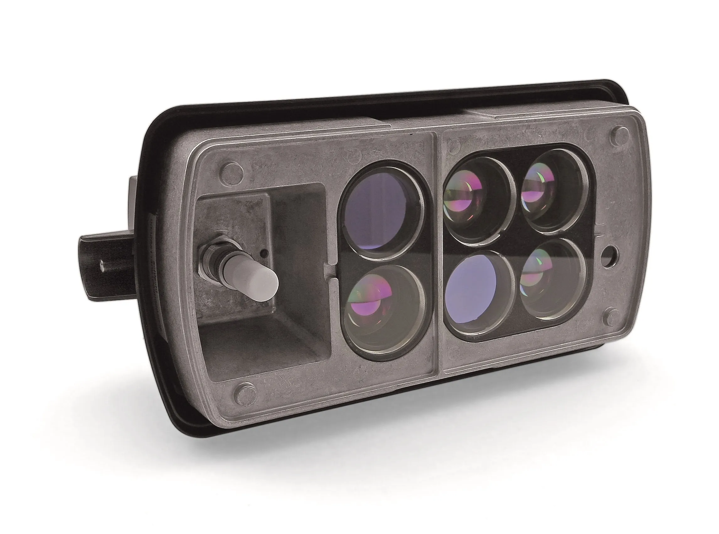
Marwis measures up to 100 times per second when the measuring vehicle is on the move

Lufft says its Marwis product is the first-to-market mobile road weather sensor that reliably records road conditions and environmental data, allowing agencies to extend their monitoring networks.

It can fill in gaps between road weather stations or identify sites for new stations, and can be mounted on nearly every car or bigger vehicle, the manufacturer says.

As well as offering flexibility, it measures up to 100 times per second when the measuring vehicle is on the move and reports data in real-time.

Data can be tracked using the Marwis app and forwarded to the cloud-based ViewMondo monitoring software, which is a customisable, state-of-the-art software package that captures measurement data from various sources.

For more information on companies in this article

Related Content

  • McCain finds new parking partner in Fisher 
    April 27, 2021
    Fisher will help bring McCain smart city parking solutions to markets in four US states
  • GridMatrix goes back to the future in New York City
    September 25, 2023
    Legacy traffic management infrastructure doesn’t have to be a marker of the past: software upgrades can bring it into the present in a cost-effective and timely way, says Gordon Feller
  • Mobile Weather System First
    May 23, 2012
    Vaisala has launched what it says is a new, first-of-its kind mobile weather system that collects information never before obtained from a single solution. The Condition Patrol uses sensors that have been trusted for many years by maintenance operators around the world. The system collects the data and displays it on a smart phone on the dashboard of a vehicle. The data can also be brought back through the phone’s mobile network to be displayed in Vaisala’s road weather management software for viewing by ot
  • Ohio DoT to use Inrix data to clear roads after major storms
    July 24, 2012
    Inrix will collaborate with the Ohio Department of Transportation (ODoT) to use the company’s traffic information and cloud-based analytics to further the state’s goal of clearing roads statewide within three hours after major storms. “Restoring travel to normal conditions as quickly as possible not only improves public safety but keeps people and commerce moving across the state,” said Ted Trepanier, senior director of public sector, Inrix. “We’re providing Ohio with an objective, data-driven approach for