
Lufft records road conditions on the move

Marwis mobile road weather sensor can be mounted on vehicles and reports in real time
By Adam Hill March 10, 2022 Read time: 1 min
Marwis measures up to 100 times per second when the measuring vehicle is on the move

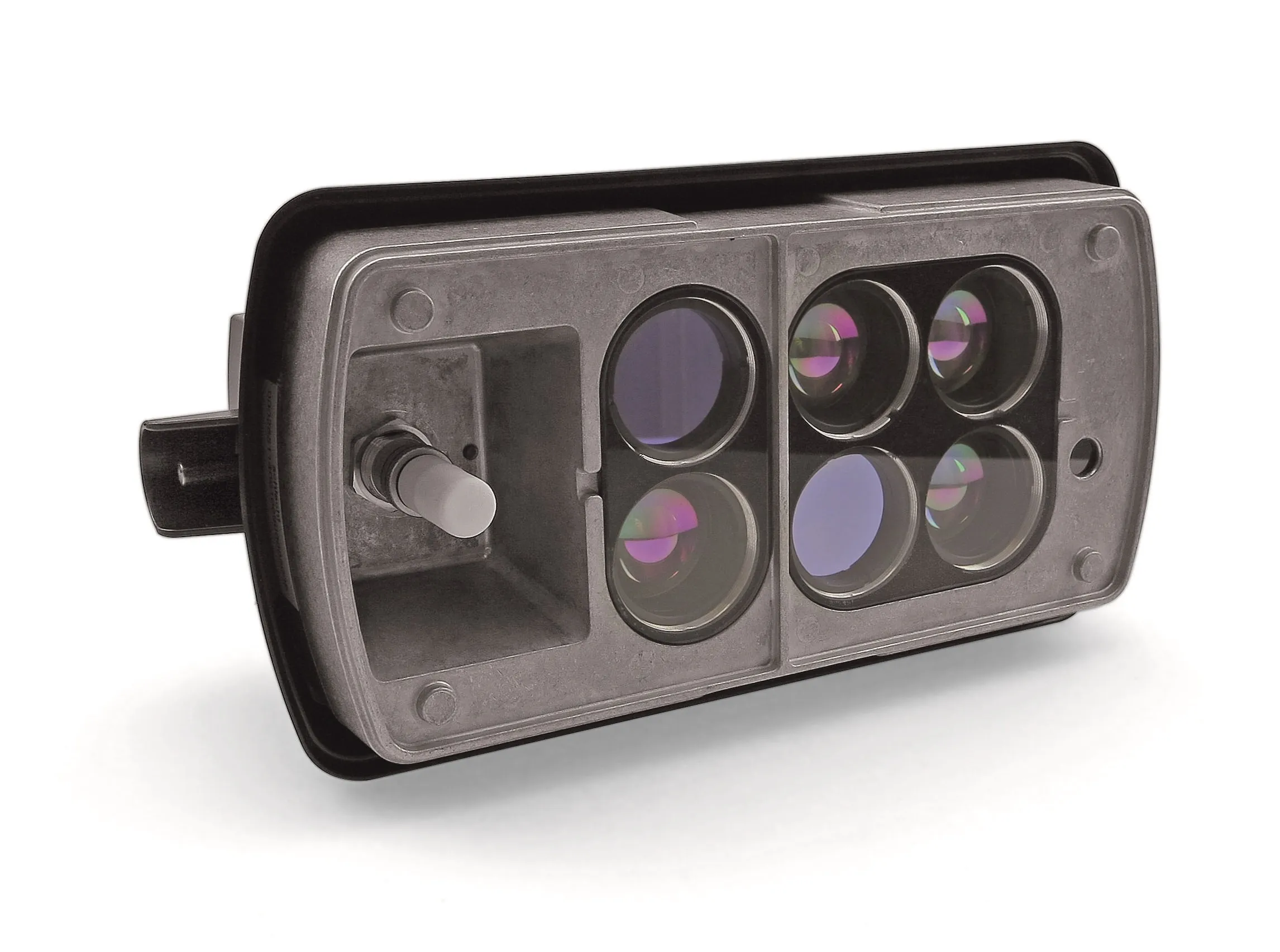
Lufft says its Marwis product is the first-to-market mobile road weather sensor that reliably records road conditions and environmental data, allowing agencies to extend their monitoring networks.

It can fill in gaps between road weather stations or identify sites for new stations, and can be mounted on nearly every car or bigger vehicle, the manufacturer says.

As well as offering flexibility, it measures up to 100 times per second when the measuring vehicle is on the move and reports data in real-time.

Data can be tracked using the Marwis app and forwarded to the cloud-based ViewMondo monitoring software, which is a customisable, state-of-the-art software package that captures measurement data from various sources.

For more information on companies in this article

Related Content

  • Iteris to show state-of-the-art sensor and virtualised workzone management in Phoenix
    March 22, 2024
    At ITS America 2024, Iteris will host demonstrations showcasing how its software, sensor and consulting solutions help agencies bring revolutionary technologies to scale for improved mobility and safety. Visitors to its booth will be able to see how its AI-powered ClearMobility Platform offers a complete portfolio of end-to-end solutions to monitor, visualise and optimise mobility infrastructure around the world. The company applies AI tools across multiple levels of its ecosystem, including neural networks that enable machine learning based on real-time and historical data to support predictive analysis within the ClearMobility Platform.
  • Kimley-Horn embraces crowd-sourced travel information at ITS America
    June 7, 2018
    Kimley-Horn is displaying a new travel time data collection platform at ITS America in Detroit, showing how crowd-sourced information can fill the gaps on roadway corridors that have little or no communications infrastructure to support remote monitoring. The cloud-based software, called Traction, provides data and analytics for user-defined routes, crowd-sourced travel times and high-level system indicators. The User Trip Module records vehicle travel times in second-by-second intervals - collecting speed,
  • Missouri’s smart solution for rural road monitoring
    July 7, 2017
    David Crawford sees how Missouri is using commercially available information to rapidly improve monitoring and driver information on rural highways. Missouri is a predominantly rural state with the second largest number of farms in the country and agriculture the main occupation in 97 of its 114 counties. US statistics starkly reveal how road accidents in rural areas tend to be more serious than in urban regions and of the 32,000 US motorists killed each year, 54% die on roads in rural areas even though onl
  • SeeDOT spots trucking transgressors
    June 1, 2015
    SeeDOT, from vehicle recognition specialist HTS, uses multiple 2MP IP imaging units with customised visible, near and invisible synchronised illumination to automatically monitor commercial vehicles entering and exiting controlled areas such as Ports of Entry, border crossings and weigh-in-motion stations. The system is said to operate effectively at both moderate and high speeds in mainline, virtual and ramp applications to capture details including DOT, LPR, Overview, KYU and Jurisdiction. HTS says Se