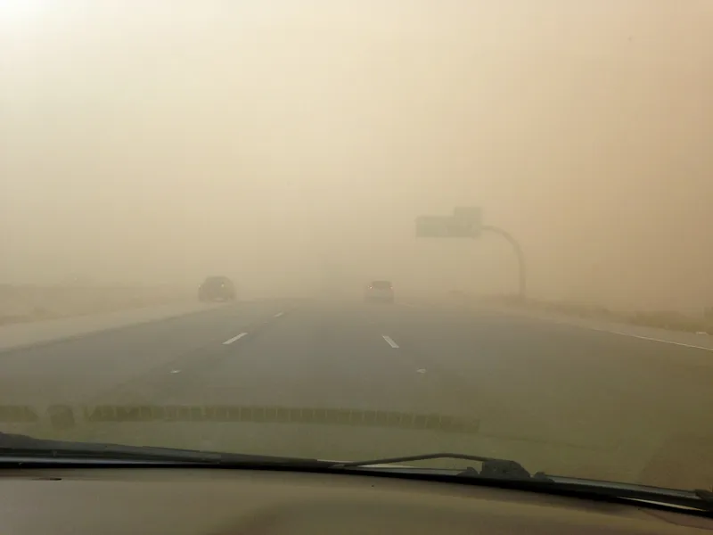
The Arizona Department of Transportation (ADoT) created an automated speed limit system based upon Vaisala’s PWD visibility sensors — a first in the US, says the manufacturer.
While the western US state is noted for being hot and dry, this depends entirely on elevation and time of year. Snow, rain, flooding, dust storms, high winds and microbursts can be common.
For the client, ADoT, Vaisala provided 13 of its PWD10 visibility sensors and its Road Weather Station RWS200 system to help make driving safer on a dangerously dusty, wind-blown highway between two major cities. ADoT now relies on an extensive road weather information system (RWIS) including 20 Vaisala Road Weather Station RWS200s for accurate conditions.
The client went about creating an innovative solution based upon these PWD10 sensors to provide visibility measurement for road weather applications. Calibrated with reference to a highly accurate transmissometer, Vaisala PWD series sensors use proven forward scatter technology to measure meteorological optical range (MOR). The downward-facing lenses protect against precipitation, spray and dust while the weather-proof design provides accurate measurements and reduces the need for maintenance.
The visibility sensors, along with variable speed limit signs, were installed along the section of highway that is most prone to dust storms. Next, they developed an automated, real-time system that integrates the PWD10 visibility measurements and adjusts speed limits accordingly so drivers can change their speed before travelling through hazardous conditions.
Visibility measurements combined with an automated system that adjusts speed limits is a safety game-changer for the ADoT — and the first solution of its kind in the nation, notes Vaisala.
The variable speed limit signs change depending on the current level of visibility, dropping in steps from 120kph to 55kph (from 75mph in 10mph steps to 35mph), while dynamic message signs alert travellers. Once visibility increases, the speed limits automatically rise again. Accurate visibility measurements are critical for this application and the PWD10 sensors provide the performance the department needs.
The solution has brought many positive results, the most important of which is safer roads, verified through data showing a reduced number of dust-related crashes.
"Even though there are operational benefits, the main benefit is safer roads for the travelling public,” said Kevin Duby, ADoT’s road weather manager. “We’re definitely embracing new technology, using weather data and automation even more in order to keep the roads safe."


