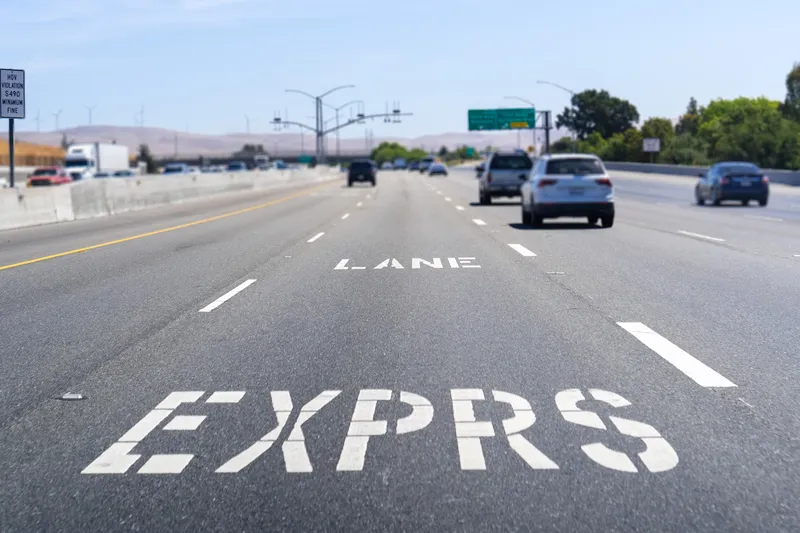
California’s regional transportation officials are taking a comprehensive approach to relieving clogged arteries that affect the health of commuters and cities along a 22-mile stretch of the Interstate 80 corridor from the Carquinez Bridge to the MacArthur Maze.
California’s regional transportation officials are taking a comprehensive approach to relieving clogged arteries that affect the health of commuters and cities along a 22-mile stretch of the Interstate 80 corridor from the Carquinez Bridge to the MacArthur Maze.
An unprecedented collaboration that includes3879 Caltrans, the 343 Metropolitan Transportation Commission, the transportation commissions in Alameda and Contra Costa counties and cities along the corridor has rolled out plans for the I-80 Integrated Corridor Mobility Project.
The US$80 million project is "a state-of-the-art technological solution to managing congestion and improving traffic conditions," Art Dao, executive director of the Alameda County Transportation Commission, said at the ceremony in Emeryville. A few yards from the groundbreaking event, traffic moved toward the maze at its usual crawl.
Officials plan to alleviate that condition with a multi-pronged and integrated high-tech approach that will give drivers real-time information about conditions on the freeway and San Pablo Avenue, as well as managing the flow of cars approaching freeway entrances.
A new type of adaptive metering light to be installed at all of the corridor's 40 on-ramps will allow entrance at rates determined by the current flow of traffic. Buses will have priority for entrance, using a transponder to turn the light green.
The freeway itself will have detectors to accurately monitor traffic; new signs on I-80 and San Pablo and other major connectors will inform motorists of current conditions, blocked lanes, speed recommendations and alternative routes; and updates will be available via car radio announcements.
The unusual cross-county collaboration, which involves some 19 agencies and jurisdictions, was created because the corridor is important to the region's economy, officials said. The freeway logs 7,500 hours of delays each day, including freight traffic coming to and from the Port of Oakland.
Such delays are costly financially and in terms of air quality, particularly as traffic spills over or backs up onto the streets of cities along the corridor. Without a change, conditions will only worsen, officials said.
Conditions also delay responses to accidents, breakdowns and other emergencies.
The traditional option of increasing capacity by widening the freeway, as was done when carpool lanes were added in recent years, was ruled out because of cost and lack of available land to expand.
"We needed something new; we needed something better," said Caltrans District 4 Director Bijan Sartipi. The high-tech approach that was chosen is "not just new to the Bay Area," but unique in California, he added.
All the information that will be available to drivers "will help get people to the most appropriate place they need to be at that time," said El Cerrito Councilwoman Janet Abelson, who is on the West Contra Costa Transportation Advisory Committee.
Special software will manage the multiple systems, which will be controlled at the Caltrans traffic management center in Oakland.
An unprecedented collaboration that includes
The US$80 million project is "a state-of-the-art technological solution to managing congestion and improving traffic conditions," Art Dao, executive director of the Alameda County Transportation Commission, said at the ceremony in Emeryville. A few yards from the groundbreaking event, traffic moved toward the maze at its usual crawl.
Officials plan to alleviate that condition with a multi-pronged and integrated high-tech approach that will give drivers real-time information about conditions on the freeway and San Pablo Avenue, as well as managing the flow of cars approaching freeway entrances.
A new type of adaptive metering light to be installed at all of the corridor's 40 on-ramps will allow entrance at rates determined by the current flow of traffic. Buses will have priority for entrance, using a transponder to turn the light green.
The freeway itself will have detectors to accurately monitor traffic; new signs on I-80 and San Pablo and other major connectors will inform motorists of current conditions, blocked lanes, speed recommendations and alternative routes; and updates will be available via car radio announcements.
The unusual cross-county collaboration, which involves some 19 agencies and jurisdictions, was created because the corridor is important to the region's economy, officials said. The freeway logs 7,500 hours of delays each day, including freight traffic coming to and from the Port of Oakland.
Such delays are costly financially and in terms of air quality, particularly as traffic spills over or backs up onto the streets of cities along the corridor. Without a change, conditions will only worsen, officials said.
Conditions also delay responses to accidents, breakdowns and other emergencies.
The traditional option of increasing capacity by widening the freeway, as was done when carpool lanes were added in recent years, was ruled out because of cost and lack of available land to expand.
"We needed something new; we needed something better," said Caltrans District 4 Director Bijan Sartipi. The high-tech approach that was chosen is "not just new to the Bay Area," but unique in California, he added.
All the information that will be available to drivers "will help get people to the most appropriate place they need to be at that time," said El Cerrito Councilwoman Janet Abelson, who is on the West Contra Costa Transportation Advisory Committee.
Special software will manage the multiple systems, which will be controlled at the Caltrans traffic management center in Oakland.