New Linux servers with ArcGIS Server 10

Cutting Edge Networked Storage and Esri have announced new Linux server solutions with ArcGIS Server Enterprise 10 pre-installed.
February 6, 2012 Read time: 1 min
1036 Cutting Edge Networked Storage and 50 ESRI have announced new Linux server solutions with ArcGIS Server Enterprise 10 pre-installed. Esri has selected Cutting Edge to manufacture and deliver the new Linux servers with ArcGIS Server 10 based on the popular Redhat Enterprise operating system to its customer base.

For more information on companies in this article

Related Content

  • High-density video server
    June 19, 2012
    Optelecom-NKF has released its Siqura S-68 E video server, an easy-to-install encoder that requires very little maintenance while still providing outstanding performance and reliability. With the capacity to compress and stream video in H.264 from 88 analogue cameras per one 19in/3U power supply cabinet, the company claims the S-68 E is now one of the industry's most efficient, high-density solutions, making it ideal for large, professional installations where space and cost per channel are a concern. Moreo
  • Esri throws weight behind White House climate change initiative
    March 26, 2014
    In the UK, train services in the south-west remain disrupted after violent winter storms destroyed track; eastern Europe enjoyed an unusually mild winter; in the USA, 2012 saw 300 deaths due to violent weather events and an estimated $110 billion in damage.
  • TidalWave sweeps over Trafficware’s ATMS 2.10
    June 11, 2020
    New addition to latest iteration of traffic management product
  • TomTom and Esri fusion transform urban mobility
    April 28, 2025

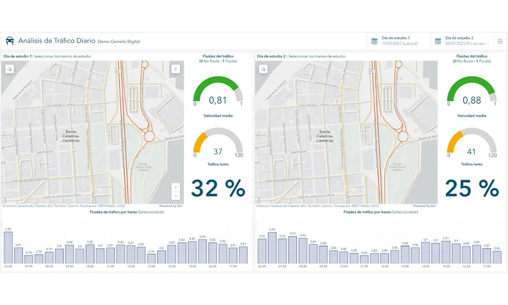
    A collaboration between TomTom and Esri will take centre stage at the upcoming Congress with a session titled "Driving Insights: Unlocking the Power of TomTom Historic Traffic Data in ArcGIS.” Led by industry experts Frans Keijzer from TomTom and Jaime Nieves from Esri Spain, this presentation will showcase how integrating TomTom's historical traffic data with the ArcGIS platform has transformed urban mobility in Gran Canaria, Spain.