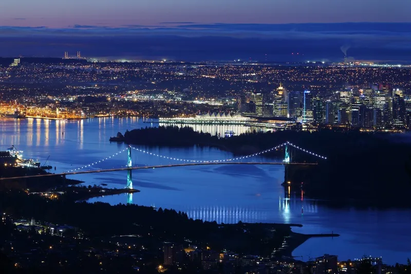
The British Columbia government has identified five potential crossings for the proposed high-capacity rapid transit across the Burrard Inlet from Vancouver to the North Shore.
The technical feasibility study, led by engineering consultancy Mott MacDonald Canada, has come up with three tunnel and two bridge proposals for cars and buses.
The plan will help inform the long-term Transport 2050 planning, led by TransLink and the Mayors’ Council, according to a statement by the BC government’s Ministry of Transportation and Infrastructure.
Possible routes for future planning consideration (see map below) are:
- Downtown Vancouver to Lonsdale via First Narrows (tunnel)
- Downtown Vancouver to Lonsdale via Brockton Point (tunnel)
- Downtown Vancouver to West Vancouver via Lonsdale (tunnel)
- Downtown Vancouver to Lonsdale via Second Narrows (new bridge)
- Burnaby to Lonsdale via Second Narrows (new bridge)
The ministry, the districts of North Vancouver and West Vancouver and the cities of Vancouver and North Vancouver all contributed funding towards the study. TransLink oversaw the technical work.
The technical feasibility study was also the first to be a co-ordinated effort by the BC province in partnership with Indigenous governments, municipalities and TransLink to identify a potential rapid transit solution across the Burrard Inlet.
TransLink is the Vancouver area’s regional transportation authority coordinating transit throughout the lower mainland area – around the Fraser River Valley.
The Mayors' Council, set up by TransLink, is composed of representatives from each of the 21 municipalities within the transportation service region. It also includes Indigenous – native American - groups such as the Tsawwassen First Nation.
Improved transit is part of the BC government’s CleanBC plan that aims to reduce congestion and carbon pollution. CleanBC was developed in collaboration with the BC Green Party, an environmental political party.