Claire Trevena, minister of transportation and infrastructure for the government of British Columbia, says: “We know that people living and working on the North Shore are frustrated with traffic congestion that has been increasing for years.”
“By investing in this study, our government is helping to take a serious look at solutions that expand our public transportation network to better connect communities and to help people move around freely.”
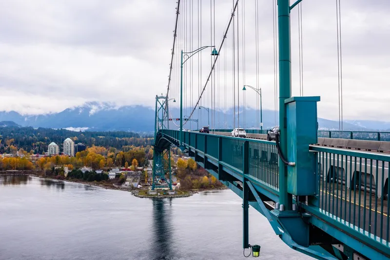
One of the main current crossings is via the iconic Lions Gate Bridge (pictured above), which takes vehicles, bikes and pedestrians.
The six new routes to be explored (see map below) are:
• Downtown Vancouver to Lonsdale via Brockton Point (tunnel)
• Downtown Vancouver to West Vancouver via Lonsdale (tunnel)
• Downtown Vancouver to Lonsdale via Second Narrows (new bridge)
• Burnaby to Lonsdale via Second Narrows (new bridge)
• Burnaby to Lonsdale via Second Narrows (existing bridge)
• Downtown Vancouver to Lonsdale via First Narrows (tunnel)
Connecting Lonsdale City Centre with Vancouver’s metropolitan area and the regional rapid transit network was put forward by the Integrated North Shore Transportation Planning Project (INSTPP) in 2018.
Bowinn Ma, member of the British Columbia Legislative Assembly for North Vancouver-Lonsdale, who leads INSTPP, says: “This technical feasibility study to find a rapid transit solution across the Burrard Inlet is an important step toward a third fixed-link crossing to the North Shore.”
The Ministry of Transportation and Infrastructure, the districts of North Vancouver and West Vancouver, and the cities of Vancouver and North Vancouver are funding the study while TransLink is leading the procurement process.
The results of the study will be used to inform the development of Transport 2050, TransLink’s updated regional transportation strategy.