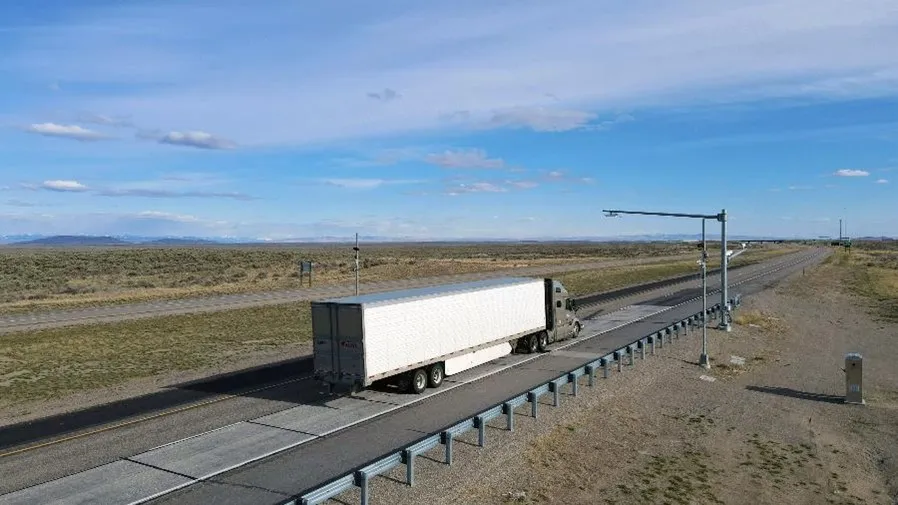
SICK launches all-weather 3D sensor system for traffic management

Sick has launched the TIC502 Lidar sensor traffic and warning system which is said to scan vehicles up to 100 times a second with 99% accuracy to generate a 3D profile of each vehicle. The all-weather solution can be used for counting fast lane, free-flowing and static traffic to facilitate real-time management and electronic toll charge assessment of all vehicle types according to standard international transport classifications. TIC502 has a range of up to 40 metres and minimum mounting height of 1.5
January 29, 2018 Read time: 2 mins

536 Sick has launched the TIC502 Lidar sensor traffic and warning system which is said to scan vehicles up to 100 times a second with 99% accuracy to generate a 3D profile of each vehicle. The all-weather solution can be used for counting fast lane, free-flowing and static traffic to facilitate real-time management and electronic toll charge assessment of all vehicle types according to standard international transport classifications.

TIC502 has a range of up to 40 metres and minimum mounting height of 1.5 metres above the tallest vehicle. It aims to provide a vehicle class assignment better than 98% and speed assessment accuracy is +/- 3kph up to 100kph, and +/- 3% above 100kph.

Vehicle class is measured according to TLS8+1, TLS5+1, TLS2+1 or Swiss10, into up to 30 different classes. The 3D view of traffic is integrated into a display and autocalibrated with moving traffic.

Additionally, the solution comes with a high all-weather capability between -40oC and +60oC and can also be combined with an additional 2D Lidar sensors to count axles for traffic profiling and assessment.

The traffic controller automatically stores a data history of the last 50 vehicles detected which is sent to storage in the user’s system via FTP or UNC transmission.

Neil Sandhu, SICK’s National product manager for imaging, measurement, ranging and systems, said: “The TIC502 generates 3D profiles and combines comprehensive and highly reliable data and warnings with excellent availability in all weather and all seasons. The unit can also be easily retrofitted on structures such as overhead gantries, bridges or tunnel entrances to upgrade existing traffic monitoring and control.

“The facility for adding an extra Lidar sensors to the TIC502 allows accurate axle counting, which is often used for improved toll assessment of very heavy transport vehicles, without needing the use of a full vision system.”

UTC

Related Content

  • May 31, 2013
    Accurate roadside visibility monitoring
    The SWS-050 visibility sensor for roadside monitoring developed by UK company Biral measures local weather conditions and instantly relays this information to road users via electronic signage, warning drivers of unexpected hazards such as fog patches and enabling rapid response by authorities in the event of dangerous conditions. With a measurement range of 10 metres to 40 kilometres, the SWS-050 operates in temperatures ranging from -40ºC to 60ºC and is unaffected by local lights or reflections. The devic
  • September 6, 2017
    Remote remedies help US authorities identify bridge deficiencies
    Every day 185 million vehicles – cars, trucks, school buses, emergency response units - cross one or more of America’s 55,710 'structurally compromised' steel and concrete road bridges, the highest concentration of which are in Iowa (nearly 5,000), Pennsylvania and Oklahoma. Nearly 2,000 of these crossings are located on interstate highways, according to the American Road and Transportation Builders Association's recent analysis of the US Department of Transportation's 2016 National Bridge Inventory.
  • January 27, 2012
    Integrate systems to reduce roadside infrastructure
    David Crawford reviews promising current developments. Instrumentation of the road infrastructure has grown to become one of the most dynamic sectors of the ITS industry. Drivers for its deployment include global concerns over the commercial and environmental pressures of traffic congestion, the importance of keeping drivers informed throughout their journeys, and the need to reduce accident rates and promote the safety of all road users, for example by enforcing traffic safety rules.
  • December 21, 2017
    Communications hold key to expanding ITS wireless network expansion
    Wireless transmission of data and control information is making smarter traffic management easier and cheaper to install. It has long been known that connectivity is the key to improving traffic management and many cost-benefit studies prove that investment in new technology can be justified in terms of reduced congestion, shorter travel times, improved safety and air quality. However, many authorities’ cap-ex budgets only cover urgent matters, not improvements, making it difficult, if not impossible to