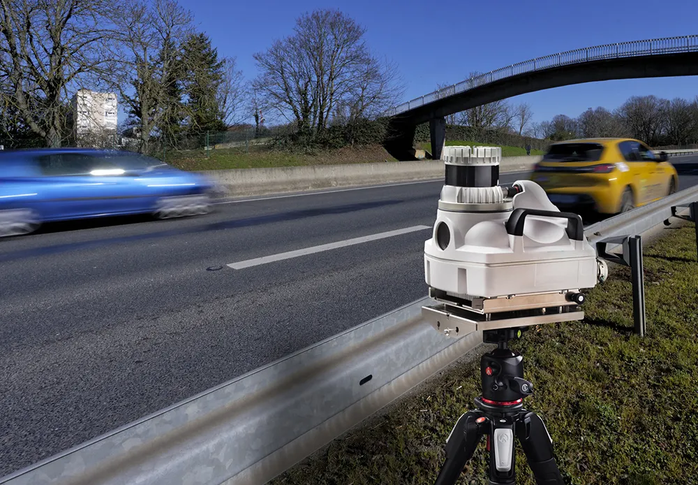
SICK launches all-weather 3D sensor system for traffic management

Sick has launched the TIC502 Lidar sensor traffic and warning system which is said to scan vehicles up to 100 times a second with 99% accuracy to generate a 3D profile of each vehicle. The all-weather solution can be used for counting fast lane, free-flowing and static traffic to facilitate real-time management and electronic toll charge assessment of all vehicle types according to standard international transport classifications. TIC502 has a range of up to 40 metres and minimum mounting height of 1.5
January 29, 2018 Read time: 2 mins

536 Sick has launched the TIC502 Lidar sensor traffic and warning system which is said to scan vehicles up to 100 times a second with 99% accuracy to generate a 3D profile of each vehicle. The all-weather solution can be used for counting fast lane, free-flowing and static traffic to facilitate real-time management and electronic toll charge assessment of all vehicle types according to standard international transport classifications.

TIC502 has a range of up to 40 metres and minimum mounting height of 1.5 metres above the tallest vehicle. It aims to provide a vehicle class assignment better than 98% and speed assessment accuracy is +/- 3kph up to 100kph, and +/- 3% above 100kph.

Vehicle class is measured according to TLS8+1, TLS5+1, TLS2+1 or Swiss10, into up to 30 different classes. The 3D view of traffic is integrated into a display and autocalibrated with moving traffic.

Additionally, the solution comes with a high all-weather capability between -40oC and +60oC and can also be combined with an additional 2D Lidar sensors to count axles for traffic profiling and assessment.

The traffic controller automatically stores a data history of the last 50 vehicles detected which is sent to storage in the user’s system via FTP or UNC transmission.

Neil Sandhu, SICK’s National product manager for imaging, measurement, ranging and systems, said: “The TIC502 generates 3D profiles and combines comprehensive and highly reliable data and warnings with excellent availability in all weather and all seasons. The unit can also be easily retrofitted on structures such as overhead gantries, bridges or tunnel entrances to upgrade existing traffic monitoring and control.

“The facility for adding an extra Lidar sensors to the TIC502 allows accurate axle counting, which is often used for improved toll assessment of very heavy transport vehicles, without needing the use of a full vision system.”

UTC

Related Content

  • March 22, 2018
    Data Collect exhibits range of traffic solutions
    Data Collect is showcasing a range of new solutions that aim to provide clients with an improved quality of traffic data collection. The Argos portable artificial intelligence (AI) traffic object analyser is said to combine AI with machine vision for object tracking, classification and speed measurement. It features an eye device which carries out turning movement count and vehicle classification at intersections as well as origin / destination count and vehicle classification at roundabouts. The platform
  • March 7, 2019
    Volvo tests autonomous electric bus on roads at Singapore campus
    Volvo is trialling its 12m long autonomous electric bus on roads at the Nanyang Technological University (NTU) in Singapore ahead of an anticipated release onto public roads. The Volvo 7900 Electric single-decker bus can carry approximately 80 passengers and is the first of two buses being trialled at the NTU’s Centre of Excellence for Testing and Research of Autonomous vehicles (CETRAN) before being extended beyond the campus. CETRAN is staffed by NTU scientists and features a track which replicates var
  • September 16, 2021
    Parifex will show three road control innovations
    Parifex, a leading solution provider in project management for speed enforcement and smart cities, will highlight three innovations including 3D-lidar technology: the Double-Side Vigie, an extra-urban speed control system; the Nano-Cam, an innovative sensor for mobile real-time data collection and speed enforcement such as vehicle counting and classification; as well as the Nomad, a multi-infringement sensor designed to fit in the urban infrastructure
  • March 2, 2012
    First 3D dataset of all Roads in Western Europe completed
    Intermap Technologies has announced the completion of its 3D Roads - the only dataset to provide accurate 3D models for every road, from the largest highway to the smallest urban and rural roads, throughout Western Europe.