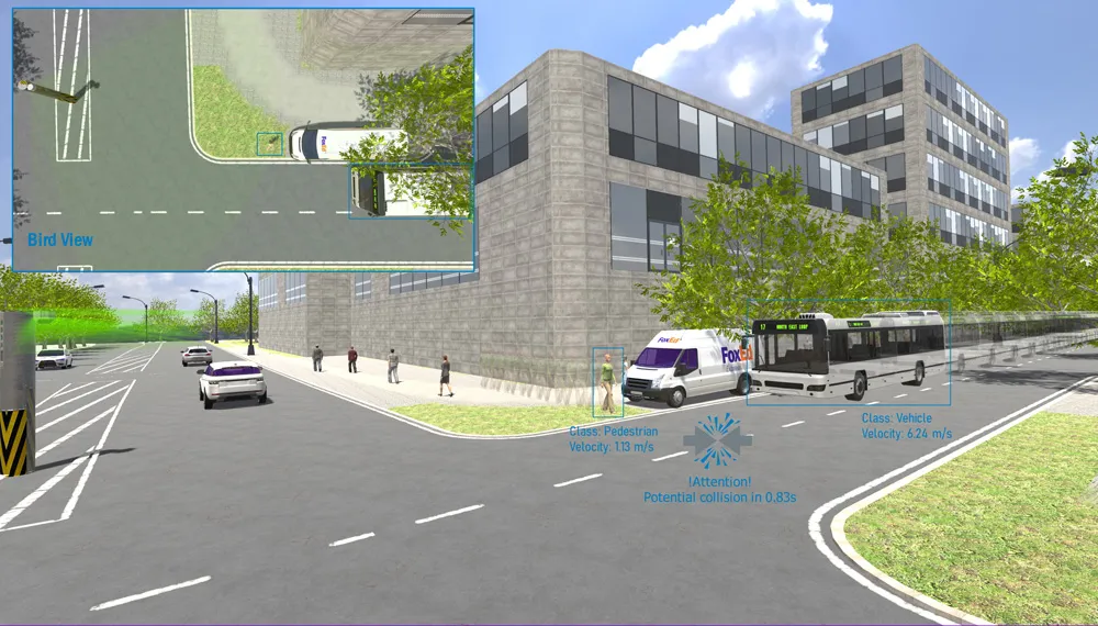
SICK launches all-weather 3D sensor system for traffic management

Sick has launched the TIC502 Lidar sensor traffic and warning system which is said to scan vehicles up to 100 times a second with 99% accuracy to generate a 3D profile of each vehicle. The all-weather solution can be used for counting fast lane, free-flowing and static traffic to facilitate real-time management and electronic toll charge assessment of all vehicle types according to standard international transport classifications. TIC502 has a range of up to 40 metres and minimum mounting height of 1.5
January 29, 2018 Read time: 2 mins

536 Sick has launched the TIC502 Lidar sensor traffic and warning system which is said to scan vehicles up to 100 times a second with 99% accuracy to generate a 3D profile of each vehicle. The all-weather solution can be used for counting fast lane, free-flowing and static traffic to facilitate real-time management and electronic toll charge assessment of all vehicle types according to standard international transport classifications.

TIC502 has a range of up to 40 metres and minimum mounting height of 1.5 metres above the tallest vehicle. It aims to provide a vehicle class assignment better than 98% and speed assessment accuracy is +/- 3kph up to 100kph, and +/- 3% above 100kph.

Vehicle class is measured according to TLS8+1, TLS5+1, TLS2+1 or Swiss10, into up to 30 different classes. The 3D view of traffic is integrated into a display and autocalibrated with moving traffic.

Additionally, the solution comes with a high all-weather capability between -40oC and +60oC and can also be combined with an additional 2D Lidar sensors to count axles for traffic profiling and assessment.

The traffic controller automatically stores a data history of the last 50 vehicles detected which is sent to storage in the user’s system via FTP or UNC transmission.

Neil Sandhu, SICK’s National product manager for imaging, measurement, ranging and systems, said: “The TIC502 generates 3D profiles and combines comprehensive and highly reliable data and warnings with excellent availability in all weather and all seasons. The unit can also be easily retrofitted on structures such as overhead gantries, bridges or tunnel entrances to upgrade existing traffic monitoring and control.

“The facility for adding an extra Lidar sensors to the TIC502 allows accurate axle counting, which is often used for improved toll assessment of very heavy transport vehicles, without needing the use of a full vision system.”

UTC

Related Content

  • March 6, 2018
    Sick release distance sensors for traffic management duties
    Sick has launched two distance sensors with the intention of providing accurate measurement and control duties for traffic management in adverse conditions via high definition distance measurement technology. The devices, according to Sick, are ideal for determining free capacity in truck parking rows, or for automated long-range detection tasks. DT1000 is said to provide distance measurement up to 460 metres on naturally light-coloured objects and 150 metres for matt black. DL1000 comes with a range of
  • March 26, 2014
    Sick shows smart sensors at Intertraffic
    Sick is highlighting three innovations on its stand: an automated hot spot detector, an integrated tunnel sensor and a vehicle profiling system. The VHD Pro (vehicle hotspot detector) combines laser-based 3D modelling and infrared imaging to automatically differentiate between allowable hot spots (such as engines and transmissions) and those which could result in a fire. Without the need for human oversight, the system can detect a worrying hot spot (brakes or load) on a vehicle in less than five seconds. T
  • September 15, 2021
    Sensors for road and rail infrastructure from Sick


    Sick will be in Hamburg to highlight its wide range of sensors and sensor system solutions for road and rail infrastructure with particular emphasis on lidar-based sensors/systems and air quality measurement devices for tunnels. Also to be featured will be the company’s light curtains and lidar sensors and systems for traffic profiling. These measure, detect, classify, count, check vehicles, and monitor other (vulnerable) road users in 3D. They determine the number of axles on trucks for vehicle classification and measure vehicle dimensions to address loading errors.

  • February 23, 2017
    LiDAR sets its sights on future problems
    AAdvances in LiDAR are helping transport authorities improve services and identify potential problem areas, as geospatial technology expert Dr Neil Slatcher explains. The effects of climate change on the transport infrastructure have long been a cause of concern within the transportation sector - and not only on the structures themselves but also on the surrounding areas. This year, those concerns have become reality with landslides, structural collapses and surfacing issues impacting services across the wo