Ohio DOT Selects Inrix and StreetLight Data for on-demand mobility intelligence

The Ohio Department of Transportation (ODOT) has added analytics and origin-destination to its existing Inrix traffic services to help monitor, measure and manage the state’s road network. As part of the agreement, StreetLight Data will enable ODOT to transform Inrix data into actionable intelligence. Ohio DOT will utilise analytic tools and traffic services from Inrix and StreetLight Data to improve system planning, traffic management and operations in Ohio.
September 26, 2017 Read time: 1 min

The 7609 Ohio Department of Transportation (ODOT) has added analytics and origin-destination to its existing 163 Inrix traffic services to help monitor, measure and manage the state’s road network. As part of the agreement, StreetLight Data will enable ODOT to transform Inrix data into actionable intelligence.

Ohio DOT will utilise analytic tools and traffic services from Inrix and StreetLight Data to improve system planning, traffic management and operations in Ohio.

These include Inrix Analytics, a suite of cloud-based analysis tools to help transportation professionals what is happening on the roads and Inrix Trips which provides data on drivers’ journeys. In addition, the newly-launched Inrix Dangerous Slowdowns provides data to prevent back-of-queue collisions in rapidly forming congestion, while Inrix Real Time Traffic Flow provides real time traffic information.

StreetLight InSight allows ODOT to design, run, visualise and download unlimited customised transportation analyses like origin-destination, select link and trip purpose.

For more information on companies in this article

Related Content

  • TomTom and Esri fusion transform urban mobility
    April 28, 2025

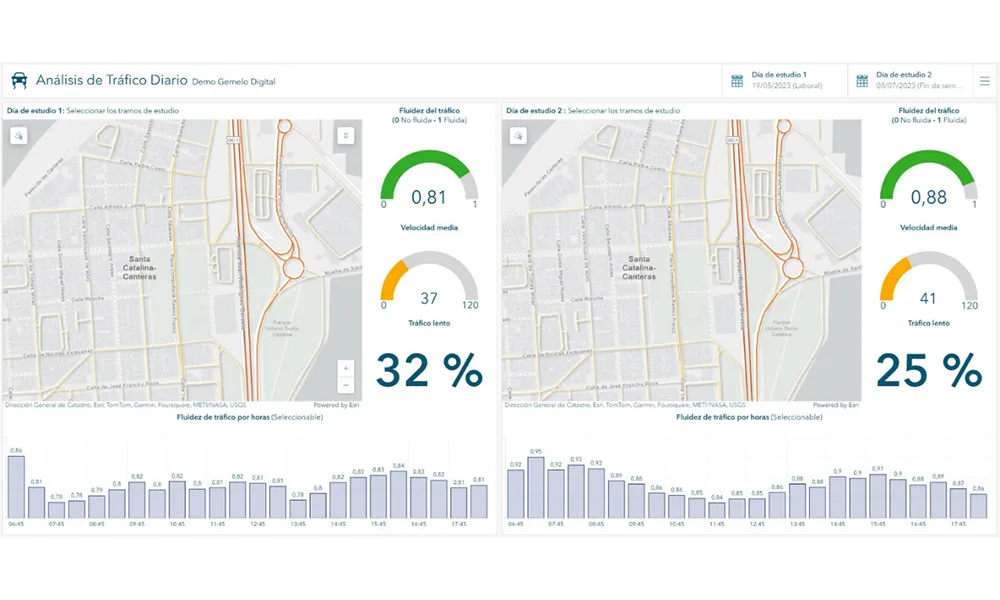
    A collaboration between TomTom and Esri will take centre stage at the upcoming Congress with a session titled "Driving Insights: Unlocking the Power of TomTom Historic Traffic Data in ArcGIS.” Led by industry experts Frans Keijzer from TomTom and Jaime Nieves from Esri Spain, this presentation will showcase how integrating TomTom's historical traffic data with the ArcGIS platform has transformed urban mobility in Gran Canaria, Spain.

  • Bluecity shows Lidar & AI capability
    March 31, 2022
    Bluecity’s high-resolution 3D Lidar sensor and AI perception software detect vehicles, bicycles and pedestrians with pinpoint accuracy in real time.
  • Here uses Alexa to offer drivers voice-first navigation
    January 8, 2019
    Here Technologies is to integrate its navigation and location services with Amazon’s Alexa to offer drivers voice-first navigation. At CES 2019 in Las Vegas, Here announced that it would utilise Alexa Auto tools to keep drivers focused on the road while offering personalised guidance. Alexa will come pre-integrated with Here Navigation On-Demand, the company’s new navigation-as-a-service model which allows drivers to search for points of interest and access live traffic information. Additionally,
  • EVs & smart cities: Tritium keeps things moving
    December 3, 2018
    Electric vehicles are widely expected to play a major role in the smarter, cleaner cities of the future. Paul Sernia explains why – and looks at the place of ultra-rapid chargers as part of a versatile public infrastructure Electric vehicles (EVs) are widely expected to play a major role in the smarter, cleaner cities of the future. With no dirty tailpipe, EVs can help improve the polluted air of inner cities. And when deployed as widely shared assets – through car clubs, ride-sharing services and taxi