
Lindsay and Iteris to create smart workzones on US roads

Lindsay, a manufacturer of infrastructure equipment, has partnered with Iteris to create smart workzones on roads across the US. The partnership supports the Federal Highways Administration’s Smarter Work Zone campaign to reduce traffic congestion and improve safety in workzones using ITS solutions. Research suggests there were 799 workzone-related fatalities in the US in 2017 – a 4.5% rise from the previous three-year average of 764. Linday says its Road Zipper moveable barrier system is designe
April 5, 2019 Read time: 2 mins

7613 Lindsay, a manufacturer of infrastructure equipment, has partnered with 73 Iteris to create smart workzones on roads across the US.

The partnership supports the Federal Highways Administration’s Smarter Work Zone campaign to reduce traffic congestion and improve safety in workzones using ITS solutions.

Research suggests there were 799 workzone-related fatalities in the US in 2017 – a 4.5% rise from the previous three-year average of 764.

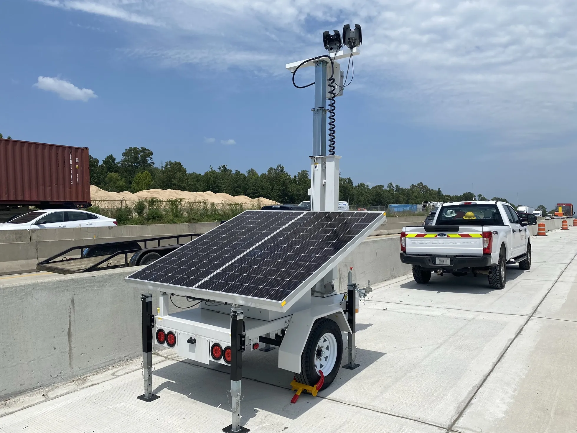
Linday says its Road Zipper moveable barrier system is designed to increase capacity and reduce congestion by making more efficient use of new or existing roadways. By using Iteris’ iPeMS, an analytics and visualisation platform, users can identify areas prone to recurring congestion and potential workzone safety risks, the company adds.

According to Lindsay, the Zipper can then be deployed in these areas to improve traffic flow, and help safeguard work crews and motorists by separating work areas and traffic.

Scott Marion, president of infrastructure at Lindsay, says: “By proactively identifying congestion issues, our customers will be able to address these concerns efficiently, and with a focus on ultimately mitigating the rising number of workzone-related fatalities.”

For more information on companies in this article

Related Content

  • More Jenoptik Vector units for Arkansas workzone speed limit initiative
    May 24, 2024
    Arkansas DoT says crashes have dropped almost 30% since programme started in 2022
  • Joining the dots: four ways to help cities make the connection
    May 18, 2018
    Smoothing the path to connected transportation systems in urban areas all round the world takes a lot of planning: Cisco’s Kyle Connor lays out the four key areas on which he thinks cities should focus. Forward-thinking cities around the world are exploring innovative, new ways to leverage the Internet of Things (IoT) and related technologies to create more connected and efficient transportation systems. Through greater digitisation and connectivity, cities can optimise public transit routes, reduce
  • Interactive map reveals the UK’s riskiest roads
    November 20, 2018
    The A254 between the junction with A28 in Margate and the junction with the A255 near Ramsgate is the UK’s riskiest road, according to an interactive Dangerous Road Map. There were 26 fatal and serious crashes per billion vehicle kilometres on this road, say motor insurer Ageas and the Road Safety Foundation (RSF). Both organisations are now calling on an immediate investment from the UK government of £75 million, and the same amount annually for five years thereafter to improve the country’s riskiest
  • Utah DoT chooses Econolite & Ouster for Lidar traffic management
    March 13, 2025
    Ouster's 3D digital Lidars are used in combination with its BlueCity platform