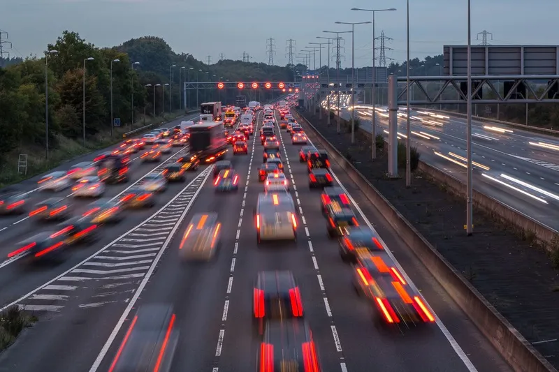
The UK Highways Agency is holding a series of public exhibitions to inform road users, local residents and businesses about proposals to transform the M4 into one of the longest stretches of ‘smart motorway’ in England by 2021.
The improvement, on a 32-mile stretch between junction 3 at Hayes in London, and junction 12 at Theale in Berkshire, would increase capacity, improve journey reliability and maintain safety.
The proposals are part of the Government’s investment into England’s motorways and majo
The 1841 UK Highways Agency is holding a series of public exhibitions to inform road users, local residents and businesses about proposals to transform the M4 into one of the longest stretches of ‘smart motorway’ in England by 2021.
The improvement, on a 32-mile stretch between junction 3 at Hayes in London, and junction 12 at Theale in Berkshire, would increase capacity, improve journey reliability and maintain safety.
The proposals are part of the Government’s investment into England’s motorways and major A-roads, which will see up to US$6.7 billion a year pumped into improving the roads by 2021, underpinning economic growth and high quality jobs across the region.
As part of the proposals, there would be 64 miles of new traffic lane taken from the existing hard shoulder, increasing capacity. The initial scheme design also includes 131 new gantries, with 32 existing gantries remaining, while eleven bridges would be rebuilt to provide space for the additional traffic lane and provide safe journeys over the M4 for decades to come. In addition, 32 refuge bays are proposed alongside the carriageway for use by drivers in an emergency.
Subject to gaining consent, construction would be carefully planned to be carried out in phases from 2016.
Lynne Stinson, Highways Agency project manager said: “The M4 is an important corridor in and out of London for those who live and work in Buckinghamshire and Berkshire, as well as those further afield in the South West and Wales, with around 130,000 vehicles using this stretch every day.
“Based on proven benefits elsewhere, we have produced outline proposals that would see 32 miles of the M4 transformed into a ‘smart motorway’; we’re planning extra capacity by converting the hard shoulder into an additional traffic lane and introducing variable mandatory speed limits displayed overhead to help smooth the flow of traffic and reduce congestion, and to provide traffic information, with safety bays in place to maintain safety.”