Siemens is supplying its satellite-based prioritisation system Sitraffic Stream (Simple Tracking Realtime Application for Managing traffic lights and passenger information) to the Icelandic capital, Reykjavik. The system ensures that traffic lights automatically turn green for emergency and urban public transport vehicles at road intersections and has initially been installed at six selected intersections in the city centre in cooperation with local sales partner Smith & Norland.
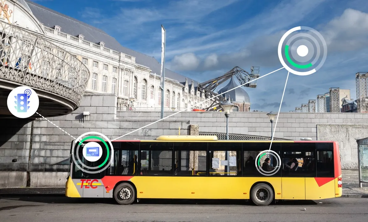
Over the next few months
Over the next few months, around 50 fire trucks and ambulances and approximately 120 buses are to be equipped with on-board units (OBUs). Using GPS, the OBUs calculate a vehicle's position to the nearest five metres and transmit this information to the control centre. When available virtual signalling points are passed, the control centre switches the lights to green. As soon as the vehicle has crossed the intersection, the lights switch back to normal operation.
Until now, only analogue prioritisation solutions were available for buses and emergency vehicles and it was difficult for smaller towns and communities to put these solutions into practice due to high implementation costs. Sitraffic Stream is cost-effective, says Siemens, as expensive roadside installations are not required and only requires a small OBU with an integrated GPS and GPRS antenna in the vehicle.
In addition, the position data transmitted is used to provide up-to-date real-time bus departure times at stops, while CO2 pollution in the cities is reduced as buses are not caught in congestion. The fire service also benefits from Sitraffic Stream in the event of an emergency, as fire trucks no longer have to go through red lights at intersections.