Mass pilgrimages, new tourists and a growing population lead Jeddah to seek some smart transport solutions as David Crawford finds out.
Rationalising traffic movement and public transport in a major Middle Eastern business and tourist centre that is also a gateway for millions of religious pilgrims every year is the challenge for the 20-year Jeddah Strategic Plan and the Jeddah Public Transport Programme (JPTP) it spawned. The latter is costed at US$8bn.
In May 2014 the municipally-owned Metro Jeddah Co. awarded engineering consultants
Lying on the east coast of the Red Sea, Jeddah is Saudi Arabia’s historic entry point from the west and the urban centre of its western region, the largest city in Makkah Province, and the second largest in the country. Its population, currently standing at over 3.4 million and growing at a rate of nearly 2.5% a year, is expected to be reach six million in 20 years.
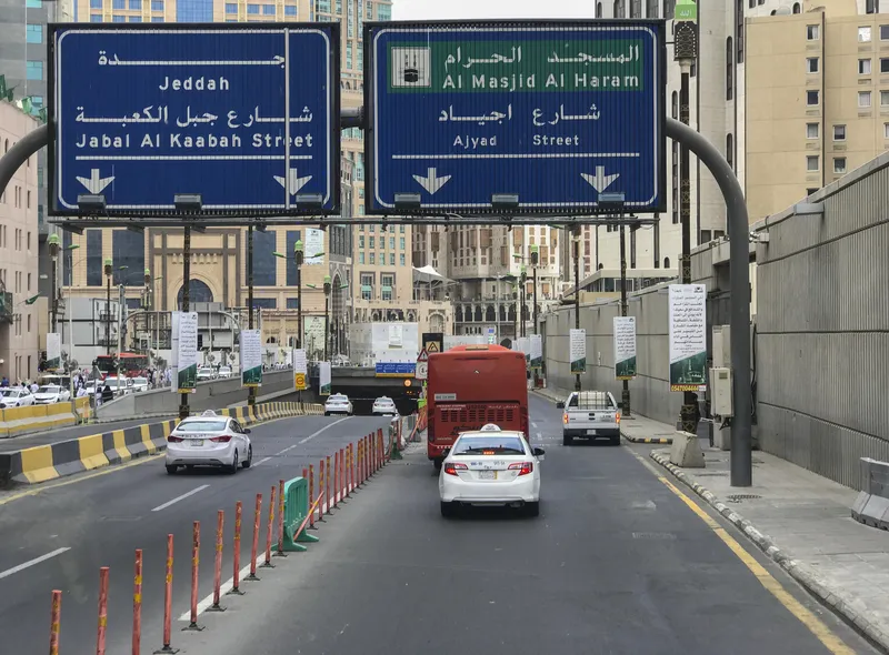
Some 19km from city is the King Abdul Aziz International Airport which is the main gateway for the annual Hajj pilgrimage to Makkah, 65km to the east of the city. This is one of the largest gatherings of people in the world with the number of arrivals typically exceeding two million. Jeddah is also within convenient reach of the world’s second most important Muslim shrine at Madinah, 330km to the north-east.
These geographical assets have driven years of economic growth and progressively expanded the city in two competing directions, concentrically around the historic core of al-Balad and linearly in the direction of the two Islamic centres. The closeness of the three cities also means that two- or three-centre visits are attractive options for visitors, who can combine their pilgrimage with a holiday on the Red Sea coast, exploring the promenades along its Corniche, the coral reefs and water sports.
The resulting traffic pressures on the city’s roads have driven an overwhelming case for vastly improved public transport. In its inaugural Sustainability Cities 2015 Index, global asset design consultancy
Despite rapid growth, Arcadis says, “the city has operated without strategic or regional plans and without an updated master plan” - documents that are “currently under commission to fast-track Jeddah into the 21st century.”
The Index concludes that: “With its beautiful geographic location, historical legacy and sensitive religious context within the Muslim world, the prospects for Jeddah to become one of the region’s leading cities are enormous.”
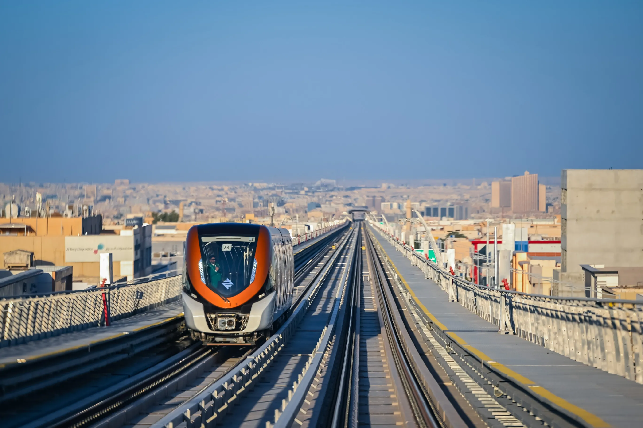
In 2013, the JPTP gained government approval for its plans, with a seven-year completion target. Elements that will be integrated include a metro network (with an airport connection), an orbital commuter rail service with strategic interchanges, and a Corniche tramway for tourists – with a combined total length of 293km. There will also be a 750km-long roll-out of bus routes, with access from park-and-rides. Linking the entire array will be smartcard ticketing and real-time travel information systems.
The central aim is to rebalance the current situation in which only between 10% and 12% of the population live within a 10-minute walk of an existing transport node; while ridership is even lower. The target is a 50% share, to be achieved through urban densification and the strategic location of US-style transit oriented development.
The new array will also serve Jeddah’s new 518ha, US$20bn Kingdom City residential and commercial hub, being developed to the north of the present built-up area, along the Red Sea coast, and closer to the airport. The scheme is being landmarked by the 1km-high Kingdom Tower, which will be the world’s tallest skyscraper on completion as part of the first phase of the scheme. Planned to pull the growth of Jeddah northwards along the Red Sea coast, Kingdom City will lie only some 10km from the international airport.
In parallel with the development of the metro network, every station node will become the focus of a new urban neighbourhood, each designed with a specific character. The elevated rail tracks will enable the creation of new public open spaces, planned to deliver walkability which is a key theme of the Strategic Plan.
Central to this is the conscious recreation of the high-density, compact urban model of the ancient quarter of al-Balad, with its mix of uses and lattice of comfortably walkable, shaded streets responding in their townscape to the local climate. Historically the walled centre of the city, al-Balad became run down during the city’s expansion throughout the 1970s/80s oil boom.
But it has since been revived by the 1990-1991 creation of the municipality-backed Jeddah Historical Preservation Society, with a programme that has culminated in UNESCO’s 2014 acceptance of the area as a World Heritage site. This has created a fresh tourist attraction, with associated needs for accessibility.
Across the city as a whole, its existing bus system - which is not available to women, forcing them into the more expensive taxis - is in dire need of attention. The lack of formal stops and shelters leads to frequent scrambles to board and rows with drivers, as well as denying passengers the fixtures needed to mount real-time arrival information displays.
The main attraction is the low fares. Even so, ridership has been falling, and the installation of a vastly-improved service is being seen as a priority under the new plan. Air-cooled shelters with integral displays to make waiting more pleasant, as in the neighbouring UAE, will be critical for attracting greater ridership. Meanwhile, the metro and other rail links will make travel easier and cheaper for women - who will travel in segregated carriages.
To prepare the way for the programme, the Metro Jeddah Co. has run many surveys of current journey times with 150 visually verified traffic counts at roundabouts and signalised intersections along 23 key corridors. It has also researched current levels of public transport and biking, deployed trip rate calibration and modelled 2,226 traffic analysis zones.
To monitor progress, the MJC is using VISUM software supplied by German traffic management solution provider
Complicating the issue of effective transport management during religious periods is the fact that the Islamic year follows a lunar cycle rather than a solar one. This means that the dates of the five-day major pilgrimage (Hajj) move progressively through the solar seasons, with their attendant weather conditions.
Also moveable is the penitential month of Ramadan, with its daily dawn-to-sunset fast starting and ending at different times depending on when it falls in the solar year. The changing lengths of daylight – up to 14 hours – and the impact on observer’s movements to eat out or at home - inevitably reflect in levels of congestion. Event planning and its associated traffic management cannot therefore rely on fairly predictable climatic conditions year by year, as with many other festivals.
One major weather hazard arises from dust and sand storms which are common in arid and semi-arid regions and increase in frequency in Saudi Arabia during the months of March, April and May. These can suddenly reduce visibility to unsafe levels for road travel and efficient freight movement.
Jeddah’s future traffic management and travel information systems will benefit from the new detection and monitoring capabilities emerging from the World Meteorological Organization’s Sand and Dust Storm Warning Advisory and Assessment System (SDS-WAS), under development since 2013, and the databases it is now generating.
Jeddah Strategic Plan
The Jeddah Strategic Plan outlines a framework for the land use management and infrastructural improvements needed to regenerate, and sustainably maintain, the city as an international visitor and business destination. Key elements include reduced car dependency, seamless transit journeys, high-density land use adjacent to transit, and mixed-use and walkable districts.