
Papercast deploys e-paper bus stop displays

Papercast has trialled solar powered e-paper displays at bus stops in two London locations. 
By Ben Spencer March 3, 2020 Read time: 1 min
Papercast trials e-paper displays in London (Source: Papercast)

Simon Reed, Transport for London's (TfL) head of tech & data – surface transport, says: “We are continuously exploring new ways to deliver information to our customers using the most cost-effective technology available that meets our challenging operating environment that works effectively.”

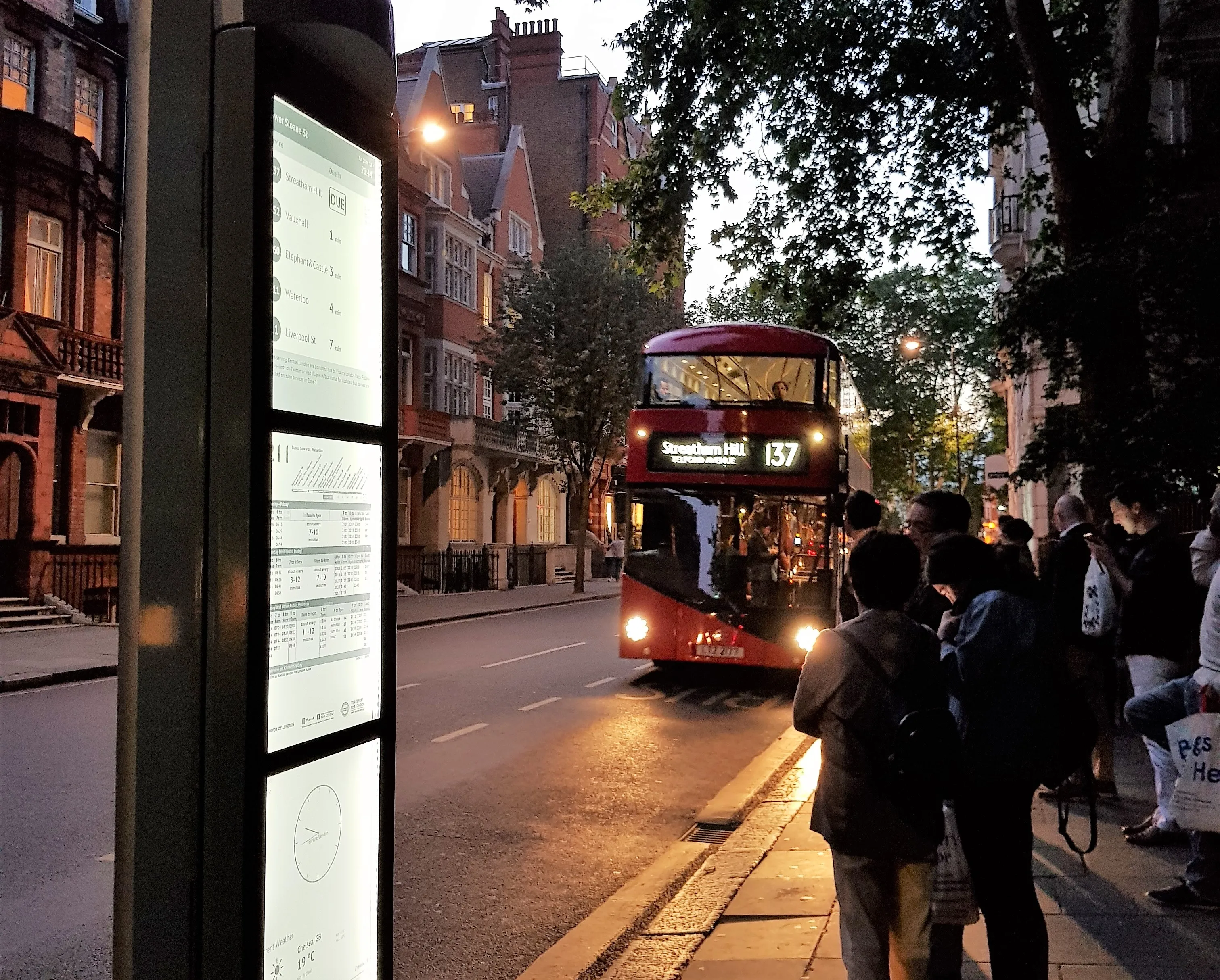
The company says the trial - on Lower Sloane Street and Waterloo Bridge - has helped identify a viable digital display technology that can operate continuously at locations without mains power.

Papercast's e-paper bus stop displays deliver a low power consumption and can be installed within TfL bus stop timetable frame, the company adds. 

The solution also comes with wireless capabilities as well as optional illumination, interactive function and text to speech modules. 

For more information on companies in this article

Related Content

  • Advanced booking: what are transportation leaders reading?
    August 21, 2023
    There’s never been more information available to us via online platforms, rolling TV news and social media channels. In this environment, does the old-fashioned book still have something to offer? We asked a few transportation leaders what they were reading…
  • Wireless traffic data in real time
    January 31, 2012
    The effect of moving objects on the electromagnetic landscape set up by cellular telephony networks can be detected and interpreted to give real-time traffic data across large geographical areas at low cost. Here, we revisit the Celldar concept. Global economic downturn has pushed public-sector agencies, transport administrations among them, to push even harder for cost efficiencies. Unfortunately, when it comes to transport safety and efficiency the public sector often has to work up to a cost rather than
  • Interactive digital map shows road collision history across London
    September 22, 2015
    London’s first interactive digital collision map has been launched by the Mayor and Transport for London (TFL) as part of a continued drive to improve road safety awareness to reduce the number of casualties in the capital. The London Collision Map uses extensive data, collected by the police and held by TfL, to shine a light on road collisions in local areas. This creates a useful new way to inform road users about junctions with high collision histories and aiding improvement work in line with TfL’s co
  • Transport for London launches competition to create accessibility apps
    March 14, 2013
    Transport for London (TfL) is launching a competition to create new 'Accessibility Apps', marking the first of a series of initiatives to improve the variety of accessibility apps on offer. As part of the competition developers are being invited to apply with ideas for a new travel app which will make Transport for London (TfL) real time data more accessible to a far wider audience than mainstream Apple/Android apps. The winning entries will receive development support from TfL. Making the transport network