
Here unveils 3D road models for ADAS and driver safety

Here Technologies has launched Here Lanes with the aim of increasing driver awareness and road safety through advanced driver assistance systems (ADAS).
By Ben Spencer January 21, 2020 Read time: 1 min
Here Lanes ADAS was launched at CES 2020 (source: Here Technologies)

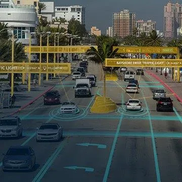
Here Lanes is a digital representation of the global road network that enables a vehicle to position itself while providing drivers with lane-level visual guidance, the company adds. 

Sheila Nedelcu, head of automated driving at Here, said at CES 2020 in Las Vegas: “Here Lanes delivers automakers and software developers the data they need to improve today’s ADAS functions in all weather conditions while building the next generation of applications supported by lane-level positioning, guidance and visualisation.”  

Here Lanes is expected to feed ADAS and mobile applications with precise lane topology, geometry and attribute data such as the rules of the road, vehicle height restrictions, lane count and centre line, direction of travel and the slope and curvature of intersections. 


For more information on companies in this article

Related Content

  • Cash for Southern Nevada bus rapid transit
    April 25, 2024
    Maryland Parkway Bus project received $150m from the US government
  • Hella and Autoliv sign license and cooperation agreement
    May 18, 2012
    Hella Aglaia Mobile Vision, a subsidiary of Hella KGaA Hueck & Co., and Autoliv have agreed to cooperate and further develop their automotive forward-looking vision systems together. As part of the agreement that bundles the competencies of both companies, Hella Aglaia is selling an exclusive license on monovision based algorithms for traffic sign recognition (TSR), lane detection and light source recognition to Autoliv. By monitoring traffic signs, TSR helps the driver to keep the correct speed and follow
  • IBM Big Data helps Dublin improve transport operations
    May 17, 2013
    The city of Dublin is using IBM Big Data identify and solve the root causes of traffic congestion in its public transport network throughout the city, which means improved traffic flow and better mobility for commuters. Integrating data from a citywide network of sensors with geospatial data means that city officials are able to better monitor and manage traffic in real time. To keep the city moving, the council’s traffic control centre works together with local transport operators to manage an extensive ne
  • The future? It's remote, says Valerann
    January 4, 2024
    More responsive traffic management is of enormous value – and Valerann thinks its SaaS system, remotely deployed in Latin America, is able to identify incidents much more quickly, finds Andrew Stone