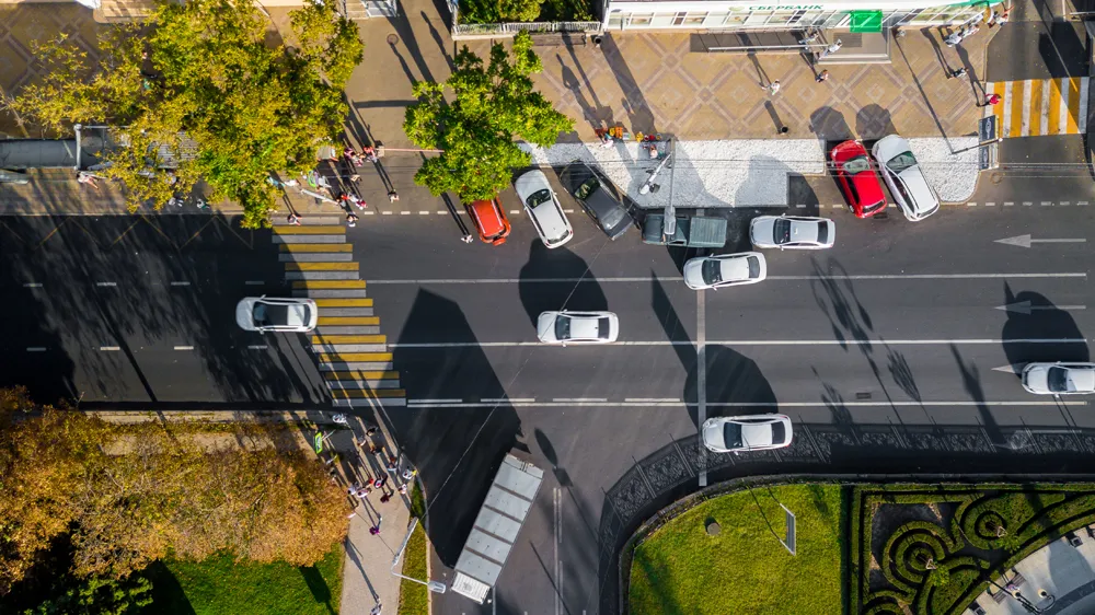
Image Sensing Systems (ISS) and Bluetooth sensors provider trafficnow have completed a distribution agreement for Image Sensing Systems to sell trafficnow’s DeepBlue sensor in most of North America and parts of the Middle East.
This partnership will allow customers to leverage ISS’ RTMS radar detection technology and trafficnow’s DeepBlue Sensor. The combination of these sensors provides a complete picture of traffic information by being a big data source for up to 12 lanes of continuous traffic.
Image Sensing Systems (ISS) and Bluetooth sensors provider 6771 trafficnow have completed a distribution agreement for Image Sensing Systems to sell trafficnow’s DeepBlue sensor in most of North America and parts of the Middle East.
This partnership will allow customers to leverage ISS’ RTMS radar detection technology and trafficnow’s DeepBlue Sensor. The combination of these sensors provides a complete picture of traffic information by being a big data source for up to 12 lanes of continuous traffic.
The RTMS Sx-300 provides the point information such as volume, occupancy, speed and classification and the DeepBlue sensor provides the spatial information such as travel time and origin/destination matrix. The data from these two sensors will provide real-time travel time information, allowing drivers to make smart travel decisions to help reduce their commute and keep traffic flowing
“ISS works hard to identify innovative technologies that complement our technology portfolio and Bluetooth is a dynamic addition,” said Dan Skites, highway general manager at Image Sensing Systems. “As traffic continues to grow and travel times increase, the motoring public is getting frustrated and demanding that travel information is available. Traffic management professionals can now rely on the most accurate real-time data and analytics.”
“More than just a partnership between two global players in the ITS market, this is a partnership between spatial information and point information; it’s about getting the full picture of the traffic situation in up to 12 lanes from the side of the road,” said Robert Nordentoft, general manager at trafficnow.