New version of free GIS portal toolkit

To further improve Geographic Information System (GIS) data access over the Web, ESRI has updated its GIS Portal Toolkit for ArcGIS. The toolkit is a free technology and services solution for implementing local, regional, national and global Spatial Data Infrastructure (SDI) portals. The toolkit gives users a website starter and all the functional capabilities needed to deploy a GIS portal for an organisation's SDI.
March 13, 2012 Read time: 1 min
To further improve Geographic Information System (GIS) data access over the Web, 50 ESRI has updated its GIS Portal Toolkit for ArcGIS. The toolkit is a free technology and services solution for implementing local, regional, national and global Spatial Data Infrastructure (SDI) portals. The toolkit gives users a website starter and all the functional capabilities needed to deploy a GIS portal for an organisation's SDI.

Related Content

  • Esri highlights benefits of a state-wide data-rich environment
    September 7, 2020
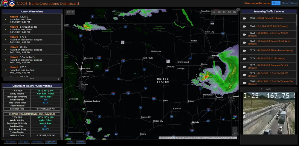
    Walk into virtually any traffic operations centre and you will be confronted by people flipping between different screens and CCTV monitors, and individually viewing a large number of stand-alone applications to try to understand a comprehensive picture of their live traffic, weather, incident, and snow conditions from these disparate sources.
  • Latest Road Safety Toolkit released
    July 15, 2022
    New version of online safety resource has a greater emphasis on vulnerable road users
  • A new beginning for travel information, based on users' needs
    February 3, 2012
    Despite its name, the EU's forthcoming SUNSET project could represent a new beginning for travel information services. Here, Susan Grant-Muller and Frances Hodgson from the Institute for Transport Studies at the University of Leeds detail a project which is intended to exert a greater influence on network users' travel habits
  • TRL launches cloud-based collision analysis system
    January 25, 2013
    The UK’s Transport Research Laboratory (TRL) has launched MAAPcloud, the new generation version of its MAAP road traffic collision data software which TRL has supplied in the UK and globally since the 1980s. TRL says this brand new version provides a better fit with today’s technological environments, and offers additional capabilities for the road safety professionals who use it. MAAPcloud has been designed to allow flexible deployment; police forces, local authorities and other road safety stakeholders ca