Luna unveils ‘cm-level’ positioning for e-scooters

Dublin-based start-up Luna has released a telematic device which it says uses 10cm-level positioning accuracy to help scooter companies ensure their scooters are ridden and parked correctly.
February 17, 2020 Read time: 1 min
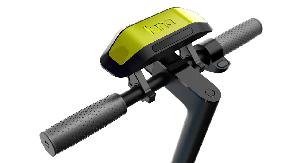
Luna escooter

The device uses GNSS/GPS positioning with an integrated correction service to achieve this accuracy. It also uses machine vision and artificial intelligence (AI) to recognise parking spaces in GPS blackspots via 2D images (QR codes) located in and around the site, the company adds.

According to Luna, the device augments satellite-based positioning with machine vision and AI to overcome GPS blackspots while moving. The unit’s street Vs pavement algorithm allows the scooter camera to analyse the surface it is riding in real time.

Luna’s safety features include obstacle/footpath recognition to prevent pedestrian collisions as well as helmet detection to ensure scooters can only be operated once a rider is wearing their helmet.

Related Content

  • Inrix aids authorities in dealing with data
    August 18, 2015
    New traffic data products and services have been launched to aid transport and urban planners and business with detailed intelligence on journey patterns, reports Jon Masters. Manual travel surveys ought soon to become a thing of the past for transport planners and the business community. The technology now exists for getting sophisticated levels of traffic and trip data from connected vehicles. Cars and commercial fleets carrying a GPS device, or a mobile phone or smartphone are the sources of the informat
  • TrafficLand and Exelis partner on real time weather detection
    March 18, 2014
    TrafficLand and global aerospace and defence company Exelis are working together to deliver real-time information on street-level weather conditions. The Exelis Helios environmental intelligence platform analyses images from TrafficLand roadway camera network to detect and track weather conditions. It uses proprietary algorithms that give users the ability to monitor current conditions and detect changes in visibility, precipitation and road surface conditions at a street scale. Helios can then inform u
  • Utah manages with Rekor's Waycare
    September 24, 2021
    UDoT is piloting traffic management system on major corridors in the Salt Lake City region
  • Aecom seatbelt and phone use trial expanded in England
    March 6, 2024
    More police forces join National Highways’ safety cameras pilot to detect motorists breaking law