
Luna unveils ‘cm-level’ positioning for e-scooters

Dublin-based start-up Luna has released a telematic device which it says uses 10cm-level positioning accuracy to help scooter companies ensure their scooters are ridden and parked correctly.
February 17, 2020 Read time: 1 min
Luna escooter

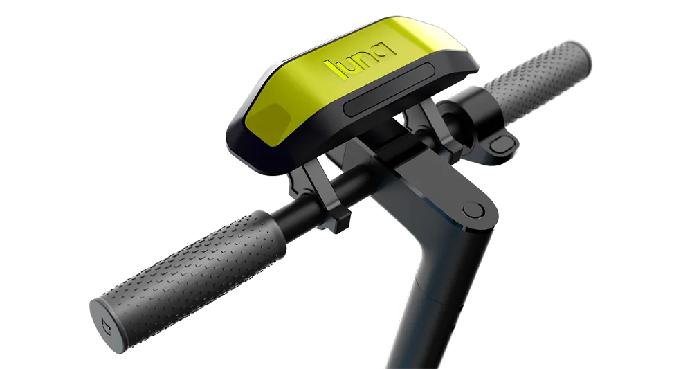
The device uses GNSS/GPS positioning with an integrated correction service to achieve this accuracy. It also uses machine vision and artificial intelligence (AI) to recognise parking spaces in GPS blackspots via 2D images (QR codes) located in and around the site, the company adds.

According to Luna, the device augments satellite-based positioning with machine vision and AI to overcome GPS blackspots while moving. The unit’s street Vs pavement algorithm allows the scooter camera to analyse the surface it is riding in real time.

Luna’s safety features include obstacle/footpath recognition to prevent pedestrian collisions as well as helmet detection to ensure scooters can only be operated once a rider is wearing their helmet.

Related Content

  • Back to school with Neuron
    August 17, 2022
    ScootSafe Academy platform aimed at users who have been reported for unsafe riding
  • Innovation without the chaos
    July 23, 2025
    Effective governance is required to ensure that artificial intelligence remains an asset rather than a liability, says Rafael Hernandez of IntelliRoad. He lays out his case here…
  • IN FOCUS: What Lidar does next
    March 16, 2023
    Automotive, tolling, robotics – outside of traffic, road safety and autonomous vehicles, what applications will move the dial in terms of Lidar during 2023? Quite a few, finds Adam Hill
  • Smart Spanish city trials cell-based traffic management
    November 7, 2013
    David Crawford reports on an urban electronic nervous system. The northern Spanish city of Santander – historically a port - is now an emerging technology showcase attracting global attention as a prototype for a medium-sized smart city of the future. In a move to determine the optimal use of available data, it is creating a de-facto experimental laboratory for sensor and mobile phone-based urban traffic management and environmental monitoring innovations.