CartoConsult delivers instant smart city models with web streaming

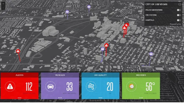
CartoConsult has added a subscription service that delivers smart 3D building and city models via live web streaming to any internet connected device. Using Cesiumjs, a cross-platform open architecture, dynamic-data visualisation package which requires no plug-in to run in a web browser, CartoConsult believes the new web streaming capability will significantly boost the appeal of applying 3D capability to projects.
August 10, 2016 Read time: 1 min

CartoConsult has added a subscription service that delivers smart 3D building and city models via live web streaming to any internet connected device.

Using Cesiumjs, a cross-platform open architecture, dynamic-data visualisation package which requires no plug-in to run in a web browser, CartoConsult believes the new web streaming capability will significantly boost the appeal of applying 3D capability to projects.

Potential users such as urban planners, developers and engineers will no longer need special software to view the models. The data is still fully compatible with GIS, CAD and other mapping software with 3D capabilities, but it is no longer a requirement for viewing the data.

Related Content

  • New traffic light controller is ‘game changer’ says Siemens
    June 6, 2014
    Siemens’ introduced its new Sitraffic sX controller as a ‘game changer’, Colin Sowman finds out why.
  • Lidar: recipes for success
    March 28, 2022
    Lidar is being deployed all over the world - and you can even read a cookbook on the subject...
  • Esri shows benefits of aggregating multiple data live streams
    November 18, 2020
    The age of connected vehicles is fast becoming a reality. While it brings great promise, it also brings new challenges for those seeking to derive insights from the voluminous data each connected vehicle will transmit. Any number of transportation agencies are beginning to grapple with the challenge of monitoring the live streams of data for traffic management, and ultimately for greater safety of their roadways.
  • PTV cloud-based transport route planner
    March 22, 2012
    PTV has unveiled what it claims is a major new innovation: map& guide internet, the first cloud-based transport route planner. Hauliers and logistics companies may now use the map&guide software as a service (SaaS). They can simply plug in and use the software directly over the Internet - saving time and money, since neither installation nor maintenance is required. PTV says the inexpensive solution, costing just €49 (US$65) per month, is particularly attractive for small and medium-sized businesses.