
Waymo redesigns fifth generation hardware sensor suite

Waymo has redesigned its fifth-generation hardware sensor suite with the aim of enabling the scaled deployment of Waymo Driver autonomous vehicles (AVs).
By Ben Spencer March 16, 2020 Read time: 2 mins
Waymo's self-driving Jaguar I-Pace electric SUV 1 (Source: Waymo)

In a blog post, Satish Jeyachandran, head of hardware at Waymo, says the new 360 Lidar system provides a bird's-eye view of the cars, cyclists and pedestrians surrounding the vehicle. It allows Waymo Driver to navigate the complexities of city driving by distinguishing the opening of a car door a city block away while also allowing its trucks to spot debris hundreds of metres ahead on the highway, he adds.
 
Perimeter Lidars are now placed at four points around the sides of the vehicle to help it navigate tight gaps in city traffic and cover potential blind spots on hilly terrain.
 
According to Jeyachandran, long range cameras and a 360 vision system identify pedestrians and stop signs greater than 500m away.
 
Additionally, a perimeter vision system is expected to work in conjunction with its perimeter Lidars to give Waymo Driver another perspective of objects close to the vehicle.
 
“For example, while our perimeter Lidars detect obstacles directly in front of the vehicle with precision, our perimeter cameras provide our machine learning algorithms additional details to reliably identify objects, providing more context to the traffic scene,” Jeyachandran explains.
 
He claims that a peripheral vision system allows Waymo to ‘peek’ around a truck driving in front to determine whether it is safe to overtake or wait.
 
Waymo has also redesigned the architecture, outputs and signal processing capabilities of the hardware sensor suite to create an “imaging radar system for self-driving”.
 
“Our next-generation radar can also see objects at great distances, including detecting a motorcyclist from hundreds of metres away,” he continues. “Like with our other long-range sensors, being able to accurately detect objects at greater distances gives us a longer reaction time to make a more comfortable experience for our riders.”
 
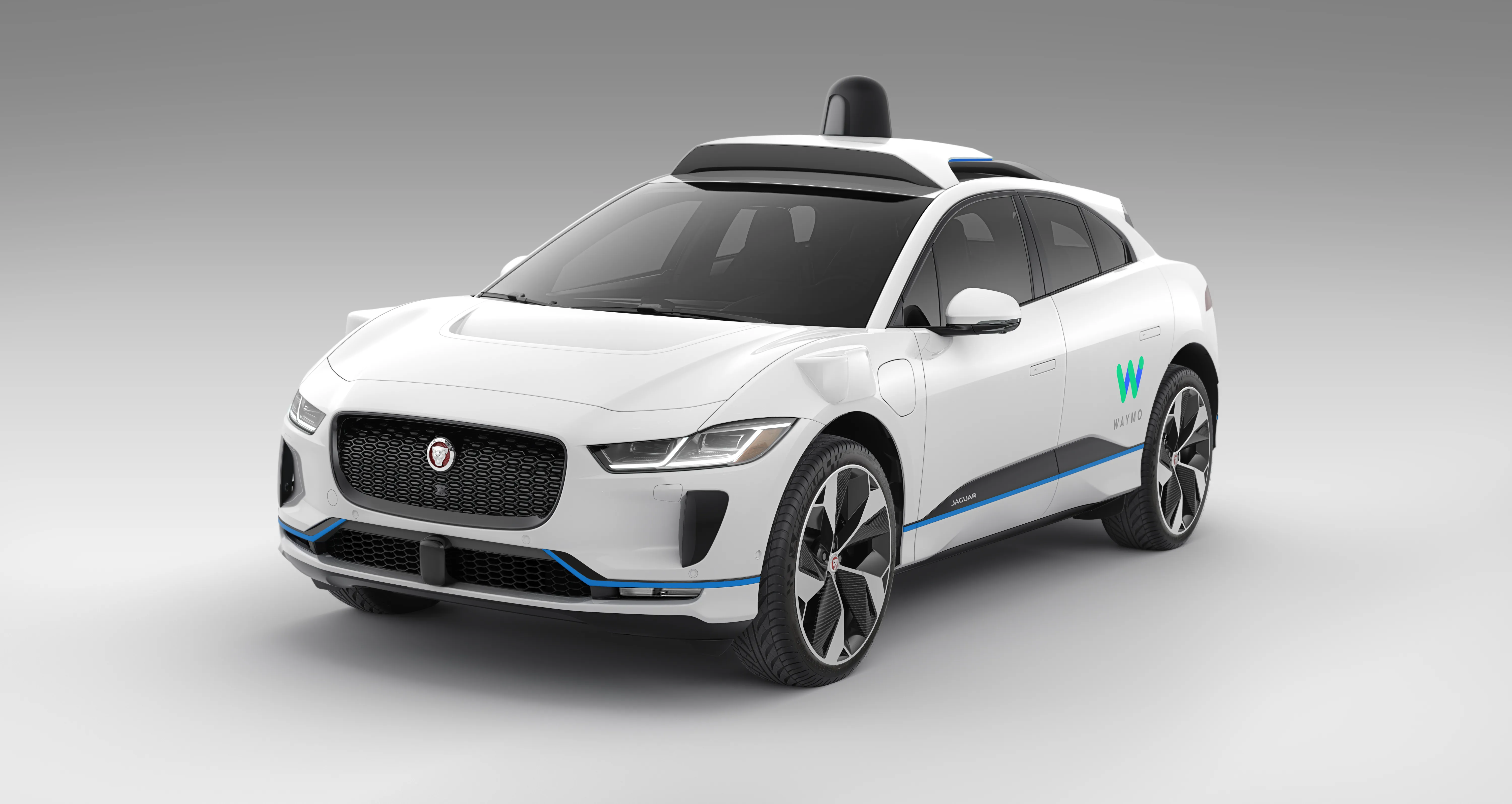
The company has integrated its new generation of sensors on its Jaguar I-PACE vehicle.
 
“With the first of these new vehicles, we’ve completed comprehensive module-level and system-level tests to ensure our next-generation hardware can withstand whatever the roads throw at it - from stormy weather and salted roads, to extreme heat and dirt storms,” Jeyachandran concludes.


For more information on companies in this article

Related Content

  • Wireless sensor data is saving lives, says Sensys Networks
    September 7, 2020
    ITS World Congress provides a unique opportunity to examine the latest innovative uses of traffic technology. One trend is the increased use of detection data - presence, volume, occupancy, and speed - to power dynamic information for drivers. And the benefits of this data go well beyond traffic information within mapping and navigation systems that are used by motorists to get to their destinations efficiently. This data can help save lives.
  • Traffex snapshot reveals enforcement advances
    July 24, 2017
    An indication of just how far beyond spot speed and red light the enforcement sector has progressed was evident in the range of new and improved equipment on display at the recent Traffex event in Birmingham. One of the key trends, particularly in the UK but also evident elsewhere, is the increase in average speed enforcement, according to RedSpeed’s managing director Robert Ryan, who predicts a big increase in installations this year. “The price point has reached a level authorities can afford,” he says, a
  • US DOTs introduce measures to stop wrong-way driving
    March 28, 2018
    Wrong-way driving (WWD) is a remarkably innocuous term for incidents that all too often cause some of the worst accidents that emergency services have to deal with. Several US states are now taking steps to minimise the problem, as Alan Dron finds out. You’re driving down a highway at night when you see approaching headlights. You initially assume they are merely those of an oncoming car on the opposite carriageway. It’s only when they are within 200 yards or so that you realise that the other driver is in
  • Inertial sensors dramatically improve GNSS for ITS applications
    January 18, 2012
    Phil Harris, Thales UK, on how fused sensor data can significantly enhance GNSS-based positioning systems' performance in urban areas. Global Navigation Satellite System (GNSS)-based positioning is unique among available positioning technology due to its universal coverage and low equipment cost. By measuring the distances between an unknown position (such as a vehicle), and at least three known positions (GPS satellites), the unknown position can be calculated in three dimensions (latitude, longitude, and