StreetLight Data provides free VMT metrics

StreetLight Data is offering vehicle miles travelled (VMT) data for US transit agencies to monitor transport networks and understand travel patterns during the Covid-19 pandemic.
By Adam Hill April 17, 2020 Read time: 2 mins
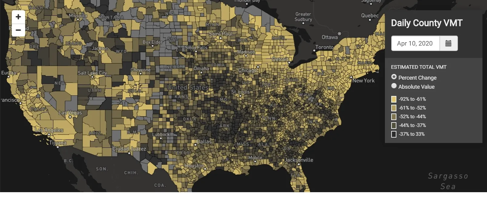
StreetLight Data maps VMT across the US

There has been massive disruption to travel patterns since February and Streetlight’s information covers more than 3,100 counties across the US, updated three times a week.

Designed to measure the transportation impact on communities, it is free to planners, researchers and engineers, as well as federal, state and local governments.

"Transportation professionals make critical budget and planning projections based on gas tax revenue and other factors derived from VMT,” explains CEO Laura Schewel.

“The recent massive drop in travel is throwing off all those plans. This data-driven map gets the key metrics out quickly, with local granularity, to those who need them. Planners, like everyone else, are adjusting to a new reality and we’re here to help navigate it. We hope this, in some way, can help our transportation community in this difficult and unprecedented time."

Location intelligence provider Cuebiq is working with StreetLight, and has developed what it calls a ‘near-real time’ mobility index to improve the outbreak forecast and response.

“StreetLight fused Cuebiq’s index with its own algorithms that transform GPS data into contextualised, aggregated and normalised travel patterns, as well as its deep repositories of data depicting historical VMT,” the company said in a statement.

The data is available here.

For more information on companies in this article

Related Content

  • Fara keeps data delivery simple
    January 25, 2018
    Simplifying the delivery of data and information gathered by traffic management, ticketing and other systems can improve travel efficiency and the traveller’s experience. Having quantified and analysed the previously unmonitored movement of road vehicles, trains, metros, cyclists and pedestrians, the ITS sector is a prime example of the digital world. Patterns discerned from those previously random happenings enable authorities to design more efficient transport systems, allow transport operators to run
  • Scenexus is new spin-off from TNO
    January 16, 2025
    Digital twin specialist receives €1.6m VC backing from Lumo Labs
  • Cohda Wireless: 'New York has the best urban canyons'
    July 21, 2020
    Dr Paul Alexander, chief technical officer of Cohda Wireless, talks to Adam Hill about DSRC versus C-V2X, global connected vehicle take-up, the uses of WiFi – and, of course, seeing round the Big Apple's buildings...
  • Vehicle manufacturers and local authorities seek satnav solutions
    December 5, 2013
    The increasing capability of satellite navigation is helping vehicle manufacturers and local authorities as well as individual drivers and fleets. In comparison to the physical ITS infrastructure in towns and cities and on motorways and highways, satellite navigation (satnav) systems have come a long way in a short time. Many (if not the majority) individual drivers and fleets use or have access to a satnav and now the vehicle manufacturers and even local authorities are beginning to utilise satnav derived