StreetLight Data provides free VMT metrics

StreetLight Data is offering vehicle miles travelled (VMT) data for US transit agencies to monitor transport networks and understand travel patterns during the Covid-19 pandemic.
By Adam Hill April 17, 2020 Read time: 2 mins
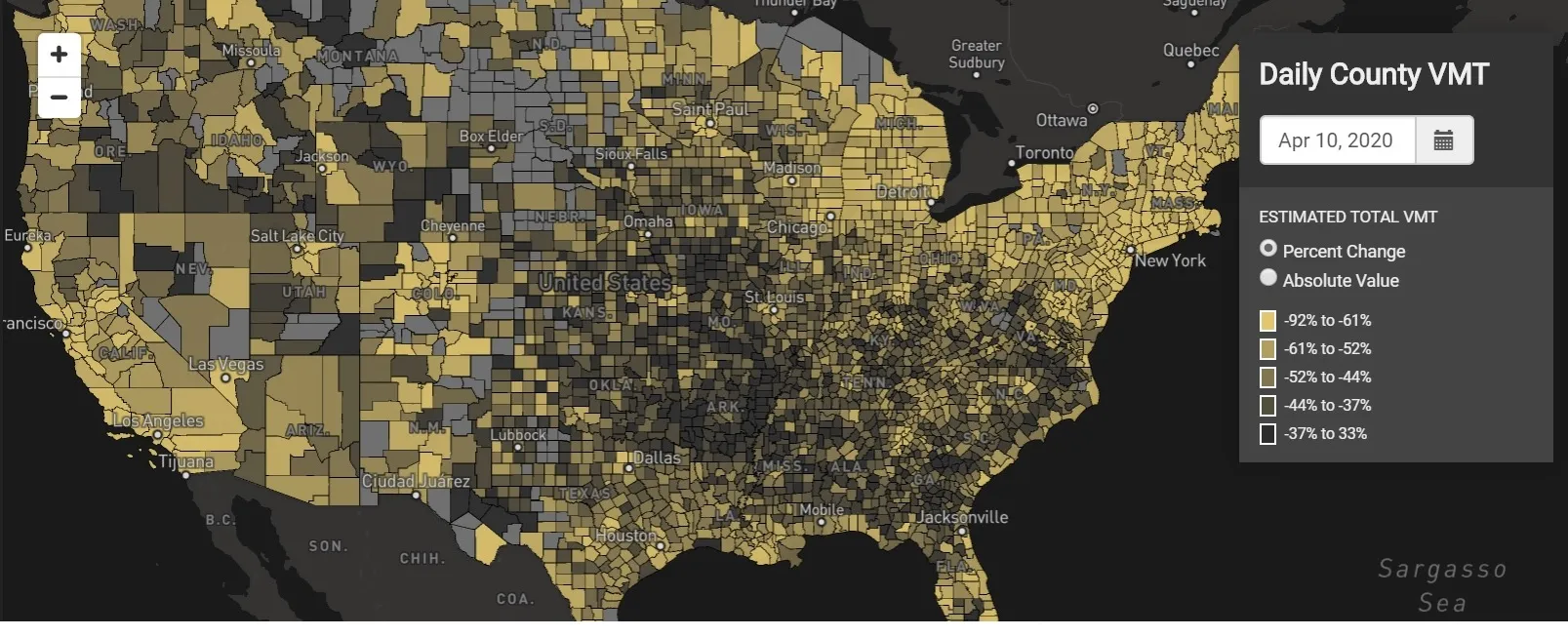
StreetLight Data maps VMT across the US

There has been massive disruption to travel patterns since February and Streetlight’s information covers more than 3,100 counties across the US, updated three times a week.

Designed to measure the transportation impact on communities, it is free to planners, researchers and engineers, as well as federal, state and local governments.

"Transportation professionals make critical budget and planning projections based on gas tax revenue and other factors derived from VMT,” explains CEO Laura Schewel.

“The recent massive drop in travel is throwing off all those plans. This data-driven map gets the key metrics out quickly, with local granularity, to those who need them. Planners, like everyone else, are adjusting to a new reality and we’re here to help navigate it. We hope this, in some way, can help our transportation community in this difficult and unprecedented time."

Location intelligence provider Cuebiq is working with StreetLight, and has developed what it calls a ‘near-real time’ mobility index to improve the outbreak forecast and response.

“StreetLight fused Cuebiq’s index with its own algorithms that transform GPS data into contextualised, aggregated and normalised travel patterns, as well as its deep repositories of data depicting historical VMT,” the company said in a statement.

The data is available here.

For more information on companies in this article

Related Content

  • Getting more for less from traffic data
    August 15, 2012
    Collection of traffic and transit data has grown significantly, combining with advances in connectivity and computational modelling to good effect. Desire to do more with less – to make budgets go further – has helped create a boom in the collection and study of traffic and transport data. Studies are becoming longer, greater in number and further in-depth as more intelligence is sought, plus, transportation agencies are looking to make processes of data collection less costly, or more efficient.
  • US favours express buses are for intercity travel
    November 26, 2013
    David Crawford records an upsurge in ground travel. Express buses are powering ahead of air and rail as the US’ most-favoured form of intercity travel and major operators are investing in passenger-attracting and retaining technologies. At the same time ‘kayak’-style price comparison websites are emerging to widen rider choice. Modelled on airline industry search engines that find cheap flight deals by comparing carriers’ offers, these new websites aim to fill the same gap for a ground-travel equivalent
  • Road usage charge pilot under way
    November 22, 2012
    The Oregon Department of Transportation (ODOT) is undertaking a pilot project to test the next generation of a road usage charge system designed to address funding gaps caused by a rise in fuel efficiency and a decline in gas tax revenue. Around forty volunteers have begun testing the new system, where, instead of paying the gas tax, automatically added at the pump, pilot participants will pay a per mile charge based on the number of miles they drive. The charge is roughly equal to the amount of gas tax the
  • $7bn funding from FHWA for US infrastructure resilience
    August 8, 2023
    Money will be available for highway and transit projects to mitigate climate change effects