StreetLight Data provides free VMT metrics

StreetLight Data is offering vehicle miles travelled (VMT) data for US transit agencies to monitor transport networks and understand travel patterns during the Covid-19 pandemic.
By Adam Hill April 17, 2020 Read time: 2 mins
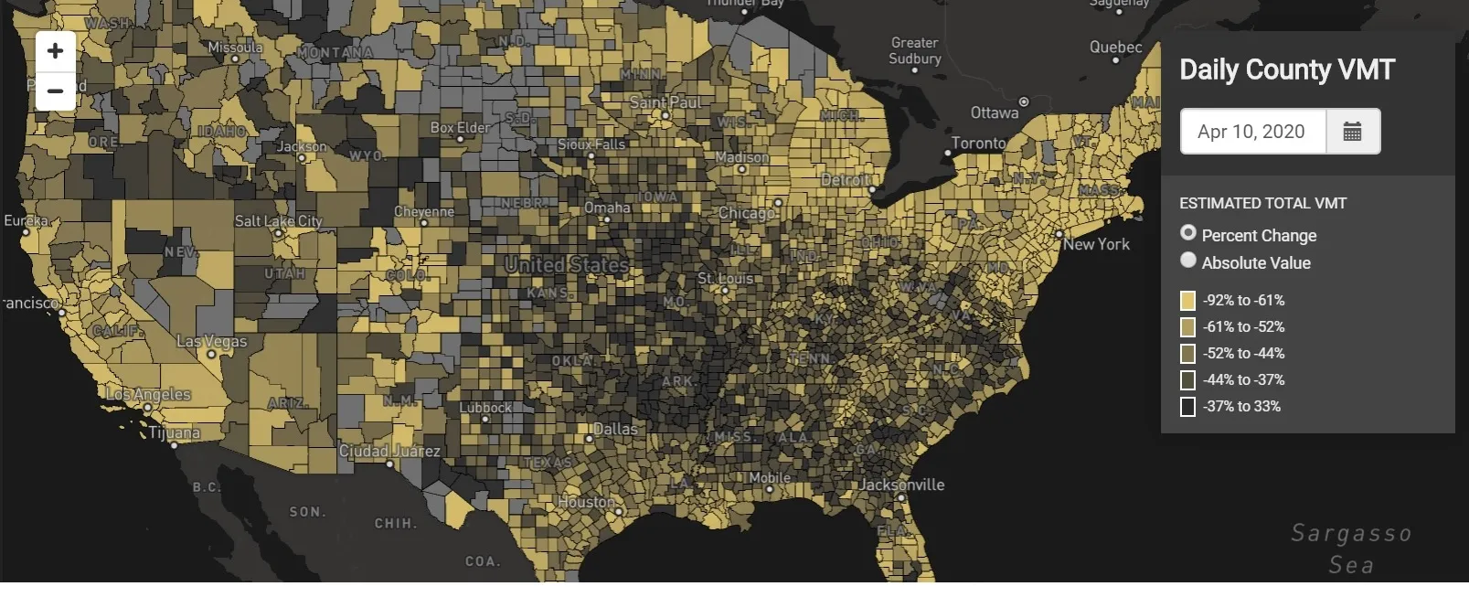
StreetLight Data maps VMT across the US

There has been massive disruption to travel patterns since February and Streetlight’s information covers more than 3,100 counties across the US, updated three times a week.

Designed to measure the transportation impact on communities, it is free to planners, researchers and engineers, as well as federal, state and local governments.

"Transportation professionals make critical budget and planning projections based on gas tax revenue and other factors derived from VMT,” explains CEO Laura Schewel.

“The recent massive drop in travel is throwing off all those plans. This data-driven map gets the key metrics out quickly, with local granularity, to those who need them. Planners, like everyone else, are adjusting to a new reality and we’re here to help navigate it. We hope this, in some way, can help our transportation community in this difficult and unprecedented time."

Location intelligence provider Cuebiq is working with StreetLight, and has developed what it calls a ‘near-real time’ mobility index to improve the outbreak forecast and response.

“StreetLight fused Cuebiq’s index with its own algorithms that transform GPS data into contextualised, aggregated and normalised travel patterns, as well as its deep repositories of data depicting historical VMT,” the company said in a statement.

The data is available here.

For more information on companies in this article

Related Content

  • Ertico is looking east: here’s why
    March 3, 2020
    The first Central Eastern Congress on ITS is to be held in Russia in September. Jacob Bangsgaard, CEO of Ertico – ITS Europe, tells Adam Hill why the event is necessary – and what visitors can expect
  • Smart data to help manage congestion in the Philippines
    May 5, 2016
    Traffic management agencies and city planners will soon have access to real-time data to better manage traffic flows on the streets of Cebu City and Metro Manila. The World Bank, the Department of Transportation and Communications (DOTC) and Grab, a third-party ride booking app provider, have launched the OpenTraffic initiative, which it is hoped will help address traffic congestion and road safety challenges.
  • Iteris to expand its iPerform data and analytics software solutions
    March 12, 2013
    Intelligent traffic management information solutions provider Iteris is expanding its iPerform traffic and weather-related data and analytics software offering. iPerform was established in 2011 and provides a new generation of intelligent traffic and weather-related information solutions. These solutions bring the power of big data to the prediction of traffic conditions and the delivery of actionable information to both the public and commercial marketplace. The segment’s initial product, IterisPeMS, is a
  • First-of-a-kind collaboration to analyse real-time traffic patterns and individual commuter travel history
    February 3, 2012
    IBM has announced a new collaboration with the California Department of Transportation (Caltrans) and California Center for Innovative Transportation (CCIT), a research institute at the University of California, Berkeley, to develop an intelligent transportation solution that will help commuters avoid congestion and enable transportation agencies to better understand, predict and manage traffic flow.