StreetLight Data provides free VMT metrics

StreetLight Data is offering vehicle miles travelled (VMT) data for US transit agencies to monitor transport networks and understand travel patterns during the Covid-19 pandemic.
By Adam Hill April 17, 2020 Read time: 2 mins
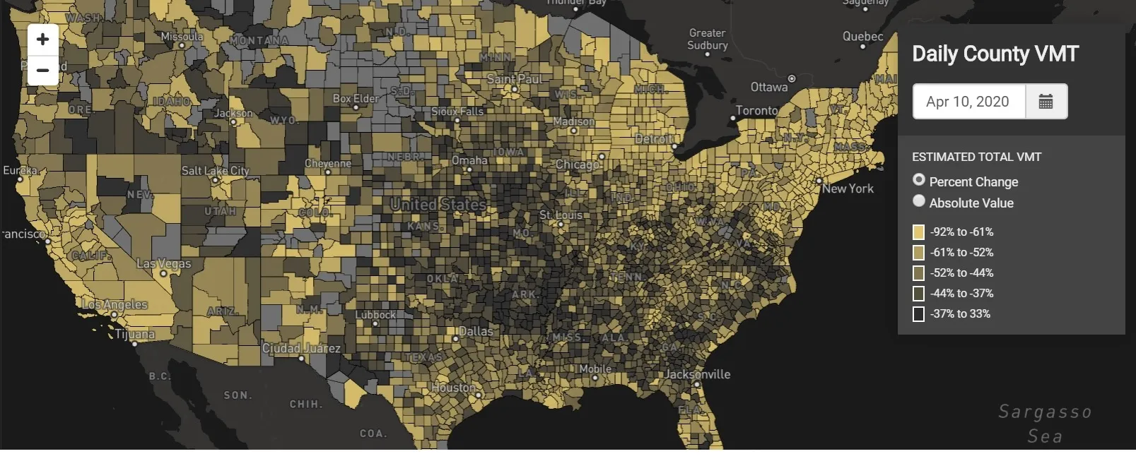
StreetLight Data maps VMT across the US

There has been massive disruption to travel patterns since February and Streetlight’s information covers more than 3,100 counties across the US, updated three times a week.

Designed to measure the transportation impact on communities, it is free to planners, researchers and engineers, as well as federal, state and local governments.

"Transportation professionals make critical budget and planning projections based on gas tax revenue and other factors derived from VMT,” explains CEO Laura Schewel.

“The recent massive drop in travel is throwing off all those plans. This data-driven map gets the key metrics out quickly, with local granularity, to those who need them. Planners, like everyone else, are adjusting to a new reality and we’re here to help navigate it. We hope this, in some way, can help our transportation community in this difficult and unprecedented time."

Location intelligence provider Cuebiq is working with StreetLight, and has developed what it calls a ‘near-real time’ mobility index to improve the outbreak forecast and response.

“StreetLight fused Cuebiq’s index with its own algorithms that transform GPS data into contextualised, aggregated and normalised travel patterns, as well as its deep repositories of data depicting historical VMT,” the company said in a statement.

The data is available here.

For more information on companies in this article

Related Content

  • Israel aspires to ITS-led future
    May 29, 2013
    Shay Soffer, Chief Scientist with the Israel National Road Safety Authority, talks to Jason Barnes about his country’s current ITS outlook and how he sees this developing in the future. Israel ranks alongside countries such as the US and France in the road safety stakes, with an average 7.1 deaths per billion kilometres driven. But at that point the similarities end, as the country’s overriding issue is pedestrian safety. This is driven by several factors, including being a relatively small country where pe
  • 5 million public transport stops mapped by Moovit as community of local editors grows to 200,000
    October 31, 2017
    Moovit has added 5 million public transport stops worldwide to its app and increased the number of local editors, Mooviters, who map out their own transport networks where public data is not readily available, to 200,000. In addition, Japanese has also been added as the 44th language available for the app. These initiatives are aimed at helping to make travel smoother for commuters while building a global repository of transport data that governments, urban planners and businesses can use to better prepare
  • Be ready before you ask for grant funding, warns USDoT
    April 27, 2023
    Polly Trottenberg, deputy secretary at US Department of Transportation, had a polite but firm message for companies and agencies seeking funding from the government: make sure you are ready before asking for money.
  • Align transport infrastructure needs with ITS offerings
    July 19, 2012
    Kallistratos Dionelis, General Secretary of ASECAP, ponders the absence of creativity and innovation in the road management sector. 'Traditional' road managers and ITS specialists share many of the same ultimate goals and yet, he says, a common understanding of what technology can achieve is still conspicuously absent.