StreetLight Data provides free VMT metrics

StreetLight Data is offering vehicle miles travelled (VMT) data for US transit agencies to monitor transport networks and understand travel patterns during the Covid-19 pandemic.
By Adam Hill April 17, 2020 Read time: 2 mins
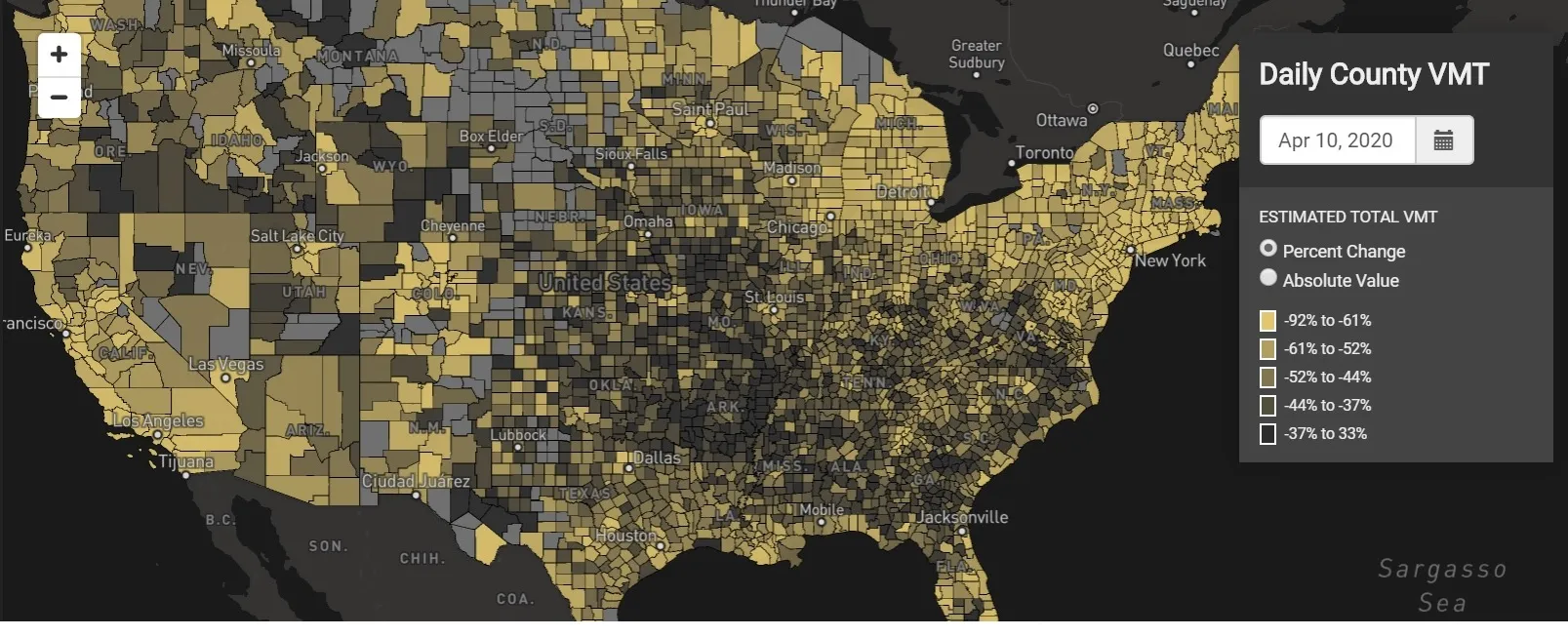
StreetLight Data maps VMT across the US

There has been massive disruption to travel patterns since February and Streetlight’s information covers more than 3,100 counties across the US, updated three times a week.

Designed to measure the transportation impact on communities, it is free to planners, researchers and engineers, as well as federal, state and local governments.

"Transportation professionals make critical budget and planning projections based on gas tax revenue and other factors derived from VMT,” explains CEO Laura Schewel.

“The recent massive drop in travel is throwing off all those plans. This data-driven map gets the key metrics out quickly, with local granularity, to those who need them. Planners, like everyone else, are adjusting to a new reality and we’re here to help navigate it. We hope this, in some way, can help our transportation community in this difficult and unprecedented time."

Location intelligence provider Cuebiq is working with StreetLight, and has developed what it calls a ‘near-real time’ mobility index to improve the outbreak forecast and response.

“StreetLight fused Cuebiq’s index with its own algorithms that transform GPS data into contextualised, aggregated and normalised travel patterns, as well as its deep repositories of data depicting historical VMT,” the company said in a statement.

The data is available here.

For more information on companies in this article

Related Content

  • Remix urges urban transport planners to Explore
    June 11, 2020
    Transport planning specialist Remix has launched a tool designed to help cities and transit agencies to reshape systems as the global pandemic changes mobility needs.
  • The search for travel management's Holy Grail
    October 10, 2018
    Combining accurate network estimates and forecasts with real-time information is the way to deal with traffic hot spots. Alan Dron looks at products which aim to achieve just that. Traffic management authorities have for years been trying to get ahead of the game. Instead of reacting to situations, they want to be able to head them off as they occur – or even before they happen. Finding that Holy Grail of successfully anticipating problems will save time, tension and tempers on city streets. Two new system
  • ACE report: private sector and user-pay for English roads
    May 16, 2018
    It’s one minute to midnight for funding England’s roads, according to a timely new report - and the clock’s big hand is pointing to some form of user-pay solution, reports David Arminas. Is there any way out of future user-pay funding for England’s highway infrastructure? The answer is a resounding ‘no’, according to the recently-published report Funding Roads for the Future. The 25-page document by the London-based Association for Consultancy and Engineering (ACE) calls for a radical rethink about how to
  • Supply chain issues: AGD looks ahead
    June 2, 2022
    There are multiple causes for current global supply chain issues – and this isn’t likely to improve in the near future. Ian Hind of ITS manufacturer AGD Systems spells out how to mitigate the impact