StreetLight Data provides free VMT metrics

StreetLight Data is offering vehicle miles travelled (VMT) data for US transit agencies to monitor transport networks and understand travel patterns during the Covid-19 pandemic.
By Adam Hill April 17, 2020 Read time: 2 mins
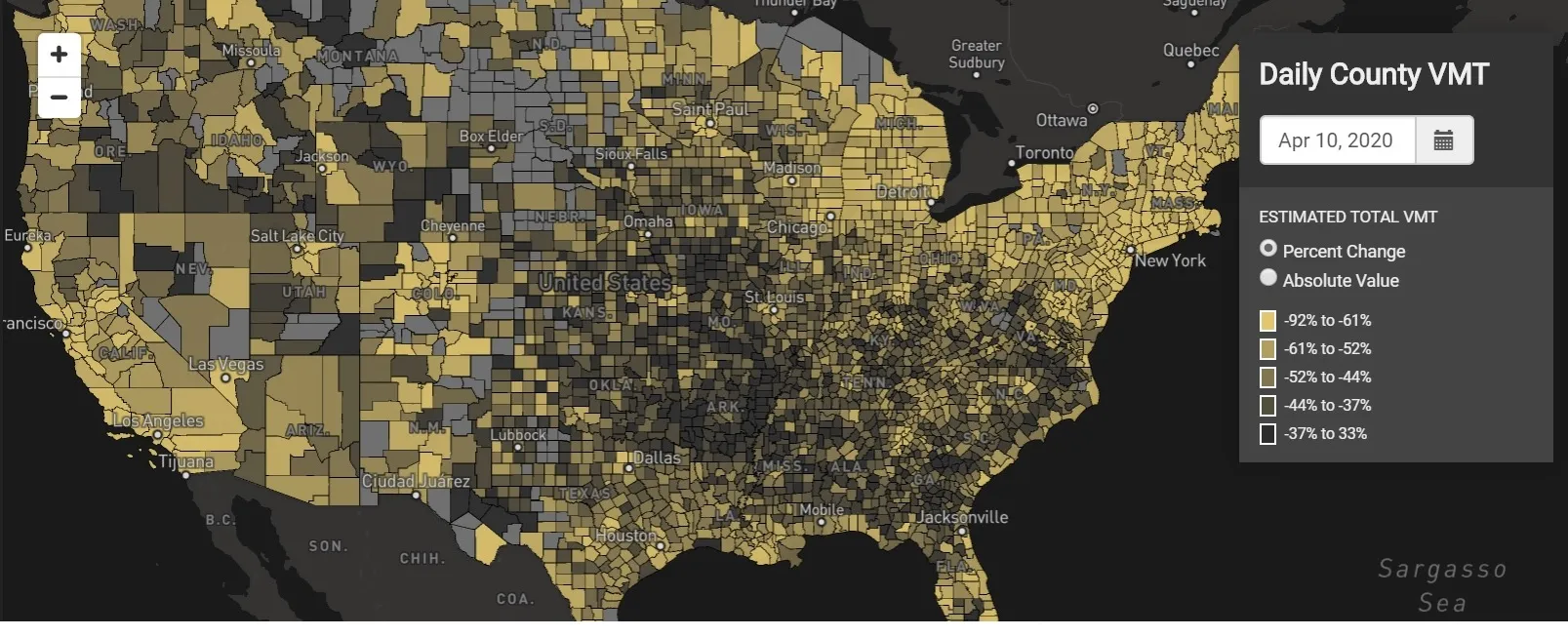
StreetLight Data maps VMT across the US

There has been massive disruption to travel patterns since February and Streetlight’s information covers more than 3,100 counties across the US, updated three times a week.

Designed to measure the transportation impact on communities, it is free to planners, researchers and engineers, as well as federal, state and local governments.

"Transportation professionals make critical budget and planning projections based on gas tax revenue and other factors derived from VMT,” explains CEO Laura Schewel.

“The recent massive drop in travel is throwing off all those plans. This data-driven map gets the key metrics out quickly, with local granularity, to those who need them. Planners, like everyone else, are adjusting to a new reality and we’re here to help navigate it. We hope this, in some way, can help our transportation community in this difficult and unprecedented time."

Location intelligence provider Cuebiq is working with StreetLight, and has developed what it calls a ‘near-real time’ mobility index to improve the outbreak forecast and response.

“StreetLight fused Cuebiq’s index with its own algorithms that transform GPS data into contextualised, aggregated and normalised travel patterns, as well as its deep repositories of data depicting historical VMT,” the company said in a statement.

The data is available here.

Related Content

  • April 12, 2022
    Drover AI’s Alex Nesic: ‘We’re still in the basement level of micromobility’
    The micromobility revolution has reshaped the way we get around cities, but it has created some problems too. Drover AI’s PathPilot is here to help cities – and pedestrians – Alex Nesic tells Adam Hill
  • April 10, 2014
    Cellint measures speed and travel time without roadside infrastructure
    Collecting speed and travel time data without using roadside infrastructure could offer new possibilities to cash-strapped road authorities. Streaming video may be useful for traffic controllers to monitor incidents and automatic number plate recognition may be required for enforcement, but neither are necessary for many ITS functions. For instance travel times, tailbacks, percentage of vehicles turning, origin and destination analysis can all be done using Bluetooth and/or WI-Fi sensors and without video o
  • January 25, 2012
    US state of the art workzone safety
    The Texas Transportation Institute's Jerry Ullman talks about the state of the art in work zone safety in the US. Work zones are places where, perhaps more than anywhere else on the road network, mobility and safety are strongly linked. Historically, field crews and contractors wanted vehicles in work zones to be moving as slowly as possible, assuming that made conditions the safest for work crews. We are though starting to see a shift in such thinking with the realisation that excessive delays or slow-down
  • March 12, 2012
    Joint IBTTA and ITS conference focuses on environmental issues
    In St Louis on 4-6 October, the IBTTA and ITS America will be co-sponsoring their first joint event, which is intended to address the burgeoning environmental issues affecting road transport infrastructures. Here, Steve Snider and Larry Yermack, the two chief meeting organisers, talk about the event and its aims