StreetLight Data provides free VMT metrics

StreetLight Data is offering vehicle miles travelled (VMT) data for US transit agencies to monitor transport networks and understand travel patterns during the Covid-19 pandemic.
By Adam Hill April 17, 2020 Read time: 2 mins
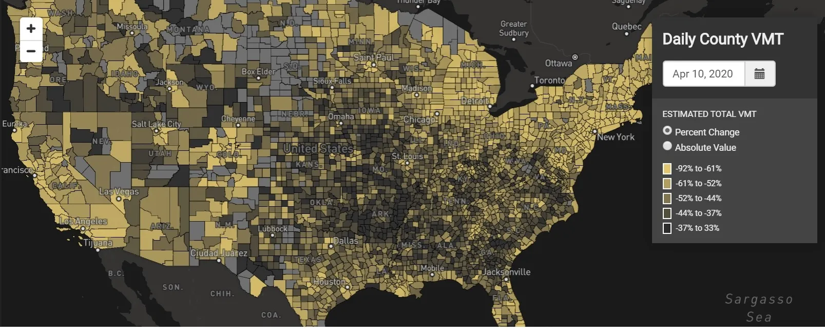
StreetLight Data maps VMT across the US

There has been massive disruption to travel patterns since February and Streetlight’s information covers more than 3,100 counties across the US, updated three times a week.

Designed to measure the transportation impact on communities, it is free to planners, researchers and engineers, as well as federal, state and local governments.

"Transportation professionals make critical budget and planning projections based on gas tax revenue and other factors derived from VMT,” explains CEO Laura Schewel.

“The recent massive drop in travel is throwing off all those plans. This data-driven map gets the key metrics out quickly, with local granularity, to those who need them. Planners, like everyone else, are adjusting to a new reality and we’re here to help navigate it. We hope this, in some way, can help our transportation community in this difficult and unprecedented time."

Location intelligence provider Cuebiq is working with StreetLight, and has developed what it calls a ‘near-real time’ mobility index to improve the outbreak forecast and response.

“StreetLight fused Cuebiq’s index with its own algorithms that transform GPS data into contextualised, aggregated and normalised travel patterns, as well as its deep repositories of data depicting historical VMT,” the company said in a statement.

The data is available here.

Related Content

  • September 26, 2024
    Esri maps cause and effect
    The work of the Connecticut Transportation Safety Research Center means engineers can concentrate on developing more effective safety measures, rather than having to sort out raw crash data
  • October 12, 2012
    Inrix expands traffic data programme collaboration
    Nearly a year after the I-95 Corridor Coalition, the University of Maryland (UMD) and Inrix announced a three-year expansion of the Vehicle Probe Project (VPP), the coalition and its partners are expanding their collaboration once again. Through a Federal Highway Administration (FHWA) Awards Grant, the coalition will use Inrix traffic information to expand coverage to over 40,000 miles of roads across fourteen states.
  • August 25, 2016
    HERMES Study provides guidance for forward ITS thinking in Finland
    Having authored HERMES, a major study for the Finnish Ministry of Transport and Communication, Josef Czako talks to ITS International about his findings and lessons for other authorities. When CEOs of major automakers are predicting more change in the next five years than in the past 50, what is the role of national authorities considering the benefits of innovations in ITS?
  • June 2, 2015
    Intersection performance and safety analytics from Sensys
    Sensys Networks is unveiling SensMetrics, a 24x7 intersection performance and safety analytics system that enables local traffic agencies to optimise performance and safety of intersections and arterial corridors on an ongoing basis. SensMetrics helps agencies reduce congestion, to greenhouse gas emissions and to improve safety. SensMetrics is a game-changer. It fuses vehicle detection data with traffic signal phase data to generate a rich suite of intersection performance and safety metrics: automatic t