StreetLight Data provides free VMT metrics

StreetLight Data is offering vehicle miles travelled (VMT) data for US transit agencies to monitor transport networks and understand travel patterns during the Covid-19 pandemic.
By Adam Hill April 17, 2020 Read time: 2 mins
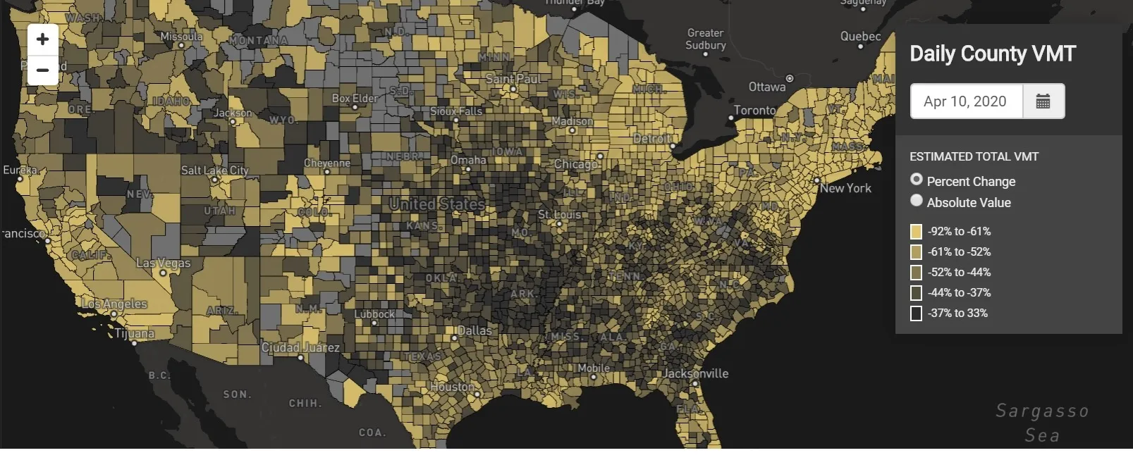
StreetLight Data maps VMT across the US

There has been massive disruption to travel patterns since February and Streetlight’s information covers more than 3,100 counties across the US, updated three times a week.

Designed to measure the transportation impact on communities, it is free to planners, researchers and engineers, as well as federal, state and local governments.

"Transportation professionals make critical budget and planning projections based on gas tax revenue and other factors derived from VMT,” explains CEO Laura Schewel.

“The recent massive drop in travel is throwing off all those plans. This data-driven map gets the key metrics out quickly, with local granularity, to those who need them. Planners, like everyone else, are adjusting to a new reality and we’re here to help navigate it. We hope this, in some way, can help our transportation community in this difficult and unprecedented time."

Location intelligence provider Cuebiq is working with StreetLight, and has developed what it calls a ‘near-real time’ mobility index to improve the outbreak forecast and response.

“StreetLight fused Cuebiq’s index with its own algorithms that transform GPS data into contextualised, aggregated and normalised travel patterns, as well as its deep repositories of data depicting historical VMT,” the company said in a statement.

The data is available here.

Related Content

  • October 21, 2016
    Caltrans takes the long view of transport
    Caltrans’ Malcolm Dougherty took time out of his schedule at ITS America 2016 in San Jose to talk to ITS International about current and future challenges. As director of California Department of Transportation (Caltrans) since mid-2012, many would say that Malcolm Dougherty has one of the best jobs in transportation. Caltrans is one of the most progressive and innovative transport authorities, implementing policies to encourage cycling, piloting new
  • December 2, 2016
    Smarter mapping makes for more informed decisions
    Following his keynote presentation at the 2016 ITS World Congress in Melbourne, ITS International caught up with Esri founder Jack Dangermond. It is getting close to half a century ago that Jack Dangermond and his wife Laura founded the Environmental Research Systems Institute – known today as Esri - of which he remains president.
  • May 30, 2025
    Big Data: Losing our way
    Beate Kubitz finds missing information means the dream of safe and accurate trip planning and travel is not being fully realised – and asks how gaps can be plugged
  • April 16, 2018
    Auckland reduces airport journey times
    Getting from the centre of Auckland to the city’s airport used to be fraught with unwanted stress for passengers – but a new system combining radar, Bluetooth and Wi-Fi is smoothing things over. Andrew Stone investigates. Struggling to cope with steady growth in passenger numbers and the costly traffic congestion which that can entail, New Zealand’s Auckland International Airport has deployed an innovative system that is smoothing traffic and passenger flows. The same system is also offering new, data-led