StreetLight Data provides free VMT metrics

StreetLight Data is offering vehicle miles travelled (VMT) data for US transit agencies to monitor transport networks and understand travel patterns during the Covid-19 pandemic.
By Adam Hill April 17, 2020 Read time: 2 mins
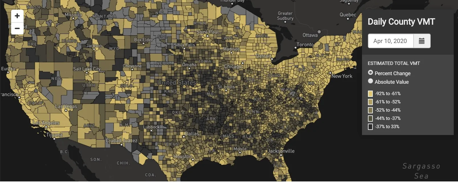
StreetLight Data maps VMT across the US

There has been massive disruption to travel patterns since February and Streetlight’s information covers more than 3,100 counties across the US, updated three times a week.

Designed to measure the transportation impact on communities, it is free to planners, researchers and engineers, as well as federal, state and local governments.

"Transportation professionals make critical budget and planning projections based on gas tax revenue and other factors derived from VMT,” explains CEO Laura Schewel.

“The recent massive drop in travel is throwing off all those plans. This data-driven map gets the key metrics out quickly, with local granularity, to those who need them. Planners, like everyone else, are adjusting to a new reality and we’re here to help navigate it. We hope this, in some way, can help our transportation community in this difficult and unprecedented time."

Location intelligence provider Cuebiq is working with StreetLight, and has developed what it calls a ‘near-real time’ mobility index to improve the outbreak forecast and response.

“StreetLight fused Cuebiq’s index with its own algorithms that transform GPS data into contextualised, aggregated and normalised travel patterns, as well as its deep repositories of data depicting historical VMT,” the company said in a statement.

The data is available here.

For more information on companies in this article

Related Content

  • Moovit: Gut feelings no match for data
    August 7, 2019
    Cities that bring in mobility services without data might be missing out on areas where demand is highest. Ben Spencer talks to Moovit’s Alon Shantzer about how the company is helping customers to pinpoint the right locations Launching mobility services without taking into account public transportation data can lead to chaos in cities. That’s the view of Alon Shantzer, vice president international sales at Moovit, the Mobility as a Service (MaaS) provider and transit app. “The data we have can define
  • Vehicle probe data aids emergency rescue vehicle routing
    June 20, 2012
    A new vehicle routeing initiative has arisen to help improve emergency response and relief following natural disasters in Japan. David Crawford reports Japan’s national ITS group ITS Japan and the country’s leading automotives have agreed on a new combined approach to the organisation of traffic management and emergency response in the wake of major natural disasters. A new, robust traffic information platform using probe data obtained from vehicles to support traffic flow will build on the shared experienc
  • Partnership to provide free real-time parking solutions for major US cities
    July 6, 2012
    ParkMe, a provider of dynamic and real-time parking data, and Parkeon, a specialist in multi-space parking solutions, have completed an integration which will enable the companies to provide free parking solutions to residents of major US cities.
  • Re-set the clock
    February 27, 2012
    The route of the London to Brighton Veteran Car Run, the world's longest-running motoring event, passes right by the end of the street where I live.