StreetLight Data provides free VMT metrics

StreetLight Data is offering vehicle miles travelled (VMT) data for US transit agencies to monitor transport networks and understand travel patterns during the Covid-19 pandemic.
By Adam Hill April 17, 2020 Read time: 2 mins
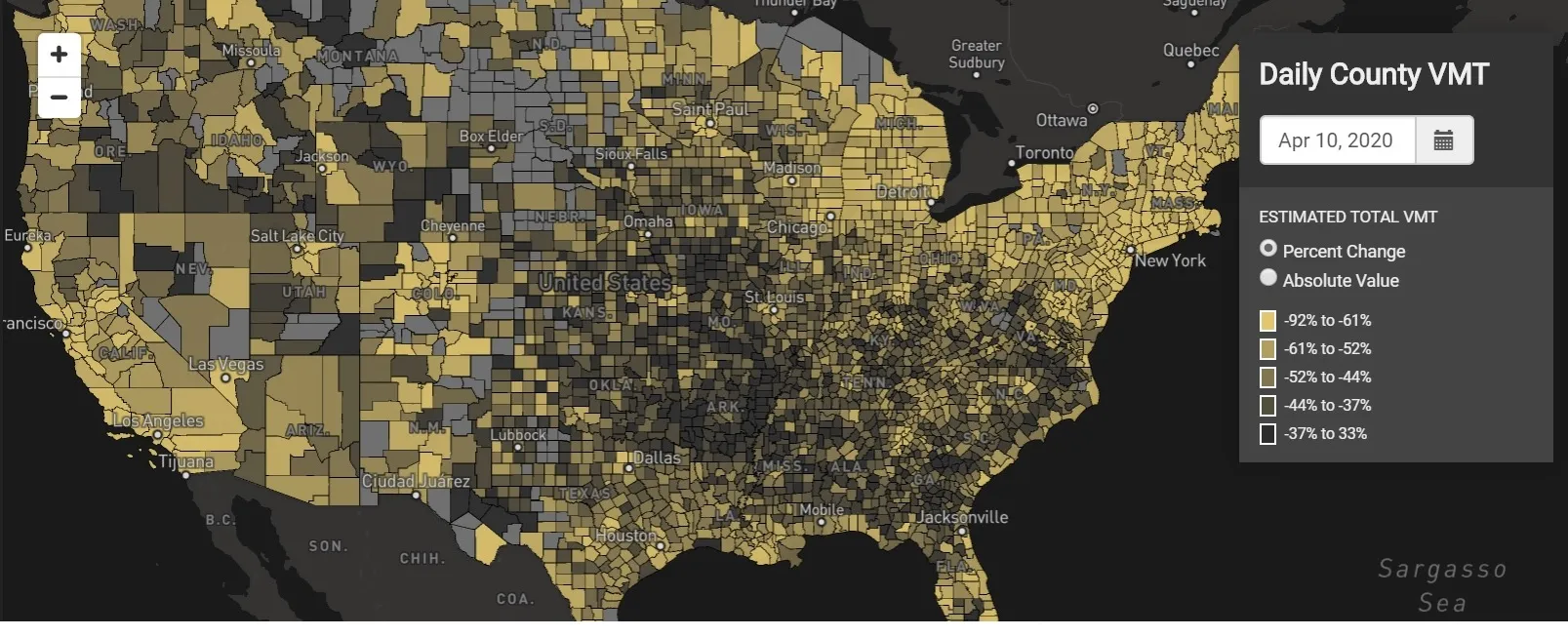
StreetLight Data maps VMT across the US

There has been massive disruption to travel patterns since February and Streetlight’s information covers more than 3,100 counties across the US, updated three times a week.

Designed to measure the transportation impact on communities, it is free to planners, researchers and engineers, as well as federal, state and local governments.

"Transportation professionals make critical budget and planning projections based on gas tax revenue and other factors derived from VMT,” explains CEO Laura Schewel.

“The recent massive drop in travel is throwing off all those plans. This data-driven map gets the key metrics out quickly, with local granularity, to those who need them. Planners, like everyone else, are adjusting to a new reality and we’re here to help navigate it. We hope this, in some way, can help our transportation community in this difficult and unprecedented time."

Location intelligence provider Cuebiq is working with StreetLight, and has developed what it calls a ‘near-real time’ mobility index to improve the outbreak forecast and response.

“StreetLight fused Cuebiq’s index with its own algorithms that transform GPS data into contextualised, aggregated and normalised travel patterns, as well as its deep repositories of data depicting historical VMT,” the company said in a statement.

The data is available here.

Related Content

  • December 14, 2021
    EVs: Time for a rethink
    Given a growing body of evidence that EVs are not the clean, green machines they are made out to be, Andrew Bunn suggests they can only be part of the puzzle – not the answer to environmental problems
  • November 5, 2015
    High-res traffic data provides planners with the big picture
    Road authorities have a lot to gain from high-resolution traffic data, argues Pravin Varaiya. Traffic engineers have traditionally been forced to operate with limited data regarding the performance of their arterials. Traffic studies are often commissioned once every three years, over a few days, to get an updated estimate of utilization.
  • September 19, 2024
    TomTom moves traffic data to new heights
    As cities get bigger and busier, decision-makers need to get creative to keep them moving. Governments and transport authorities rely on data analytics to identify mobility issues, evaluate investments, and set policies based on traffic trends.
  • April 26, 2023
    Marc Williams, Texas DoT: 'We need to end this streak of daily death'
    Texas DoT’s road safety campaign #EndTheStreakTX is part of a plan to reduce traffic deaths to zero in the Lone Star State by 2050. The agency’s executive director Marc Williams explains why it’s needed…